|
|
|
|
   |
Go to thumbnail:
|
|
|
|
|
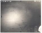
| Photograph, recto: [Aerial view of Biscayne Bay by Biscayne Point, the Police fire range in 1930] |

|
| Photograph, verso: Abrams Aerial Survey Corp. |
|
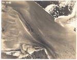
| Photograph, recto: [Aerial view of Norris Cut, Fisher Island and Virginia Key, June 6, 1941] |
|
| Photograph, verso: Abrams Aerial Survey Corp. |
|
|
|
|


