|
|
|
|
   |
Go to thumbnail:
|
|
|
|
|
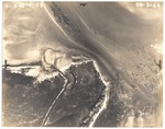
| Photograph, recto: [Aerial view of Norris Cut and Virginia Key, June 6, 1941] |
|
| Photograph, verso: Abrams Aerial Survey Corp. |

|
| Photograph, recto: [Aerial view of Fisher Island, June 6, 1941] |

|
| Photograph, verso: Abrams Aerial Survey Corp. |
|
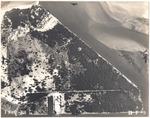
| Photograph, recto: [Aerial view of Fisher Island and view of its water tower] |
|
| Photograph, verso: Abrams Aerial Survey Corp. |
|
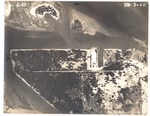
| Photograph, recto: [Aerial view of Fisher Island, Dodge Island and Sam Island] |

|
| Photograph, verso: Abrams Aerial Survey Corp. |

|
| Photograph, recto: [Aerial view of Fisher Island, Dodge and Sam Islands, Causeway Terminal Island and Bay side between First and Third Streets] |
|
| Photograph, verso: Abrams Aerial Survey Corp. |

|
| Photograph, recto: [Aerial view of Dodge and Sam Islands, Causeway Terminal Island, County Causeway (named MacArthur in 1942), James Allison Aquarium and Bay side between First and Fifth Streets] |
|
| Photograph, verso: Abrams Aerial Survey Corp. |

|
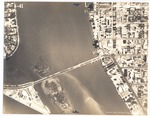
| Photograph, recto: [Aerial view of Causeway Terminal Island, Star Island, U.S. Coast Guard Island, County Causeway and Bay side between First and Eighth Streets] |
|
| Photograph, verso: Abrams Aerial Survey Corp. |
|
| Photograph, recto: [Aerial view of Causeway Terminal Island, Star Island, U.S. Coast Guard Island, County Causeway and Bay side between First and Eighth Streets] |
|
| Photograph, verso: Abrams Aerial Survey Corp. |
|
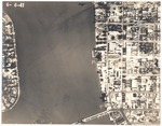
| Photograph, recto: [Aerial view of Star Island, County Causeway and Bay side between Fourth and Eleventh Streets] |

|
| Photograph, verso: Abrams Aerial Survey Corp. |
|
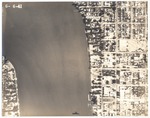
| Photograph, recto: [Aerial view of Star Island and Bay side between Sixth and Fourteenth Streets] |

|
| Photograph, verso: Abrams Aerial Survey Corp. |

|
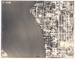
| Photograph, recto: [Aerial view of Biscayne Bay north of the County Causeway (named MacArthur Causeway in 1942] |
|
| Photograph, verso: Abrams Aerial Survey Corp. |
|
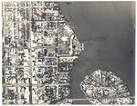
| Photograph, recto: [Aerial view of Biscayne Bay's side between Tenth and Sixteenth Streets] |
|
| Photograph, verso: Abrams Aerial Survey Corp. |
|
| Photograph, recto: [Aerial view of Belle Isle Island and its estates, the Flamingo Hotel, and the Venetian Causeway] |

|
| Photograph, verso: Abrams Aerial Survey Corp. |
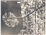
|
| Photograph, recto: [Aerial view of Belle Isle Island and its estates in 1941, the Flamingo Hotel, and the Venetian Causeway] |
|
| Photograph, verso: Abrams Aerial Survey Corp. |
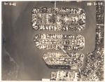
|
| Photograph, recto: [Aerial view of Sunset Islands and Aristotle and Artemis Ares House on 1630 N 21st Street, Sunset Island no. 4] |
|
| Photograph, verso: Abrams Aerial Survey Corp. |

|
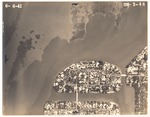
| Photograph, recto: [Aerial view of Sunset Islands] |
|
| Photograph, verso: Abrams Aerial Survey Corp. |
|
| Photograph, recto: [Aerial view of Sunset Islands] |
|
| Photograph, verso: Abrams Aerial Survey Corp. |

|
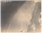
| Photograph, recto: [Aerial view of Biscayne Bay north of Sunset Islands] |

|
| Photograph, verso: Abrams Aerial Survey Corp. |
|
| Photograph, recto: [Aerial view of Biscayne Bay north of Sunset Islands] |
|
| Photograph, verso: Abrams Aerial Survey Corp. |
|
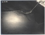
| Photograph, recto: [Aerial view of North Bay Causeway to Normandy Isle] |

|
| Photograph, verso: Abrams Aerial Survey Corp. |
|
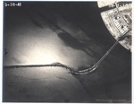
| Photograph, recto: [Aerial view of North Bay Causeway to Normandy Isle] |

|
| Photograph, verso: Abrams Aerial Survey Corp. |
|
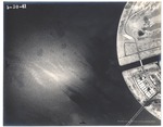
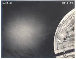
| Photograph, recto: [Aerial view of North Bay Causeway to Normandy Isle] |
|
| Photograph, verso: Abrams Aerial Survey Corp. |
|
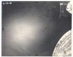
| Photograph, recto: [Aerial view of north end Normandy Isle] |

|
| Photograph, verso: Abrams Aerial Survey Corp. |
|
| Photograph, recto: [Aerial view of Biscayne Bay north of Normandy Isle] |
|
| Photograph, verso: Abrams Aerial Survey Corp. |
|
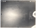
| Photograph, recto: [Aerial view of Biscayne Bay by Biscayne Point] |
|
| Photograph, verso: Abrams Aerial Survey Corp. |
|
|
|
|


