| |
|
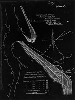 |
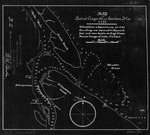
| Comparative Sketch of Shore Lines at the Entrance of Saint Augustine Harbor, Fla. |
|
| Creator: | |
W. M. Black
|
| Format: | |
map
|
| Subjects.Display: | |
Coastal chart
|
| Source Institution: | |
University of Florida
|
|
| Comparative Sketch of Shore Lines at the Entrance of Saint Augustine Harbor, Fla. |
|
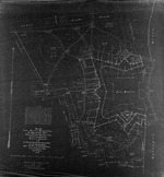 |
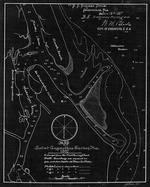
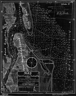
| Map of Fort Marion Reservation St. Augustine, Fla. |
|
| Creator: | |
W. M. Black
|
| Format: | |
map
|
| Subjects.Display: | |
Survey
|
| Source Institution: | |
University of Florida
|
|
| Map of Fort Marion Reservation St. Augustine, Fla. |
|
|
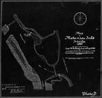 |
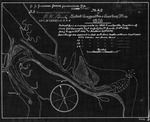
| Map of Matanzas Inlet |
|
| Creator: | |
W. M. Black
|
| Format: | |
map
|
| Subjects.Display: | |
Coastal chart
|
| Source Institution: | |
University of Florida
|
|
| Map of Matanzas Inlet |
|
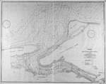 |
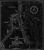
| Map of St. Augustine Harbor |
|
| Creator: | |
W. M. Black
|
| Format: | |
map
|
| Subjects.Display: | |
Coastal chart
|
| Source Institution: | |
University of Florida
|
|
| Map of St. Augustine Harbor |
|
|
 |
| Map of St. Augustine Harbor (1791) |
|
| Creator: | |
W. M. Black
|
| Format: | |
map
|
| Subjects.Display: | |
Coastal chart
|
| Source Institution: | |
University of Florida
|
|
| Map of St. Augustine Harbor (1791) |
|
 |
| Map of St. Augustine Harbor (1826) |
|
| Creator: | |
W. M. Black
|
| Format: | |
map
|
| Subjects.Display: | |
Coastal chart
|
| Source Institution: | |
University of Florida
|
|
| Map of St. Augustine Harbor (1826) |
|
|
 |
| Map of St. Augustine Harbor (1862/3) |
|
| Creator: | |
W. M. Black
|
| Format: | |
map
|
| Subjects.Display: | |
Coastal chart
|
| Source Institution: | |
University of Florida
|
|
| Map of St. Augustine Harbor (1862/3) |
|
 |
| Map of St. Augustine Harbor (1882) |
|
| Creator: | |
W. M. Black
|
| Format: | |
map
|
| Subjects.Display: | |
Coastal chart
|
| Source Institution: | |
University of Florida
|
|
| Map of St. Augustine Harbor (1882) |
|
|
 |
| Map of St. Augustine Harbor (1887) |
|
| Creator: | |
W. M. Black
|
| Format: | |
map
|
| Subjects.Display: | |
Coastal chart
|
| Source Institution: | |
University of Florida
|
|
| Map of St. Augustine Harbor (1887) |
|
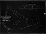 |
| Sketch showing Proposed Location of Jetties at the Entrance to Saint Augustine Harbor, Fla. |
|
| Creator: | |
W. M. Black
|
| Format: | |
map
|
| Subjects.Display: | |
Coastal chart
|
| Source Institution: | |
University of Florida
|
|
| Sketch showing Proposed Location of Jetties at the Entrance to Saint Augustine Harbor, Fla. |
|

