| |
|
 |
| Castillo del Presidio |
|
| Creator: | |
Pablo de Hita y Salazar
|
| Format: | |
map
|
| Subjects.Display: | |
Plan
|
| Source Institution: | |
University of Florida
|
|
| Castillo del Presidio |
|
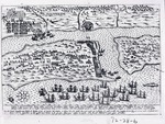 |
| La Citte Sainct Augustin toute Bastie de Maisons |
|
| Creator: | |
Anon.
|
| Format: | |
map
|
| Subjects.Display: | |
Map
|
| Source Institution: | |
University of Florida
|
|
| La Citte Sainct Augustin toute Bastie de Maisons |
|
|
 |
| City of St. Augustine and Environs |
|
| Creator: | |
Anon.
|
| Format: | |
map
|
| Subjects.Display: | |
Plan
|
| Source Institution: | |
University of Florida
|
|
| City of St. Augustine and Environs |
|
 |
| City of St. St. Augustine + Environs |
|
| Creator: | |
Anon.
|
| Format: | |
map
|
| Subjects.Display: | |
Plan
|
| Source Institution: | |
University of Florida
|
|
| City of St. St. Augustine + Environs |
|
|
 |
| City plan of St. Augustine |
|
| Creator: | |
Antonio Arredondo
|
| Format: | |
map
|
| Subjects.Display: | |
Plan
|
| Source Institution: | |
University of Florida
|
|
City plan of St. Augustine
( 2 volumes ) |
|
 |
| The Coast of West Florida and Louisiana |
|
| Creator: | |
Thomas Jefferys
|
| Format: | |
map
|
| Subjects.Display: | |
Map
|
| Source Institution: | |
University of Florida
|
|
| The Coast of West Florida and Louisiana |
|
|
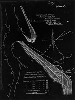 |
| Comparative Sketch of Shore Lines at the Entrance of Saint Augustine Harbor, Fla. |
|
| Creator: | |
W. M. Black
|
| Format: | |
map
|
| Subjects.Display: | |
Coastal chart
|
| Source Institution: | |
University of Florida
|
|
| Comparative Sketch of Shore Lines at the Entrance of Saint Augustine Harbor, Fla. |
|
 |
| Copy of a Plan of the City of St. Augustine, Flora with some additions for the year 1833 |
|
| Creator: | |
Anon.
|
| Format: | |
map
|
| Subjects.Display: | |
Plan
|
| Source Institution: | |
University of Florida
|
|
| Copy of a Plan of the City of St. Augustine, Flora with some additions for the year 1833 |
|
|
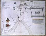 |
| Cove and River of Apalache and road from San Luis to San Marcos |
|
| Creator: | |
Anon.
|
| Format: | |
map
|
| Subjects.Display: | |
Map
|
| Source Institution: | |
University of Florida
|
|
| Cove and River of Apalache and road from San Luis to San Marcos |
|
 |
| Del Plano del Reducto de la Isla Amelia |
|
| Creator: | |
Pedro Díaz Berrío
|
| Format: | |
map
|
| Subjects.Display: | |
Profile
|
| Source Institution: | |
University of Florida
|
|
| Del Plano del Reducto de la Isla Amelia |
|
|
 |
| Descripcion del Puerte de Apalache |
|
| Creator: | |
Pablo de Hita y Salazar
|
| Format: | |
map
|
| Subjects.Display: | |
Map
|
| Source Institution: | |
University of Florida
|
|
| Descripcion del Puerte de Apalache |
|
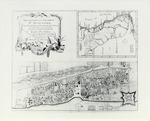 |
| Descripcion Geographica, de la parte que los Espanoles poseen acualmente en el continente de la Florida |
|
| Creator: | |
Fernando Martinez
|
| Format: | |
map
|
| Subjects.Display: | |
Map
|
| Source Institution: | |
University of Florida
|
|
| Descripcion Geographica, de la parte que los Espanoles poseen acualmente en el continente de la Florida |
|
|
 |
| Descripcion Geographica de la parte que lost Espanoles |
|
| Creator: | |
Anon.
|
| Format: | |
map
|
| Subjects.Display: | |
Map
|
| Source Institution: | |
University of Florida
|
|
| Descripcion Geographica de la parte que lost Espanoles |
|
 |
| Descripción hidrografica de una parte de la Costa de la Florida Occidental |
|
| Creator: | |
José de Evia
|
| Format: | |
map
|
| Subjects.Display: | |
Map
|
| Source Institution: | |
University of Florida
|
|
| Descripción hidrografica de una parte de la Costa de la Florida Occidental |
|
|
 |
| Diagram of Dragoon Barracks Lot, St. Augustine |
|
| Creator: | |
W. D. Bloxham
|
| Format: | |
map
|
| Subjects.Display: | |
Plan
|
| Source Institution: | |
University of Florida
|
|
| Diagram of Dragoon Barracks Lot, St. Augustine |
|
 |
| Diagram of Statement of Block Pavement, Cordova St.; Diagram Showing Estimate of Block Pavement, Orange St. |
|
| Creator: | |
Anon.
|
| Format: | |
map
|
| Subjects.Display: | |
Plan
|
| Source Institution: | |
University of Florida
|
|
| Diagram of Statement of Block Pavement, Cordova St.; Diagram Showing Estimate of Block Pavement, Orange St. |
|
|
 |
| Diagram of the Blacksmith Shop lot in the City of St. Augustine |
|
| Creator: | |
A. Martin
|
| Format: | |
map
|
| Subjects.Display: | |
Plan
|
| Source Institution: | |
University of Florida
|
|
| Diagram of the Blacksmith Shop lot in the City of St. Augustine |
|
 |
| Diagram of the Hospital Lot in the City of St. Augustine |
|
| Creator: | |
A. Martin
|
| Format: | |
map
|
| Subjects.Display: | |
Plan
|
| Source Institution: | |
University of Florida
|
|
| Diagram of the Hospital Lot in the City of St. Augustine |
|
|
 |
| The East of St. Augustine Town Castle and Forces before it on the Island of Anastasia |
|
| Creator: | |
Anon.
|
| Format: | |
map
|
| Subjects.Display: | |
Plan
|
| Source Institution: | |
University of Florida
|
|
| The East of St. Augustine Town Castle and Forces before it on the Island of Anastasia |
|
![Elevacion, Vista, y Perfil que pasa por la Linea 1.2.3. [plan of barracks]](http://dpanther.fiu.edu/sobek/content/US/AC/H0/02/93/00001/USACH00293_00001_00001thm.jpg) |
| Elevacion, Vista, y Perfil que pasa por la Linea 1.2.3. [plan of barracks] |
|
| Creator: | |
Mariano de la Rocque
|
| Format: | |
map
|
| Subjects.Display: | |
Profile
|
| Source Institution: | |
University of Florida
|
|
| Elevacion, Vista, y Perfil que pasa por la Linea 1.2.3. [plan of barracks] |
|

