| |
|
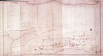 |
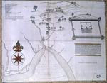
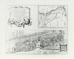
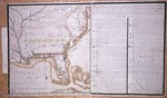
| Copy of a Plan of the City of St. Augustine, Flora with some additions for the year 1833 |
|
|
| Copy of a Plan of the City of St. Augustine, Flora with some additions for the year 1833 |
|
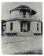 |
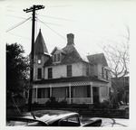
| A copy of an old print showing the Octagon House (in the Lighthouse Park neighborhood) from the corner of Lighthouse Avenue and Busam Street, looking Northwest |
|
|
| A copy of an old print showing the Octagon House (in the Lighthouse Park neighborhood) from the corner of Lighthouse Avenue and Busam Street, looking Northwest |
|
|
 |
|
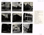
| Cordova Street, Series-E |
|
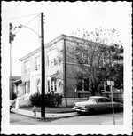 |
| County Courthouse from the corner of Charlotte Street and Treasury Street, looking Southwest |
|
|
County Courthouse from the corner of Charlotte Street and Treasury Street, looking Southwest
( 3 volumes ) |
|
|
 |
| Cove and River of Apalache and road from San Luis to San Marcos |
|
|
| Cove and River of Apalache and road from San Luis to San Marcos |
|
 |
| Coverage of the Start of the Quadracentennial Celebrations |
|
|
| Coverage of the Start of the Quadracentennial Celebrations |
|
|
 |
|
Cuna Street, Series-B
( 5 volumes ) |
|
 |
| Davis Property from the intersection of Marine Street and Bridge Street, looking Southeast, ca. 1960 |
|
|
| Davis Property from the intersection of Marine Street and Bridge Street, looking Southeast, ca. 1960 |
|
|
 |
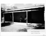
| De Mesa Sanchez House from St. George Street looking Northeast, ca. 1955 |
|
|
De Mesa Sanchez House from St. George Street looking Northeast, ca. 1955
( 32 volumes ) |
|
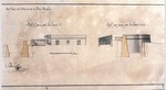 |
| Del Plano del Reducto de la Isla Amelia |
|
|
| Del Plano del Reducto de la Isla Amelia |
|
|
 |
| DeMesa House Façade (Grounds & Exterior Facades) |
|
|
DeMesa House Façade (Grounds & Exterior Facades)
( 2 volumes ) |
|
 |
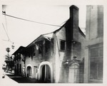
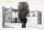
| Demolition at the corner of St. George Street and Cathedral Street, looking Northwest, 1961 |
|
|
| Demolition at the corner of St. George Street and Cathedral Street, looking Northwest, 1961 |
|
|
 |
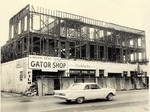
| Demolition of Appliance Center for the construction of the Hispanic Garden, seen from Hypolita Street, looking Northwest |
|
|
Demolition of Appliance Center for the construction of the Hispanic Garden, seen from Hypolita Street, looking Northwest
( 15 volumes ) |
|
 |
| Demolition of the Bernstein Property prior to the construction of the Wakeman House, as seen from King Street looking Southwest, 1964 |
|
|
Demolition of the Bernstein Property prior to the construction of the Wakeman House, as seen from King Street looking Southwest, 1964
( 9 volumes ) |
|
|
 |
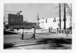
| Demolition of the Monson Hotel from Avenida Menendez, looking West |
|
|
Demolition of the Monson Hotel from Avenida Menendez, looking West
( 8 volumes ) |
|
 |
| Descripcion del Puerte de Apalache |
|
|
| Descripcion del Puerte de Apalache |
|
|
 |
| Descripcion Geographica, de la parte que los Espanoles poseen acualmente en el continente de la Florida |
|
|
| Descripcion Geographica, de la parte que los Espanoles poseen acualmente en el continente de la Florida |
|
 |
| Descripcion Geographica de la parte que lost Espanoles |
|
|
| Descripcion Geographica de la parte que lost Espanoles |
|
|
|
| Descripción hidrografica de una parte de la Costa de la Florida Occidental |
|
|
| Descripción hidrografica de una parte de la Costa de la Florida Occidental |
|
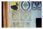 |
| Detail of tile work on fireplace mantel in Sanchez House, left side, 1970 |
|
|
Detail of tile work on fireplace mantel in Sanchez House, left side, 1970
( 10 volumes ) |
|

