| |
|
 |
| Plan of St. Augustine, Fort Marion and the Sea Wall |
|
| Creator: | |
F. L. Dancy
|
| Format: | |
map
|
| Subjects.Display: | |
Map
|
| Source Institution: | |
University of Florida
|
|
| Plan of St. Augustine, Fort Marion and the Sea Wall |
|
 |
| Plan of Sea Wall St. Augustine with Parts of the City and Harbor |
|
| Creator: | |
F. L. Dancy
|
| Format: | |
map
|
| Subjects.Display: | |
Plan and Profile
|
| Source Institution: | |
University of Florida
|
|
| Plan of Sea Wall St. Augustine with Parts of the City and Harbor |
|
|
 |
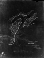
| Florida, Matanzas River, St. Augustine, and Fort St. Marks |
|
| Creator: | |
Wilson
|
| Format: | |
map
|
| Subjects.Display: | |
Map
|
| Source Institution: | |
University of Florida
|
|
| Florida, Matanzas River, St. Augustine, and Fort St. Marks |
|
 |
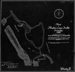
| Survey of the Sea Wall of St. Augustine with City Proper and the Adjacent Shore |
|
| Creator: | |
H. W. Benham
|
| Format: | |
map
|
| Subjects.Display: | |
Plan and Profile
|
| Source Institution: | |
University of Florida
|
|
| Survey of the Sea Wall of St. Augustine with City Proper and the Adjacent Shore |
|
|
 |
| Saint Augustine Harbor |
|
| Creator: | |
Lt. Col. P. H. Perrault
|
| Format: | |
map
|
| Subjects.Display: | |
Coastal chart
|
| Source Institution: | |
University of Florida
|
|
| Saint Augustine Harbor |
|
 |
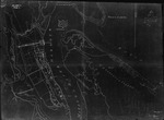
| Map of Matanzas Inlet |
|
| Creator: | |
W. M. Black
|
| Format: | |
map
|
| Subjects.Display: | |
Coastal chart
|
| Source Institution: | |
University of Florida
|
|
| Map of Matanzas Inlet |
|
|
 |
| View of St. Augustine, East Florida |
|
| Creator: | |
John S. Horton
|
| Format: | |
map
|
| Subjects.Display: | |
Skyline View
|
| Source Institution: | |
University of Florida
|
|
| View of St. Augustine, East Florida |
|
|
| Plan of the Northern Part of the City of St. Augustine |
|
| Creator: | |
Anon.
|
| Subjects.Display: | |
Plan
|
| Source Institution: | |
University of Florida
|
|
| Plan of the Northern Part of the City of St. Augustine |
|
|
 |
| Plan of Magazine Lot |
|
| Creator: | |
H. W. Benham
|
| Format: | |
map
|
| Subjects.Display: | |
Plan
|
| Source Institution: | |
University of Florida
|
|
| Plan of Magazine Lot |
|
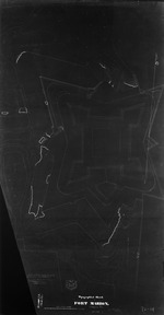 |
| Fort Marion, 1842 |
|
| Creator: | |
H. W. Benham
|
| Format: | |
map
|
| Subjects.Display: | |
Topgraphic
|
| Source Institution: | |
University of Florida
|
|
| Fort Marion, 1842 |
|
|
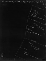 |
| Lots Situated North of the Ditch in the City of St. Augustine and West of the Road (1 of 2) |
|
| Creator: | |
[Copyist] Lt. H. L. Eustis ( contributor )
|
| Format: | |
map
|
| Subjects.Display: | |
Survey
|
| Source Institution: | |
University of Florida
|
|
| Lots Situated North of the Ditch in the City of St. Augustine and West of the Road (1 of 2) |
|
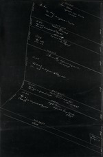 |
| Lots Situated North of the Ditch in the City of St. Augustine and West of the Road (2 of 2) |
|
| Creator: | |
[Copyist] Lt. H. L. Eustis ( contributor )
|
| Format: | |
map
|
| Subjects.Display: | |
Survey
|
| Source Institution: | |
University of Florida
|
|
| Lots Situated North of the Ditch in the City of St. Augustine and West of the Road (2 of 2) |
|
|
|
| Florida, c. 1850 |
|
| Creator: | |
S. Augustus Mitchell
|
| Format: | |
map
|
| Subjects.Display: | |
Map
|
| Source Institution: | |
University of Florida
|
|
| Florida, c. 1850 |
|
 |
| Preliminary Chart of St. Augustine Harbor, U. S. C & G Survey |
|
| Creator: | |
A. D. Bache
|
| Format: | |
map
|
| Subjects.Display: | |
Coastal chart
|
| Source Institution: | |
University of Florida
|
|
| Preliminary Chart of St. Augustine Harbor, U. S. C & G Survey |
|
|
 |
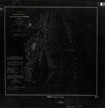
| Map of the City of St. Augustine & Vicinity, 1863 |
|
| Creator: | |
Col. J. R. Hawley
|
| Format: | |
map
|
| Subjects.Display: | |
Map
|
| Source Institution: | |
University of Florida
|
|
| Map of the City of St. Augustine & Vicinity, 1863 |
|
|
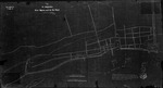
| The St. Augustine Plan, Section of Spanish and Cuna Street |
|
| Creator: | |
American Park Builders, Chicago
|
| Format: | |
map
|
| Source Institution: | |
University of Florida
|
|
| The St. Augustine Plan, Section of Spanish and Cuna Street |
|
|
|
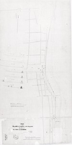
| The St. Augustine Plan, Section near St. George and Cuna Street |
|
| Creator: | |
American Park Builders, Chicago
|
| Format: | |
map
|
| Subjects.Display: | |
Plan
|
| Source Institution: | |
University of Florida
|
|
| The St. Augustine Plan, Section near St. George and Cuna Street |
|
|
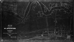
| Map of St. Augustine, Fla., 1880 |
|
| Creator: | |
Q. A. Gillmore
|
| Format: | |
map
|
| Subjects.Display: | |
Plan
|
| Source Institution: | |
University of Florida
|
|
| Map of St. Augustine, Fla., 1880 |
|
|
|
| Surveys of Dragoon Barracks lot, Spanish Government House Lot, Treasury Lot, and Hospital Lot |
|
| Creator: | |
Q. A. Gillmore
|
| Format: | |
map
|
| Subjects.Display: | |
Plan
|
| Source Institution: | |
University of Florida
|
|
| Surveys of Dragoon Barracks lot, Spanish Government House Lot, Treasury Lot, and Hospital Lot |
|
|
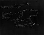
| Survey of Properties Bounding Ft. Marion |
|
| Creator: | |
Q. A. Gillmore
|
| Format: | |
map
|
| Subjects.Display: | |
Plan
|
| Source Institution: | |
University of Florida
|
|
| Survey of Properties Bounding Ft. Marion |
|

