|
|
|
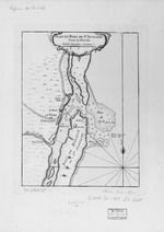
Plan du Port de St. Augustin dans la Florida |
|
Creator: | |
Anon. Nicolas Bellin ( contributor )
|
Format: | |
map
|
Subjects.Display: | |
Coastal chart
|
Source Institution: | |
University of Florida
|
|
Plan du Port de St. Augustin dans la Florida |
|
|
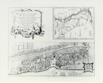
Plano de la Ciudad y Puerto de San Agusitin de la Florida |
|
Creator: | |
Tomas Lopez
|
|
Plano de la Ciudad y Puerto de San Agusitin de la Florida |
|
|
|
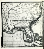
Descripcion Geographica, de la parte que los Espanoles poseen acualmente en el continente de la Florida |
|
Creator: | |
Fernando Martinez
|
Format: | |
map
|
Subjects.Display: | |
Map
|
Source Institution: | |
University of Florida
|
|
Descripcion Geographica, de la parte que los Espanoles poseen acualmente en el continente de la Florida |
|
|
Sketch of the City and Environs of St. Augustine |
|
Creator: | |
Anon.
|
Format: | |
map
|
Subjects.Display: | |
Plan
|
Source Institution: | |
University of Florida
|
|
Sketch of the City and Environs of St. Augustine |
|
|
|
City of St. Augustine and Environs |
|
Creator: | |
Anon.
|
Format: | |
map
|
Subjects.Display: | |
Plan
|
Source Institution: | |
University of Florida
|
|
City of St. Augustine and Environs |
|
|
A New & Accurate Plan of the Town of St. Augustine |
|
Creator: | |
John de Solis
|
Format: | |
map
|
Subjects.Display: | |
Plan
|
Source Institution: | |
University of Florida
|
|
A New & Accurate Plan of the Town of St. Augustine |
|
|
|
Map Furnished by Spain to England , 1756 |
|
Creator: | |
Anon.
|
Format: | |
map
|
Subjects.Display: | |
Map
|
Source Institution: | |
University of Florida
|
|
Map Furnished by Spain to England , 1756 |
|
|
Scetch Shewing the Kings ground at St. Augustine |
|
Creator: | |
William Brasier
|
Format: | |
map
|
Subjects.Display: | |
Plan
|
Source Institution: | |
University of Florida
|
|
Scetch Shewing the Kings ground at St. Augustine |
|
|
|
Plan of the Castle + Barr at Matansas |
|
Creator: | |
Anon.
|
Format: | |
map
|
Subjects.Display: | |
Plan
|
Source Institution: | |
University of Florida
|
|
Plan of the Castle + Barr at Matansas |
|
|
Plan of the New Town of Pensacola and Country Adjacent |
|
Creator: | |
Elias Durnford
|
Format: | |
map
|
Subjects.Display: | |
Plan
|
Source Institution: | |
University of Florida
|
|
Plan of the New Town of Pensacola and Country Adjacent |
|
|
|
A Plan + Section of Fort St. Marks St. Augustine |
|
Creator: | |
James Moncrief
|
Format: | |
map
|
Subjects.Display: | |
Plan
|
Source Institution: | |
University of Florida
|
|
A Plan + Section of Fort St. Marks St. Augustine |
|
|
Plan of St. Augustine |
|
Creator: | |
James Moncrief
|
Format: | |
map
|
Subjects.Display: | |
Plan
|
Source Institution: | |
University of Florida
|
|
Plan of St. Augustine |
|
|
|
Spanish Land Holdings |
|
Creator: | |
James Moncrief
|
Format: | |
map
|
Subjects.Display: | |
Plan
|
Source Institution: | |
University of Florida
|
|
Spanish Land Holdings |
|
|
New Map of East Florida |
|
Creator: | |
William Stork P. Andrews ( contributor )
|
Format: | |
map
|
Subjects.Display: | |
Map
|
Source Institution: | |
University of Florida
|
|
New Map of East Florida |
|
|
|
A Plan of the Fort Harbour of Matanzas |
|
Creator: | |
James Moncrief
|
Format: | |
map
|
Subjects.Display: | |
Plan
|
Source Institution: | |
University of Florida
|
|
A Plan of the Fort Harbour of Matanzas |
|
|
Plan of Fort Picolata on St. Johns River |
|
Creator: | |
James Moncrief
|
Format: | |
map
|
Subjects.Display: | |
Plan
|
Source Institution: | |
University of Florida
|
|
Plan of Fort Picolata on St. Johns River |
|
|
|
Plan of St. Augustin Inlet and Town, with it's Environs |
|
Creator: | |
Wm. Gerard De Brahm
|
Format: | |
map
|
Subjects.Display: | |
Plan
|
Source Institution: | |
University of Florida
|
|
Plan of St. Augustin Inlet and Town, with it's Environs |
|
|
Plan of the Environs of St. Augustine |
|
Creator: | |
Anon.
|
Format: | |
map
|
Source Institution: | |
University of Florida
|
|
Plan of the Environs of St. Augustine |
|
|
|
St. Augustine and its Environs, 1768 |
|
Creator: | |
Juan Joseph Elixio de la Puente
|
Format: | |
map
|
Subjects.Display: | |
Map
|
Source Institution: | |
University of Florida
|
|
St. Augustine and its Environs, 1768 |
|
|
Plano de las Provincias de la Florida |
|
Creator: | |
Juan Joseph Elixio de la Puente
|
Format: | |
map
|
Subjects.Display: | |
Plan
|
Source Institution: | |
University of Florida
|
|
Plano de las Provincias de la Florida |
|