| |
|
 |
| Accurata delineatio celeberrimae Regionis LUDOVICIANÆ vel Gallice LOUISIANE…(North America) |
|
| Creator: | |
Matthew Seutter
|
| Format: | |
map
|
| Subjects.Display: | |
Map
|
| Source Institution: | |
University of Florida
|
|
| Accurata delineatio celeberrimae Regionis LUDOVICIANÆ vel Gallice LOUISIANE…(North America) |
|
 |
| Descripcion Geographica de la parte que lost Espanoles |
|
| Creator: | |
Anon.
|
| Format: | |
map
|
| Subjects.Display: | |
Map
|
| Source Institution: | |
University of Florida
|
|
| Descripcion Geographica de la parte que lost Espanoles |
|
|
 |
| City plan of St. Augustine |
|
| Creator: | |
Antonio Arredondo
|
| Format: | |
map
|
| Subjects.Display: | |
Plan
|
| Source Institution: | |
University of Florida
|
|
| City plan of St. Augustine |
|
 |
| City plan of St. Augustine |
|
| Creator: | |
Antonio Arredondo
|
| Format: | |
map
|
| Subjects.Display: | |
Plan
|
| Source Institution: | |
University of Florida
|
|
| City plan of St. Augustine |
|
|
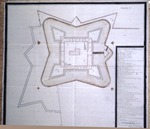 |
| Plan of the Castillo de San Marcos |
|
| Creator: | |
Antonio Arredondo
|
| Format: | |
map
|
| Subjects.Display: | |
Plan
|
| Source Institution: | |
University of Florida
|
|
| Plan of the Castillo de San Marcos |
|
 |
| Fort Marion, 1737 |
|
| Creator: | |
Antonio Arredondo
Robert Ranson (1929) ( contributor )
|
| Format: | |
map
|
| Subjects.Display: | |
Plan
|
| Source Institution: | |
University of Florida
|
|
| Fort Marion, 1737 |
|
|
 |
| Plano y Perfil del nuevo Fortina de S. Francisco de Pupo… |
|
| Creator: | |
Pedro Ruiz de Olano
|
| Format: | |
map
|
| Subjects.Display: | |
Manuscript
|
| Source Institution: | |
University of Florida
|
|
| Plano y Perfil del nuevo Fortina de S. Francisco de Pupo… |
|
 |
| Planta y Perfil de esta fabrica que se propone para…S. Maria de Galues alias Pensacola |
|
| Creator: | |
Anon.
|
| Format: | |
map
|
| Subjects.Display: | |
Plan
|
| Source Institution: | |
University of Florida
|
|
| Planta y Perfil de esta fabrica que se propone para…S. Maria de Galues alias Pensacola |
|
|
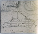 |
| Plan de la Bahia de Pensacola en el Seno Mexicano |
|
| Creator: | |
Anon.
|
| Format: | |
map
|
| Subjects.Display: | |
Plan
|
| Source Institution: | |
University of Florida
|
|
| Plan de la Bahia de Pensacola en el Seno Mexicano |
|
 |
| Plan of Fort of San Augustin and Environs |
|
| Format: | |
map
|
| Subjects.Display: | |
Plan
|
| Source Institution: | |
University of Florida
|
|
| Plan of Fort of San Augustin and Environs |
|
|
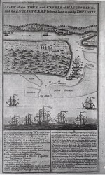 |
| A View of the Town and Castle of St. Augustine and the English Camp Before June 20, 1740 |
|
| Creator: | |
Thomas Silver
|
| Format: | |
map
|
| Subjects.Display: | |
Plan
|
| Source Institution: | |
University of Florida
|
|
| A View of the Town and Castle of St. Augustine and the English Camp Before June 20, 1740 |
|
 |
| Part of the Florida Inlet of Matanza |
|
| Creator: | |
Live Todiman
|
| Format: | |
map
|
| Subjects.Display: | |
Coastal chart
|
| Source Institution: | |
University of Florida
|
|
| Part of the Florida Inlet of Matanza |
|
|
 |
| The East of St. Augustine Town Castle and Forces before it on the Island of Anastasia |
|
| Creator: | |
Anon.
|
| Format: | |
map
|
| Subjects.Display: | |
Plan
|
| Source Institution: | |
University of Florida
|
|
| The East of St. Augustine Town Castle and Forces before it on the Island of Anastasia |
|
![Scetch [sic.] of the City and Environs of St. Augustine](http://dpanther.fiu.edu/sobek/content/US/AC/H0/02/11/00001/USACH00211_00001_00002thm.jpg) |
| Scetch [sic.] of the City and Environs of St. Augustine |
|
| Creator: | |
[Copyist] William Brasier
|
| Format: | |
map
|
| Subjects.Display: | |
Plan
|
| Source Institution: | |
University of Florida
|
|
| Scetch [sic.] of the City and Environs of St. Augustine |
|
|
 |
| A Survey of the Coast from Fort William near St. Ivans River to Mosquito River |
|
| Creator: | |
Justly Watson
|
| Format: | |
map
|
| Subjects.Display: | |
Map
|
| Source Institution: | |
University of Florida
|
|
| A Survey of the Coast from Fort William near St. Ivans River to Mosquito River |
|
 |
| Profiles of fort of San Agustin, Florida |
|
| Creator: | |
Anon.
|
| Format: | |
map
|
| Subjects.Display: | |
Profile
|
| Source Institution: | |
University of Florida
|
|
| Profiles of fort of San Agustin, Florida |
|
|
 |
| Plano que de nuestra la perfecta conclusion del Recinto del Castillo de S. Agustin |
|
| Creator: | |
Pedro de Brozas y Garay
|
| Format: | |
map
|
| Subjects.Display: | |
Plan
|
| Source Institution: | |
University of Florida
|
|
| Plano que de nuestra la perfecta conclusion del Recinto del Castillo de S. Agustin |
|
 |
| Plano, Perfiles y Elevacion…del Fuerte de S. Agustin |
|
| Creator: | |
Pedro de Brozas y Garay
|
| Format: | |
map
|
| Subjects.Display: | |
Plan
|
| Source Institution: | |
University of Florida
|
|
| Plano, Perfiles y Elevacion…del Fuerte de S. Agustin |
|
|
 |
| Plano de la Bahia y Puerto de S. Maria de Galbe y del Presidio llamado Pansacola |
|
| Creator: | |
Agustin Lopez de la Camara Alta
|
| Format: | |
map
|
| Subjects.Display: | |
Plan
|
| Source Institution: | |
University of Florida
|
|
| Plano de la Bahia y Puerto de S. Maria de Galbe y del Presidio llamado Pansacola |
|
 |
| Planta de un Castillo para la provincia de Apalache |
|
| Creator: | |
Anon.
|
| Format: | |
map
|
| Subjects.Display: | |
Plan
|
| Source Institution: | |
University of Florida
|
|
| Planta de un Castillo para la provincia de Apalache |
|

