| |
|
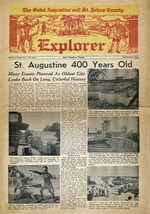 |
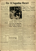
| St. Augustine 400 Years Old |
|
|
| St. Augustine 400 Years Old |
|
 |
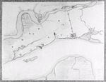
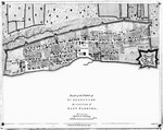
| St. Augustine and its Environs, 1768 |
|
|
| St. Augustine and its Environs, 1768 |
|
|
 |
| St. Augustine and its Environs, 1782 |
|
|
| St. Augustine and its Environs, 1782 |
|
 |
| St. Augustine Electric Street Railway |
|
|
| St. Augustine Electric Street Railway |
|
|
 |
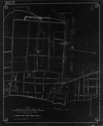
| St. Augustine Fire Insurance Map |
|
|
| St. Augustine Fire Insurance Map |
|
|
| St. Augustine, Florida, 1947 |
|
|
| St. Augustine, Florida, 1947 |
|
|
|
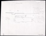
| St. Augustine Harbor (Part of Canal Plan) |
|
|
| St. Augustine Harbor (Part of Canal Plan) |
|
|
| The St. Augustine Plan, Section near St. George and Cuna Street |
|
|
| The St. Augustine Plan, Section near St. George and Cuna Street |
|
|
|
| The St. Augustine Plan, Section of Spanish and Cuna Street |
|
|
| The St. Augustine Plan, Section of Spanish and Cuna Street |
|
 |
| St. Augustine Record Coverage |
|
|
| St. Augustine Record Coverage |
|
|
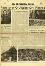 |
| St. Augustine Record, Special Historic Restoration Issue |
|
|
| St. Augustine Record, Special Historic Restoration Issue |
|
 |
| St. Augustine the Capital of East Florida |
|
|
| St. Augustine the Capital of East Florida |
|
|
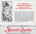 |
| St. Augustine's Restored Spanish Quarter, Coping With Colonial Change and Conflict |
|
|
| St. Augustine's Restored Spanish Quarter, Coping With Colonial Change and Conflict |
|
 |
| St. Augustine's Restored Spanish Quarter, Florida's Living History Museum |
|
|
| St. Augustine's Restored Spanish Quarter, Florida's Living History Museum |
|
|
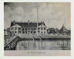 |
| St. Francis Barracks and parade ground, looking West, ca. early 1900's |
|
|
St. Francis Barracks and parade ground, looking West, ca. early 1900's
( 10 volumes ) |
|
 |
| St. Francis Barracks Lot, New Hospital Lot |
|
|
| St. Francis Barracks Lot, New Hospital Lot |
|
|
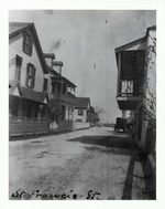 |
| St. Francis Street near the intersection with Charlotte Street (Llambias House on the right) looking East, ca. 1903 |
|
|
St. Francis Street near the intersection with Charlotte Street (Llambias House on the right) looking East, ca. 1903
( 4 volumes ) |
|
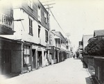 |
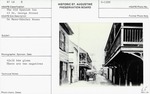
| St. George Street looking north toward the intersection of Cuna Street, ca. 1900 |
|
|
St. George Street looking north toward the intersection of Cuna Street, ca. 1900
( 26 volumes ) |
|
|
 |
| St. George Street with De Mesa Sanchez House on the right (as Waddill House), looking North |
|
|
St. George Street with De Mesa Sanchez House on the right (as Waddill House), looking North
( 111 volumes ) |
|
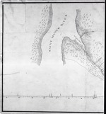 |
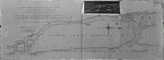
| St. Johns River, Six Mile Creek Blowup (Part of Canal Plan) |
|
|
| St. Johns River, Six Mile Creek Blowup (Part of Canal Plan) |
|

