| |
|
 |
| Assessing future risk |
|
| Creator: | |
Christine C. Shepard
Vera N. Agostini
Ben Gilmer
Tashya Allen
Jeff Stone
William Brooks
Michael W. Beck
|
| Subjects.Display: | |
Climate change
Geographic information systems
Sea Level rise
Storm surges
Long Island (N.Y.)
|
| Source Institution: | |
Florida International University
|
|
| Assessing future risk |
|
 |
| Assessment of Coastal Vulnerability Through the Use of GIS Tools in South Sicily (Italy) |
|
| Publication Date: | |
2009
|
| Creator: | |
Anfuso, Giorgio
Martinez Del Pozo, Josel Angel
|
| Publisher.Display: | |
Springer
|
| Subjects.Display: | |
Climate change
Geographic information systems
coastal management
Erosion
Italy
|
| Source Institution: | |
Florida International University
|
|
| Assessment of Coastal Vulnerability Through the Use of GIS Tools in South Sicily (Italy) |
|
|
 |
| Background Documents Supporting Climate Change Science Program Synthesis and Assessment Prdouct 4.1 |
|
| Publication Date: | |
2008-05
|
| Creator: | |
Titus, J.G.
Strange, E.M.
|
| Publisher.Display: | |
United States Environmental Protection Agency
|
| Subjects.Display: | |
Climate change
Geographic information systems
Sea Level rise
|
| Source Institution: | |
Florida International University
|
|
| Background Documents Supporting Climate Change Science Program Synthesis and Assessment Prdouct 4.1 |
|
 |
| Climate simulations for 1880-2003 with GISS modelE |
|
| Publication Date: | |
2007
|
| Creator: | |
J. Hansen
T. Hall
M. Sato
R. Ruedy
P. Kharecha
A. Lacis
R. Miller
L. Nazarenko
K. Lo
G.A. Schmidt
G. Russell
I. Aleinov
S. Bauer
E. Baum
B. Cairns
V. Canuto
M. Chandler
Y. Cheng
A. Cohen
A. Del Genio
G. Faluvegi
E. Fleming
A. Friend
C. Jackman
J. Jonas
M. Kelley
N.Y. Kiang
D. Koch
G. Labow
J. Lerner
S. Menon
T. Novakov
V. Oinas
Ja. Perlwitz
Ju. Perlwitz
D. Rind
A. Romanou
R. Schmunk
D. Shindell
P. Stone
S. Sun
D. Streets
N. Tausnev
D. Thresher
N. Unger
M. Yao
S. Zhang
|
| Publisher.Display: | |
Springer
|
| Subjects.Display: | |
Climate change
Global warming
Geographic information systems
|
| Source Institution: | |
Florida International University
|
|
| Climate simulations for 1880-2003 with GISS modelE |
|
|
 |
| Edge Atlas |
|
| Publication Date: | |
2010
|
| Creator: | |
Catherine Seavitt
Adam Yarinsky
|
| Subjects.Display: | |
Climate change
Geographic information systems
coastal management
New Jersey
New York
|
| Source Institution: | |
Florida International University
|
|
| Edge Atlas |
|
 |
| A framework for using GIS and stakeholder input to assess vulnerability to coastal-inundation hazards |
|
| Creator: | |
Wood, Nathan
Yarnal, Brent
Frazier, Tim
|
| Subjects.Display: | |
Florida
Climate change
Geographic information systems
Sarasota County (Fla.)
|
| Source Institution: | |
Florida International University
|
|
| A framework for using GIS and stakeholder input to assess vulnerability to coastal-inundation hazards |
|
|
 |
| Geographic Information System Planning for Future Sea-Level Rise Using Evidence and Response Mechanisms from the Past |
|
| Publication Date: | |
2012-08
|
| Creator: | |
Baker, Robert G.V.
McGowan, Sarah A.
|
| Publisher.Display: | |
Coastal Education and Research Foundation
|
| Subjects.Display: | |
Geographic information systems
Sea Level rise
coastal management
New South Wales
|
| Source Institution: | |
Florida International University
|
|
| Geographic Information System Planning for Future Sea-Level Rise Using Evidence and Response Mechanisms from the Past |
|
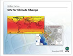 |
| GIS for Climate Change |
|
| Publication Date: | |
2008-11
|
| Creator: | |
ESRI (Environmental Systems Research Institute)
|
| Publisher.Display: | |
ESRI (Environmental Systems Research Institute)
|
| Subjects.Display: | |
Climate change
Geographic information systems
Maps
geography
|
| Source Institution: | |
Florida International University
|
|
| GIS for Climate Change |
|
|
 |
| Modeling Spatial Variations of Sea Level Rise and Corresponding Inundation Impacts |
|
| Publication Date: | |
2013-10-25
|
| Creator: | |
Chang, Biao
Guan, Jiabao
Aral, Mustafa M.
|
| Publisher.Display: | |
Springer
|
| Subjects.Display: | |
Florida
Climate change
Geographic information systems
Sea Level rise
|
| Source Institution: | |
Florida International University
|
|
| Modeling Spatial Variations of Sea Level Rise and Corresponding Inundation Impacts |
|
 |
| Our disappearing past |
|
| Publication Date: | |
2012
|
| Creator: | |
Reeder, Leslie A.
Rick, Torben C.
Erlandson, Jon M.
|
| Publisher.Display: | |
Springer
|
| Subjects.Display: | |
Climate change
Urban development
Geographic information systems
Sea Level rise
California
|
| Source Institution: | |
Florida International University
|
|
| Our disappearing past |
|
|
 |
| SLAMM 6.0.1 beta |
|
| Publication Date: | |
2010-01
|
| Creator: | |
Clough, Jonathan S.
Larson, Evan C.
|
| Publisher.Display: | |
Warren Pinnacle Consulting
|
| Subjects.Display: | |
Geographic information systems
Sea Level rise
Salinity
|
| Source Institution: | |
Florida International University
|
|
| SLAMM 6.0.1 beta |
|
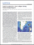 |
| South Greenland ice-sheet collapse during Marine Isotope Stage 11 |
|
| Publication Date: | |
2014
|
| Creator: | |
Carlson, Anders E.
Reyes, Alberto V.
Beard, Brian L.
Hatfield, Robert G.
Stoner, Joseph S.
Winsor, Kelsey
Welke, Bethany
Ullman, David J.
|
| Publisher.Display: | |
Macmillan Publishers Limited
|
| Subjects.Display: | |
Climate change
Geographic information systems
ice sheets
Greenland
|
| Source Institution: | |
Florida International University
|
|
| South Greenland ice-sheet collapse during Marine Isotope Stage 11 |
|
|
 |
| State and local governments plan for development of most land vulnerable to rising sea level along the US Atlantic coast |
|
| Publication Date: | |
2009
|
| Creator: | |
Titus, James G.
|
| Subjects.Display: | |
Climate change
Geographic information systems
Wetlands
Maps
|
| Source Institution: | |
Florida International University
|
|
| State and local governments plan for development of most land vulnerable to rising sea level along the US Atlantic coast |
|
|

