|
|
| |
|
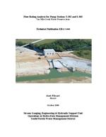 |
| Flow Rating Analysis for Pump Stations S-382 and S-383 Ten Mile Creek Water Preserve Area |
|
| Publication Date: | |
2006-10
|
| Creator: | |
South Florida Water Management District ( Contributor )
Li, Hua
Wdsnack, Mark
|
| Publisher.Display: | |
South Florida Water Management District
|
| Format: | |
PDF, 40 pages, illustrations, charts, maps
|
| Subjects.Display: | |
Florida
Rain and rainfall--Florida--Charts, diagrams, etc.
Water-supply engineering--Florida--Everglades
Pumping stations -- Florida -- Everglades National Park.
Ten Mile Creek Water Preserve Area
|
| Source Institution: | |
Florida International University
|
|
| Flow Rating Analysis for Pump Stations S-382 and S-383 Ten Mile Creek Water Preserve Area |
|
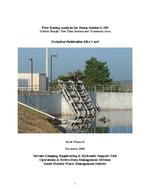 |
| Flow Rating Analysis for Pump Stations S-385 Nubbin Slough / New Palm Stormwater Treatment Area |
|
| Publication Date: | |
2006-12
|
| Creator: | |
South Florida Water Management District ( Contributor )
Wdsnack, Mark
|
| Publisher.Display: | |
South Florida Water Management District
|
| Format: | |
PDF, vii, 22 pages, illustrations, charts, maps
|
| Subjects.Display: | |
Florida
Rain and rainfall--Florida--Charts, diagrams, etc.
Water-supply engineering--Florida--Everglades
Pumping stations -- Florida -- Everglades National Park.
|
| Source Institution: | |
Florida International University
|
|
| Flow Rating Analysis for Pump Stations S-385 Nubbin Slough / New Palm Stormwater Treatment Area |
|
|
 |
| Flow Rating Analysis Procedures for Pumps |
|
| Publication Date: | |
2003-12
|
| Creator: | |
South Florida Water Management District ( Contributor )
Imru, Muluneh
Wang, Youchao
|
| Publisher.Display: | |
South Florida Water Management District
|
| Format: | |
PDF, iv, 23 pages, illustrations, charts.
|
| Subjects.Display: | |
Florida
Everglades
Hydraulics
Water supply – Florida
Flood control -- Florida
Flow rating analysis
|
| Source Institution: | |
Florida International University
|
|
| Flow Rating Analysis Procedures for Pumps |
|
 |
| Flow Rating Development for New Pump Stations (S319, S361, S362, G370, G370S, G372, G372S, S25B, S26, G420, G420S, S332C, S356) |
|
| Publication Date: | |
2004-08
|
| Creator: | |
South Florida Water Management District ( Contributor )
Imru, Muluneh
Wang, Youchao
|
| Publisher.Display: | |
South Florida Water Management District
|
| Format: | |
PDF, vi, 44 pages , illustrations, charts, maps.
|
| Subjects.Display: | |
Florida
Everglades
Water supply – Florida
Flood control -- Florida
Hydraulics -- Florida
|
| Source Institution: | |
Florida International University
|
|
| Flow Rating Development for New Pump Stations (S319, S361, S362, G370, G370S, G372, G372S, S25B, S26, G420, G420S, S332C, S356) |
|
|
 |
| Flow-proportional sampling from variable flow canals |
|
| Publication Date: | |
1997-07
|
| Creator: | |
South Florida Water Management District ( Contributor )
Abtew, W.
Lindstrom, L.J.
Bechtel, T.
|
| Publisher.Display: | |
South Florida Water Management District
|
| Format: | |
PDF, 16 pages, illustrations, charts
|
| Subjects.Display: | |
Water quality sampling -- Florida
Runoff -- Environmental aspects -- Florida
|
| Source Institution: | |
Florida International University
|
|
| Flow-proportional sampling from variable flow canals |
|
 |
| Forecasting and management of groundwater drought conditions in Collier County, Florida |
|
| Publication Date: | |
1995-05
|
| Creator: | |
South Florida Water Management District
Ahn, Hosung
|
| Publisher.Display: | |
Hydrogeology Division, Water Resources Evaluation Dept., South Florida Water Management District ( West Palm Beach, Fla.)
|
| Format: | |
1 v. (various pagings) : ill. ; 28 cm.
|
| Subjects.Display: | |
Water-supply ( lcsh )
Collier County (Fla.)
Drought forecasting -- Mathematical models ( lcsh )
|
| Source Institution: | |
Florida International University
|
|
| Forecasting and management of groundwater drought conditions in Collier County, Florida |
|
|
 |
| A framework of the water quality planning model for the conservation areas of the Florida Everglades |
|
| Publication Date: | |
1977-06
|
| Creator: | |
South Florida Water Management District ( Contributor )
Hamrick, Robert L.
Shahane, Ashok N.
Paich, Donald
|
| Publisher.Display: | |
South Florida Water Management District
|
| Format: | |
PDF, 196 pages, illustrations, charts, maps
|
| Subjects.Display: | |
Everglades (Fla.)
South Florida Everglades
Water quality management -- Florida -- Everglades -- Mathematical models
Water districts -- Florida -- Everglades
|
| Source Institution: | |
Florida International University
|
|
| A framework of the water quality planning model for the conservation areas of the Florida Everglades |
|
 |
| Frequency analysis of daily rainfall maxima for central and south Florida |
|
| Publication Date: | |
2001-01
|
| Creator: | |
South Florida Water Management District -- Hydro Information Systems & Assessment Department
Pathak, Chandra S
|
| Publisher.Display: | |
Hydro Information Systems & Assessment Dept., South Florida Water Management District ( West Palm Beach,Fla. )
|
| Format: | |
vii, 63 pages : charts, maps ; 28 cm +
|
| Subjects.Display: | |
Florida
Hydrology
Rainfall frequencies ( lcsh )
Rain and rainfall -- Periodicity ( lcsh )
South Florida Water Management District
|
| Source Institution: | |
Florida International University
|
|
| Frequency analysis of daily rainfall maxima for central and south Florida |
|
|
 |
| Frequency analysis of one and three-day rainfall maxima for central and southern Florida |
|
| Publication Date: | |
1990-10
|
| Creator: | |
South Florida Water Management District (Fla.) -- Water Resources Division
Trimble, Paul J
|
| Publisher.Display: | |
Water Resources Division, Dept. of Research and Evaluation, South Florida Water Management District ( West Palm Beach, Fla. )
|
| Format: | |
iv, 23 p. : ill., maps ; 28 cm.
|
| Subjects.Display: | |
Florida
Rainfall intensity duration frequencies ( lcsh )
|
| Source Institution: | |
Florida International University
|
|
| Frequency analysis of one and three-day rainfall maxima for central and southern Florida |
|
 |
| Frequency analysis of rainfall maximums for central and south Florida |
|
| Publication Date: | |
1981-05
|
| Creator: | |
South Florida Water Management District ( Contributor )
MacVicar, Thomas K.
|
| Publisher.Display: | |
South Florida Water Management District
|
| Format: | |
PDF, 75 pages, illustrations, charts, maps
|
| Subjects.Display: | |
Florida
South Florida
Rainfall intensity duration frequencies -- Florida.
Rainfall intensity duration frequencies.
|
| Source Institution: | |
Florida International University
|
|
| Frequency analysis of rainfall maximums for central and south Florida |
|
|
 |
| Frequency analysis of SFWMD rainfall |
|
| Publication Date: | |
1986-12
|
| Creator: | |
South Florida Water Management District (Fla.) -- Water Resources Division ( Contributor )
Sculley, Shawn P.
|
| Publisher.Display: | |
Water Resources Division, Resource Planning Dept., South Florida Water Management District
|
| Format: | |
iii, 69, [98] p. :
|
| Subjects.Display: | |
Florida
Rain and rainfall -- Florida ( lcsh )
|
| Source Institution: | |
Florida International University
|
|
| Frequency analysis of SFWMD rainfall |
|
 |
| Frequency and spatial analyses for monthly rainfall in central and south Florida |
|
| Publication Date: | |
1999-01
|
| Creator: | |
Abtew, Wossenu
Khanal, Nagendra
Ali, Alaa
South Florida Water Management District. ( Contributor )
Van Horn, Stuart
|
| Publisher.Display: | |
South Florida Water Management District. Water Resources Evaluation Department.
|
| Format: | |
PDF, 198 pages, illustrations, charts, maps
|
| Subjects.Display: | |
Rainfall frequencies -- Florida -- South Florida Water Management District
|
| Source Institution: | |
Florida International University
|
|
| Frequency and spatial analyses for monthly rainfall in central and south Florida |
|
|
 |
| A functional assessment of south Florida freshwater wetlands and models for estimates of runoff and pollution loading |
|
| Publication Date: | |
2001-12
|
| Creator: | |
South Florida Water Management District. ( Contributor )
Zahina, John G
Saari, Kurt
Woodruff, Dale
|
| Publisher.Display: | |
South Florida Water Management District.
|
| Format: | |
PDF, 104 pages, illustrations, charts, maps
|
| Subjects.Display: | |
South Florida
Water -- Pollution -- Florida, South
Wetland hydrodology -- Mathematical models
Wetland conservation
|
| Source Institution: | |
Florida International University
|
|
| A functional assessment of south Florida freshwater wetlands and models for estimates of runoff and pollution loading |
|
 |
| The functionality of Melaleuca-dominated wetlands in South Florida |
|
| Publication Date: | |
1996-04
|
| Creator: | |
South Florida Water Management District ( Contributor )
Shaw, Douglas T.
Jacobs, Kimberly J.
|
| Publisher.Display: | |
South Florida Water Management District, Water Resources Evaluation Dept., Resource Assessment Division
|
| Format: | |
PDF, iii, 53 pages, charts, maps
|
| Subjects.Display: | |
Melaleuca quinquenervia -- Florida, South
Wetlands -- Florida
|
| Source Institution: | |
Florida International University
|
|
| The functionality of Melaleuca-dominated wetlands in South Florida |
|
|
 |
| Generic quality assurance plan |
|
| Publication Date: | |
1990-02
|
| Creator: | |
South Florida Water Management District (Fla.)
|
| Publisher.Display: | |
The District ( West Palm Beach, Fla )
|
| Format: | |
1 v. (various pagings) : ill. ; 28 cm.
|
| Subjects.Display: | |
Florida
Water quality management ( lcsh )
Water quality -- Measurement ( lcsh )
|
| Source Institution: | |
Florida International University
|
|
| Generic quality assurance plan |
|
 |
| A geographic overview of 1977 land use/cover patterns in the lower west coast planning area of south Florida |
|
| Publication Date: | |
1980-11
|
| Creator: | |
South Florida Water Management District ( Contributor )
Isern, Louis F.
Brown, Robert T.
|
| Publisher.Display: | |
South Florida Water Management District
|
| Format: | |
PDF, 79 pages, illustrations, charts, maps
|
| Subjects.Display: | |
Lower West Coast Florida
Land use -- Florida
|
| Source Institution: | |
Florida International University
|
|
| A geographic overview of 1977 land use/cover patterns in the lower west coast planning area of south Florida |
|
|
 |
| Geophysical signature of Pliocene reef limestones using direct current and electromagnetic resistivity survey methods, Collier County, Florida |
|
| Publication Date: | |
1982-07
|
| Creator: | |
South Florida Water Management District ( Contributor )
Layton, Michael C.
Stewart, Mark T.
|
| Publisher.Display: | |
South Florida Water Management District
|
| Format: | |
PDF, 83 pages, illustrations, charts, maps
|
| Subjects.Display: | |
Collier County (Fla.)
Groundwater -- Florida -- Collier County
|
| Source Institution: | |
Florida International University
|
|
| Geophysical signature of Pliocene reef limestones using direct current and electromagnetic resistivity survey methods, Collier County, Florida |
|
 |
| Ground water availability assessment for the surficial aquifer on Pine Island, Lee County, Florida |
|
| Publication Date: | |
1988-12
|
| Creator: | |
South Florida Water Management District (Fla.) -- Resource Planning Dept
Burns, William Scott
South Florida Water Management District (Fla.) -- Hydrogeology Division
Bower, Richard F
|
| Publisher.Display: | |
Hydrogeology Division, Resource Planning Dept., South Florida Water Management District ( West Palm Beach, Fla. )
|
| Format: | |
vi, 28 p. : ill. ; 28 cm.
|
| Subjects.Display: | |
Florida
Water use ( lcsh )
Water resources development -- Computer simulation ( lcsh )
Water resources development ( lcsh )
Pine Island
|
| Source Institution: | |
Florida International University
|
|
| Ground water availability assessment for the surficial aquifer on Pine Island, Lee County, Florida |
|
|
 |
| A ground water drought management model for Collier County, Florida |
|
| Publication Date: | |
1992-02
|
| Creator: | |
South Florida Water Management District (Fla.)
Burns, William Scott
Bower, Richard F
Shih, George B
|
| Publisher.Display: | |
Hydrology Division, Dept. of Research and Evaluation, South Florida Water Management District ( West Palm Beach, Fla. )
|
| Format: | |
vi, 32 p. : ill., maps ; 28 cm.
|
| Subjects.Display: | |
Groundwater ( lcsh )
Floridan Aquifer
Collier County (Fla.)
Droughts -- Management ( lcsh )
|
| Source Institution: | |
Florida International University
|
|
| A ground water drought management model for Collier County, Florida |
|
 |
| Ground Water Monitor Well Network Assessment A District Task Force Report |
|
| Publication Date: | |
2002-03
|
| Creator: | |
South Florida Water Management District ( Contributor )
Hopkins, Emily
Lukasiewicz, John
Butler, David
James, Cherry
Radin, Hope
Bengtsson, Terry
Herr, Jeff
|
| Publisher.Display: | |
South Florida Water Management District
|
| Format: | |
PDF, 128 pages, illustrations, charts, maps
|
| Subjects.Display: | |
South Florida
Wells -- Florida -- South Florida Water Management District
Groundwater--Florida--Everglades
Groundwater flow -- Research -- Florida
|
| Source Institution: | |
Florida International University
|
|
| Ground Water Monitor Well Network Assessment A District Task Force Report |
|
|

