| |
|
 |
| Unarrested development |
|
| Publication Date: | |
2010
|
| Creator: | |
Schrope,Mark
|
| Subjects.Display: | |
Florida
Climate change
Sea Level rise
coastal management
|
| Source Institution: | |
Florida International University
|
|
| Unarrested development |
|
 |
| Underbanked neighborhood market study : Liberty City, Miami |
|
| Publication Date: | |
2012-08
|
| Creator: | |
Florida International University
Center for Place-Based Initiatives
Hernandez-Siquiera
Hendon, James
Gary, Lorraine
Lord, Annie
Hopkins, Elwood
Prudential Foundation
Berker, Mehmet
|
| Publisher.Display: | |
Center for Place-Based Initiatives ( Los Angeles (Calif.) )
|
| Format: | |
pdf
|
| Subjects.Display: | |
Poverty.
Miami (Fla.)
Market study
Liberty City (Miami, Fla.)
Banks and banking.
Banks and banking -- Florida -- Miami.
Poverty -- Florida -- Miami.
|
| Source Institution: | |
South Florida Collection, Government Documents, Green Library, Florida International University
|
|
| Underbanked neighborhood market study : Liberty City, Miami |
|
|
 |
| The Underline : framework plan and demonstration projects |
|
| Publication Date: | |
2015-12-18
|
| Creator: | |
Kimley-Horn and Associates
James Corner Field Operations
Miami-Dade (Fla.). Transit Department
Miami-Dade (Fla.). Parks, Recreation and Open Spaces Department
Hamilton, Rabinovitz & Alschuler, Inc.
HLB Lighting
Pentagram
Stuart-Lynn Company
Fairchild Tropical Garden
|
| Publisher.Display: | |
James Corner Field Operations ( New York (N.Y.), )
|
| Format: | |
pdf
|
| Subjects.Display: | |
Pedestrian areas -- Florida -- Planning.
Pedestrian areas -- Florida -- Miami.
Pedestrian areas -- Florida -- Miami-Dade County.
Pedestrian areas -- Florida -- South Miami.
Pedestrian areas -- Florida -- Coral Gables.
Pedestrian areas -- Florida -- Pinecrest.
Pedestrian areas -- Florida -- Palmetto Bay.
|
| Source Institution: | |
Florida International University
|
|
| The Underline : framework plan and demonstration projects |
|
 |
| Underwater cities |
|
| Publication Date: | |
2011-10-26
|
| Creator: | |
Davis, Tony
|
| Subjects.Display: | |
Miami Beach (Fla.)
Climate change
Sea Level rise
flooding
|
| Source Institution: | |
Florida International University
|
|
| Underwater cities |
|
|
 |
| Unified sea level rise projection : Southeast Florida |
|
| Publication Date: | |
2015-10
|
| Creator: | |
Southeast Florida Regional Climate Change Compact
Southeast Florida Regional Climate Change Compact. Sea Level Rise Work Group
|
| Publisher.Display: | |
Southeast Florida Regional Climate Change Compact
|
| Format: | |
pdf
|
| Subjects.Display: | |
Climate change.
Sea level.
Climate change -- Florida -- Miami-Dade County.
Sea level -- Florida -- Miami-Dade County.
Sea level -- Florida -- Broward County.
Sea level -- Florida -- Palm Beach County.
Sea level -- Florida -- Monroe County.
Climate change -- Florida -- Broward County.
Climate change -- Florida -- Palm Beach County.
Climate change -- Florida -- Monroe County.
|
| Source Institution: | |
South Florida Collection, Government Documents, Green Library, Florida International University
|
|
| Unified sea level rise projection : Southeast Florida |
|
 |
| A Unified Sea Level Rise Projection for Southeast Florida |
|
| Publication Date: | |
2011-04
|
| Creator: | |
Southeast Florida Regional Compact Climate Change
|
| Subjects.Display: | |
Florida
Climate change
Sea Level rise
coastal management
|
| Source Institution: | |
Florida International University
|
|
| A Unified Sea Level Rise Projection for Southeast Florida |
|
|
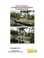 |
| A Unified Sea Level Rise Projection for Southeast Florida |
|
| Publication Date: | |
2011
|
| Creator: | |
Technical Ad Hoc Work Group
|
| Publisher.Display: | |
Southeast Florida Regional Compact Climate Change
|
| Subjects.Display: | |
Florida
Miami-Dade County (Fla.)
Climate change
Sea Level rise
|
| Source Institution: | |
Florida International University
|
|
| A Unified Sea Level Rise Projection for Southeast Florida |
|
 |
| Updating Maryland's Sea-level Rise Projections |
|
| Publication Date: | |
2013-06-26
|
| Subjects.Display: | |
Sea Level rise
Shorelines
Tides
Maryland
|
| Source Institution: | |
Florida International University
|
|
| Updating Maryland's Sea-level Rise Projections |
|
|
 |
| Upland Detention/ Retention Demonstration Project Final Report |
|
| Publication Date: | |
1986-03
|
| Creator: | |
South Florida Water Management District (Fla.)
Goldstein, Alan L
|
| Publisher.Display: | |
Water Chemistry Division, Resource Planning Dept., South Florida Water Management District ( West Palm Beach, Fla. )
|
| Format: | |
viii, 374 pages; illustrations; maps ; 28 cm.
|
| Subjects.Display: | |
Water quality
Kissimmee River (Fla.)
Kissimmee River Watershed (Fla.)
Wetlands ( lcsh )
|
| Source Institution: | |
Florida International University
|
|
| Upland Detention/ Retention Demonstration Project Final Report |
|
 |
| Upland Detention/Retention Demonstration Project: Semi-Annual Report to the Coordinating Council on the Restoration of the Kissimmee River Valley and Taylor Creek/Nubbin Slough Basin |
|
| Publication Date: | |
1980-01
|
| Creator: | |
South Florida Water Management District ( Contributor )
Goldstein, Alan L.
MacVicar, Thomas K.
Mierau, Ronald L.
|
| Publisher.Display: | |
South Florida Water Management District
|
| Format: | |
PDF, 263 pages, illustrations, charts, maps
|
| Subjects.Display: | |
Kissimmee River Valley and Taylor Creek/Nubbin Slough Basin
Water quality monitoring -- Florida -- Kissimmee River (Fla.)
Nitrogen.
Phosphorus.
Hydrology -- Florida -- Kissimmee River (Fla.)
|
| Source Institution: | |
Florida International University
|
|
| Upland Detention/Retention Demonstration Project: Semi-Annual Report to the Coordinating Council on the Restoration of the Kissimmee River Valley and Taylor Creek/Nubbin Slough Basin |
|
|
 |
| Upland Detention/Retention Demonstration Project: Third Annual Report to the Coordinating Council on the Restoration of the Kissimmee River Valley and Taylor Creek/Nubbin Slough Basin |
|
| Publication Date: | |
1981-07
|
| Creator: | |
South Florida Water Management District ( Contributor )
Goldstein, Alan L.
|
| Publisher.Display: | |
South Florida Water Management District
|
| Format: | |
PDF, 285 pages, illustrations, charts, maps
|
| Subjects.Display: | |
Kissimmee River Valley and Taylor Creek/Nubbin Slough Basin
South Florida Water Management District.
Water quality -- Florida -- Kissimmee River.
Wetlands -- Florida -- Kissimmee River Watershed.
|
| Source Institution: | |
Florida International University
|
|
| Upland Detention/Retention Demonstration Project: Third Annual Report to the Coordinating Council on the Restoration of the Kissimmee River Valley and Taylor Creek/Nubbin Slough Basin |
|
 |
| Urban and landscape design guidelines : Downtown Coral Springs |
|
| Publication Date: | |
2002-06
|
| Creator: | |
Coral Springs (Fla.)
ICON architecture, Inc.
Gee & Jenson Engineers, Architects, Planners, Inc.
Selbert Perkins Design (Firm)
|
| Format: | |
pdf
|
| Subjects.Display: | |
City planning.
Landscape design -- Florida.
Landscape design.
City planning -- Florida -- Coral Springs.
Coral Springs (Fla.)
|
| Source Institution: | |
South Florida Collection, Government Documents, Green Library, Florida International University
|
|
| Urban and landscape design guidelines : Downtown Coral Springs |
|
|
 |
| Urban ecosystem analysis Palm Beach County |
|
| Publication Date: | |
2007-07
|
| Creator: | |
Palm Beach County (Fla.)
Florida. Department of Agriculture and Consumer Services
American Forests (Association)
|
| Publisher.Display: | |
American Forests (Association) ( Washington (D.C.) )
|
| Format: | |
pdf
|
| Subjects.Display: | |
Palm Beach County (Fla.)
Urban forestry -- Florida -- Palm Beach County.
Urban forests
Urban ecology (Biology) -- Florida -- Miami-Dade County.
Urban ecology (Biology)
|
| Source Institution: | |
South Florida Collection, Government Documents, Green Library, Florida International University
|
|
| Urban ecosystem analysis Palm Beach County |
|
 |
| Urban noise study of the City of Miami |
|
| Publication Date: | |
1976
|
| Creator: | |
Miami (Fla.)
Mahlbacher, M. H
Joint Center for Environmental and Urban Problems
Florida Atlantic University -- Dept. of Ocean Engineering
Dunn, Stanley E
|
| Publisher.Display: | |
City of Miami
|
| Format: | |
1 v. (various pagings) : ill., maps ; 28 cm.
|
| Subjects.Display: | |
Miami-Dade County (Fla.)
City noise -- Florida -- Miami ( lcsh )
Noise control -- Florida -- Miami ( lcsh )
|
| Source Institution: | |
Florida International University
|
|
| Urban noise study of the City of Miami |
|
|
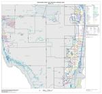 |
| Urbanized area outline map (Census 2000) |
|
| Creator: | |
U.S. Census Bureau
|
| Format: | |
pdf
|
| Subjects.Display: | |
Miami-Dade County (Fla.)
Metropolitan areas.
Metropolitan areas -- Florida -- Miami-Dade County.
Census districts -- Florida -- Miami-Dade County -- Maps.
|
| Source Institution: | |
South Florida Collection, Government Documents, Green Library, Florida International University
|
|
| Urbanized area outline map (Census 2000) |
|
 |
| US Department of Transportation Federal Highway Administration and Florida Deapartment of Transportation Draft Environmental Statement Administrative Action for State Job No. 99004-1504 |
|
| Publication Date: | |
1974
|
| Source Institution: | |
Florida International University
|
|
| US Department of Transportation Federal Highway Administration and Florida Deapartment of Transportation Draft Environmental Statement Administrative Action for State Job No. 99004-1504 |
|
|
 |
| Using enhanced dasymetric mapping techniques to improve the spatial accuracy of sea level rise vulnerability assessments |
|
| Publication Date: | |
2012
|
| Creator: | |
Mitsova, D.
Esnard, A.M.
Li, Y.
|
| Publisher.Display: | |
Springer
|
| Subjects.Display: | |
Florida
Climate change
Sea Level rise
coastal management
|
| Source Institution: | |
Florida International University
|
|
| Using enhanced dasymetric mapping techniques to improve the spatial accuracy of sea level rise vulnerability assessments |
|
 |
| Vegetation Changes in the Lake Okeechobee Littoral Zone 1972-1982 |
|
| Publication Date: | |
1987-04
|
| Creator: | |
Milleson, James F
South Florida Water Management District (Fla.) -- Environmental Sciences Division
|
| Publisher.Display: | |
Environmental Sciences Division, Resource Planning Dept., South Florida Water Management District ( West Palm Beach, Fla )
|
| Format: | |
iii, 33 p. : ill., map ; 28 cm.
|
| Subjects.Display: | |
Marsh plants ( lcsh )
Marsh ecology ( lcsh )
Vegetation dynamics ( lcsh )
Plant communities ( lcsh )
Okeechobee, Lake, Region (Fla.)
|
| Source Institution: | |
Florida International University
|
|
| Vegetation Changes in the Lake Okeechobee Littoral Zone 1972-1982 |
|
|
 |
| Vegetation Cover Types of Shark River Slough, Everglades National Park Derived from LANDSAT Thematic Mapper Data |
|
| Publication Date: | |
1986-01
|
| Creator: | |
Lance H. Gunderson
outh Florida Natural Resources Center/South Florida Research Center, Everglades National Park
David P. Brannon
Gary Irish
|
| Publisher.Display: | |
National Park Service, U.S. Department of the Interior ( Homestead, Florida )
|
| Subjects.Display: | |
Florida
Everglades National Park (Fla.)
Remote sensing
Shark River Slough (Fla.)
Botany
Landsat satellites
|
| Source Institution: | |
Florida International University
|
|
| Vegetation Cover Types of Shark River Slough, Everglades National Park Derived from LANDSAT Thematic Mapper Data |
|
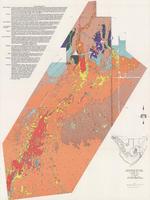 |
| Vegetation Map of Taylor Slough, Everglades National Park |
|
| Publication Date: | |
1978
|
| Creator: | |
South Florida Natural Resources Center/South Florida Research Center, Everglades National Park
Lloyd L. Loope
Richard E. Rintz
|
| Source Institution: | |
Florida International University
|
|
| Vegetation Map of Taylor Slough, Everglades National Park |
|

