|
|
| |
|
 |
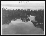
| Bird rookeries on Whitewater Bay, June 12, 1931 |
|
| Publication Date: | |
1931-06-12
|
| Creator: | |
Matlack, Claude Carson, 1878-1944.
|
| Format: | |
11 photos. : black and white; 13 x 10.5 cm.
|
| Subjects.Display: | |
Everglades
Everglades (Fla.)--Photographs
White ibis.
Red mangrove (rhizophora mangle)
Whitewater Bay (Fla.)
Birds
Mangrove plants--Florida--Everglades
Birds--Florida--Everglades
Swallow-tailed kite
Tricolored heron
|
| Source Institution: | |
Florida International University
|
|
| Bird rookeries on Whitewater Bay, June 12, 1931 |
|
 |
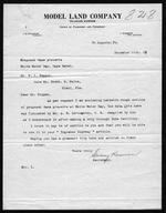
| Correspondence relating to proposed game preserve in the Cape Sable area |
|
| Publication Date: | |
1919
|
| Creator: | |
Model Land Company
Reclaiming the Everglades ( Contributor )
Ingraham, James Edmundson, 1850-1924 ( contributor )
Harrison, Sidney ( contributor )
Pepper, Frank J., b. 1880 ( contributor )
|
| Format: | |
10 items (14 p.) : ;
|
| Subjects.Display: | |
Sable, Cape (Fla.)
Ingraham Highway (Fla.)
Whitewater Bay (Fla.)
Parks -- Everglades (Fla.)
Kendall Grove (Fla.)
|
| Source Institution: | |
Florida International University
|
|
| Correspondence relating to proposed game preserve in the Cape Sable area |
|
|
 |
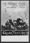
| Everglades advertising, 1929-1931 |
|
| Publication Date: | |
1931
|
| Creator: | |
Matlack, Claude Carson, 1878-1944.
|
| Format: | |
4 photos. : black and white; 18 x 13 cm.
|
| Subjects.Display: | |
Advertising
Everglades National Park (Fla.)
Everglades
Tropic Everglades National Park (Fla.)
Everglades (Fla.)--Photographs
Everglades (Fla.)--Maps.
Whitewater Bay (Fla.)
White ibis
United States--Maps
|
| Source Institution: | |
Florida International University
|
|
| Everglades advertising, 1929-1931 |
|
 |
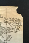
| Map made for the U.S. Coast and Geodetic Survey of Cape Sable : East Cape to Shark River, April 12, 1928 |
|
| Publication Date: | |
1928
|
| Creator: | |
U.S. Coast and Geodetic Survey.
Reading, O. S. ( contributor )
|
| Format: | |
1 map
|
| Subjects.Display: | |
Everglades (Fla.)--Maps.
Sable, Cape (Fla.)--Maps.
Shark River (Fla.)--Maps.
Whitewater Bay (Fla.)--Maps.
|
| Source Institution: | |
Florida International University
|
|
| Map made for the U.S. Coast and Geodetic Survey of Cape Sable : East Cape to Shark River, April 12, 1928 |
|
|

