|
|
| |
|
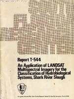 |
| An Application of LANDSAT Multispectral Imagery for the Classification of Hydrobiological Systems, Shark River Slough, Everglades National Park, Florida |
|
| Publication Date: | |
1979
|
| Creator: | |
South Florida Natural Resources Center/South Florida Research Center, Everglades National Park
Paul W. Rose
Peter C. Rosendahl
|
| Publisher.Display: | |
National Park Service, U.S. Department of the Interior ( Homestead, Florida )
|
| Subjects.Display: | |
Hydrology
Remote sensing
Shark River Slough (Fla.)
Wetlands
Landsat satellites
Multispectral imaging
|
| Source Institution: | |
Florida International University
|
|
| An Application of LANDSAT Multispectral Imagery for the Classification of Hydrobiological Systems, Shark River Slough, Everglades National Park, Florida |
|
 |
| AVHRR satellite monitoring of algal blooms and turbidity on Lake Okeechobee, Florida |
|
| Publication Date: | |
1989-08
|
| Creator: | |
Worth, Dewey F
|
| Publisher.Display: | |
South Florida Water Management District ( West Palm Beach, Fla )
|
| Format: | |
iv, 25 leaves : ill. (some col.) ; 28 cm.
|
| Subjects.Display: | |
Okeechobee, Lake (Fla.)
Algal blooms ( lcsh )
Freshwater algae ( lcsh )
Remote sensing ( lcsh )
|
| Source Institution: | |
Florida International University
|
|
| AVHRR satellite monitoring of algal blooms and turbidity on Lake Okeechobee, Florida |
|
|
 |
| Developing a user-friendly tool for BMP assessment model using a GIS |
|
| Publication Date: | |
1996-08
|
| Creator: | |
South Florida Water Management District ( Contributor )
Xue, Richard Z.
Bechtel, Timothy J.
Chen, Zhenquen
|
| Publisher.Display: | |
South Florida Water Management District
|
| Format: | |
PDF, 18 pages, illustrations, charts, maps
|
| Subjects.Display: | |
Environmental monitoring -- Remote sensing -- Florida
Geographic information systems -- Florida
|
| Source Institution: | |
Florida International University
|
|
| Developing a user-friendly tool for BMP assessment model using a GIS |
|
 |
| Proceedings of GeoInformatics '95 Hong Kong International Symposium on Remote Sensing, Geographic Information Systems & Global Positioning Systems in Sustainable Development and Environmental Monitoring. Volume 2 |
|
| Publication Date: | |
1995-05
|
| Creator: | |
South Florida Water Management District ( Contributor )
Xue, Richard Z.
Lovell, John
Lahlou, Mohammed
|
| Publisher.Display: | |
South Florida Water Management District
|
| Format: | |
PDF, 11 pages, charts, maps
|
| Subjects.Display: | |
Sustainable development -- Congresses -- South Florida
Environmental monitoring -- Remote sensing -- Congresses -- South Florida
Geographic information systems -- Congresses -- South Florida
|
| Source Institution: | |
Florida International University
|
|
| Proceedings of GeoInformatics '95 Hong Kong International Symposium on Remote Sensing, Geographic Information Systems & Global Positioning Systems in Sustainable Development and Environmental Monitoring. Volume 2 |
|
|
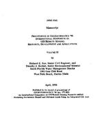 |
| Proceedings of GeoInformatics '96 International Symposium on GIS/Remote Sensing: research, development and applications. Volume II |
|
| Publication Date: | |
1996-04
|
| Creator: | |
South Florida Water Management District ( Contributor )
Xue, Richard Z.
Bechtel, Timothy J.
|
| Publisher.Display: | |
South Florida Water Management District
|
| Format: | |
PDF, 10 pages, illustrations, charts, maps
|
| Subjects.Display: | |
Geographic information systems -- Congresses -- South Florida
Remote sensing -- Congresses -- South Florida
|
| Source Institution: | |
Florida International University
|
|
| Proceedings of GeoInformatics '96 International Symposium on GIS/Remote Sensing: research, development and applications. Volume II |
|
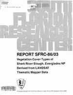 |
| Vegetation Cover Types of Shark River Slough, Everglades National Park Derived from LANDSAT Thematic Mapper Data |
|
| Publication Date: | |
1986-01
|
| Creator: | |
Lance H. Gunderson
outh Florida Natural Resources Center/South Florida Research Center, Everglades National Park
David P. Brannon
Gary Irish
|
| Publisher.Display: | |
National Park Service, U.S. Department of the Interior ( Homestead, Florida )
|
| Subjects.Display: | |
Florida
Everglades National Park (Fla.)
Remote sensing
Shark River Slough (Fla.)
Botany
Landsat satellites
|
| Source Institution: | |
Florida International University
|
|
| Vegetation Cover Types of Shark River Slough, Everglades National Park Derived from LANDSAT Thematic Mapper Data |
|
|

