|
|
| |
|
 |
| An atlas of surface water management basins in the Everglades: THE WATER CONSERVATION AREAS AND EVERGLADES NATIONAL PARK |
|
| Creator: | |
South Florida Water Management District (Fla.) -- Dept. of Research and Evaluation
Cooper, Richard M
Roy, Joanne
|
| Publisher.Display: | |
Water Resources Engineering Division, Dept. of Research and Evaluation, South Florida Water Management District ( West Palm Beach, Fla )
|
| Format: | |
viii, 88 p. : maps ; 28 cm.
|
| Subjects.Display: | |
Everglades (Fla.)
Everglades National Park (Fla.)
Water resources development ( lcsh )
Watersheds -- Maps ( lcsh )
Watershed management ( lcsh )
|
| Source Institution: | |
Florida International University
|
|
| An atlas of surface water management basins in the Everglades: THE WATER CONSERVATION AREAS AND EVERGLADES NATIONAL PARK |
|
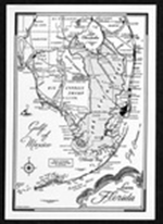 |
| Everglades and Big Cypress postcard. |
|
| Creator: | |
Douglas, Marjory Stoneman
|
| Format: | |
1 item.
|
| Subjects.Display: | |
Everglades (Fla.)--Maps.
|
| Source Institution: | |
Florida International University
|
|
| Everglades and Big Cypress postcard. |
|
|
![Map of South Florida. 19--]](http://dpanther.fiu.edu/sobek/content/MW/00/99/00/02/00001/001a_thm.jpg) |
| Map of South Florida. 19--] |
|
| Creator: | |
Moore-Willson, Minnie, b. 1863. ( Contributor )
|
| Format: | |
1 map.
|
| Subjects.Display: | |
Everglades (Fla.)--Maps.
|
| Source Institution: | |
Florida International University
|
|
| Map of South Florida. 19--] |
|
![For sale Fertile Florida lands in large tracts. 19--]](http://dpanther.fiu.edu/sobek/content/MW/00/99/00/01/00001/001a_thm.jpg) |
| For sale Fertile Florida lands in large tracts. 19--] |
|
| Creator: | |
Moore-Willson, Minnie, b. 1863. ( Contributor )
Hedges, George T. ( Contributor )
|
| Publisher.Display: | |
George T. Hedges & Company.
|
| Format: | |
1 map
|
| Subjects.Display: | |
Everglades (Fla.)--Maps.
Real estate development--Florida--Everglades.
George T. Hedges & Company.
|
| Source Institution: | |
Florida International University
|
|
| For sale Fertile Florida lands in large tracts. 19--] |
|
|
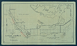 |
| Map of Cape Sable. |
|
| Creator: | |
Model Land Company.
|
| Format: | |
1 item.
|
| Subjects.Display: | |
Sable, Cape (Fla.)--Maps.
|
| Source Institution: | |
Florida International University
|
|
| Map of Cape Sable. |
|
 |
| Maps and letter relating to Cape Sable and Monroe County, Fla., 1927-1930. |
|
| Creator: | |
Model Land Company.
Bowen, Reeves. ( Contributor )
Hoffman, J. W. ( Contributor )
|
| Format: | |
3 items
|
| Subjects.Display: | |
Sable, Cape (Fla.)
Everglades (Fla.)--Maps.
|
| Source Institution: | |
Florida International University
|
|
| Maps and letter relating to Cape Sable and Monroe County, Fla., 1927-1930. |
|
|
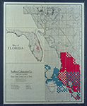 |
| Map of Florida 500,000 acres choice prairie farming lands in Florida. |
|
| Creator: | |
Moore-Willson, Minnie, b. 1863. ( Contributor )
Southern Colonization Company.
|
| Publisher.Display: | |
Southern Colonization Company
|
| Format: | |
1 map.
|
| Subjects.Display: | |
Everglades (Fla.)--Maps.
Real estate development--Florida--Everglades.
Florida--Maps.
|
| Source Institution: | |
Florida International University
|
|
| Map of Florida 500,000 acres choice prairie farming lands in Florida. |
|
 |
| Hydrogeologic reconnaissance of the Floridan aquifer system, Upper East Coast Planning Area |
|
| Creator: | |
South Florida Water Management District. ( Contributor )
Brown, Michael P.
Reece, Dennis.
|
| Format: | |
11 maps : col. ; 58 x 84 cm. folded in envelope 27 x 34 cm.
|
| Subjects.Display: | |
Water quality -- Florida -- Upper East Coast Planning Area -- Maps.
Aquifers -- Florida -- Upper East Coast Planning Area -- Maps.
Groundwater -- Florida -- Upper East Coast Planning Area -- Maps.
|
| Source Institution: | |
Florida International University
|
|
| Hydrogeologic reconnaissance of the Floridan aquifer system, Upper East Coast Planning Area |
|
|
![[1891/1895] General Topographical Map Sheet XI](http://dpanther.fiu.edu/sobek/content/FI/07/04/25/12/00001/FI07042512_thm.jpg) |
| General Topographical Map Sheet XI |
|
| Publication Date: | |
1891/1895
|
| Creator: | |
United States. War Department.
Julius Bien & Co.
|
| Publisher.Display: | |
Washington: G.P.O.
|
| Format: | |
1 map : col. ; 41 x 69 cm.
|
| Subjects.Display: | |
Florida
Florida, U.S.A.
Railroads
Military bases
Swamps
History -- Civil War, 1861-1865
United States -- History -- Civil War, 1861-1865
Maps -- Florida
|
| Source Institution: | |
Florida International University
|
|
| [1891/1895] General Topographical Map Sheet XI |
|
![[1903] Map of Florida showing routes and railroad connections.](http://dpanther.fiu.edu/sobek/content/MW/00/99/00/04/00001/001a_thm.jpg) |
| Map of Florida showing routes and railroad connections. |
|
| Publication Date: | |
1903
|
| Creator: | |
Moore-Willson, Minnie, b. 1863. ( Contributor )
Clyde Steamship Company.
|
| Publisher.Display: | |
C. S. Hammond & Co., ( New York : )
|
| Format: | |
1 map.
|
| Subjects.Display: | |
Florida--Maps.
|
| Source Institution: | |
Florida International University
|
|
| [1903] Map of Florida showing routes and railroad connections. |
|
|
![[1908] Map and Seal of Florida](http://dpanther.fiu.edu/sobek/content/FI/05/11/15/01/00001/FI05111501_001_thm.jpg) |
| Map and Seal of Florida |
|
| Publication Date: | |
1908
|
| Publisher.Display: | |
Emanuel Co.
|
| Subjects.Display: | |
Florida
Florida-Maps
|
| Source Institution: | |
Florida International University
|
|
| [1908] Map and Seal of Florida |
|
![[1910] Map of Florida](http://dpanther.fiu.edu/sobek/content/MW/00/99/00/06/00001/001a_thm.jpg) |
| Map of Florida |
|
| Publication Date: | |
1910
|
| Creator: | |
Moore-Willson, Minnie, b. 1863. ( Contributor )
|
| Format: | |
1 map. : ill.
|
| Subjects.Display: | |
Drainage--Florida--Everglades.
Everglades (Fla.)--Maps.
Broward, Napoleon Bonaparte,--1857-1910.
Florida--Maps.
|
| Source Institution: | |
Florida International University
|
|
| [1910] Map of Florida |
|
|
![[1911] Records pertaining to Everglades land in T59S R37E](http://dpanther.fiu.edu/sobek/content/ML/00/02/00/57/00001/file10thm.jpg) |
| Records pertaining to Everglades land in T59S R37E |
|
| Publication Date: | |
1911
|
| Creator: | |
Model Land Company
Reclaiming the Everglades ( Contributor )
Ingraham, James Edmundson, 1850-1924 ( contributor )
Morse, Frederick S., 1859-1920 ( contributor )
|
| Format: | |
33 items (34 p.), 1 map. : ;
|
| Subjects.Display: | |
Maps -- Everglades (Fla.)
Florida Fruit Land Company
Indian reservations -- Maps -- Florida
Seminole Indians -- Reservations
Krome, William J. -- 1876-1939
Holmberg, J. L.,--Dr.
Richardson Kollet Company
|
| Source Institution: | |
Florida International University
|
|
| [1911] Records pertaining to Everglades land in T59S R37E |
|
![[1913] Records relating to land in the Cape Sable region](http://dpanther.fiu.edu/sobek/content/ML/00/04/01/25/00001/file1thm.jpg) |
| Records relating to land in the Cape Sable region |
|
| Publication Date: | |
1913
|
| Creator: | |
Model Land Company
Reclaiming the Everglades ( Contributor )
|
| Format: | |
3 items. : ;
|
| Subjects.Display: | |
Sable, Cape (Fla.)
Maps -- Everglades (Fla.)
Maps -- Monroe County (Fla.)
Maps -- Sable, Cape (Fla.)
Jennings, William Sherman -- 1863-1920
Dewhurst, William W. -- (William Whitwell) -- b. 1850
|
| Source Institution: | |
Florida International University
|
|
| [1913] Records relating to land in the Cape Sable region |
|
|
![[1917] Records relating to T48S R43S section 30 (Pompano Beach)](http://dpanther.fiu.edu/sobek/content/ML/00/13/03/53/00001/file10thm.jpg) |
| Records relating to T48S R43S section 30 (Pompano Beach) |
|
| Publication Date: | |
1917
|
| Creator: | |
Model Land Company
Reclaiming the Everglades ( Contributor )
Ingraham, James Edmundson, 1850-1924 ( contributor )
Pepper, Frank J., b. 1880 ( contributor )
Morse, Frederick S., 1859-1920 ( contributor )
Chapman, Thomas H. ( contributor )
Dooley, A. A. ( contributor )
Marshall, Carlton ( contributor )
Marshall, Victoria B ( contributor )
|
| Format: | |
31 items (35 p.), 2 maps. : ;
|
| Subjects.Display: | |
Maps -- Everglades (Fla.)
Reclamation of land -- Florida -- Pompano Beach
Florida East Coast Canal (Fla.)
Pompano Beach (Fla.)
Florida East Coast Railway
Everglades Plantation Company
Everglades Engineering Company
Florida Coast Line Canal & Transportation Company
|
| Source Institution: | |
Florida International University
|
|
| [1917] Records relating to T48S R43S section 30 (Pompano Beach) |
|
![[1917] Map showing results of examination of the Tamiami Trail lands in Dade County, Florida, to accompany report dated March 23, 1917.](http://dpanther.fiu.edu/sobek/content/JJ/99/16/00/02/00001/001a_thm.jpg) |
| Map showing results of examination of the Tamiami Trail lands in Dade County, Florida, to accompany report dated March 23, 1917. |
|
| Publication Date: | |
1917
|
| Creator: | |
King, John W.
Jaudon, James Franklin, 1873-1938. ( contributor )
|
| Publisher.Display: | |
King ( Miami )
|
| Format: | |
1 map : blueprint.
|
| Subjects.Display: | |
Everglades (Fla.)--Maps.
Tamiami Trail (Fla.)--Maps.
|
| Source Institution: | |
Florida International University
|
|
| [1917] Map showing results of examination of the Tamiami Trail lands in Dade County, Florida, to accompany report dated March 23, 1917. |
|
|
![[1917] Map showing results of exploration and examinations in Lee, Monroe and Dade Counties, Florida.](http://dpanther.fiu.edu/sobek/content/JJ/97/16/00/02/00001/001a_thm.jpg) |
| Map showing results of exploration and examinations in Lee, Monroe and Dade Counties, Florida. |
|
| Publication Date: | |
1917
|
| Creator: | |
King, John W.
Jaudon, James Franklin, 1873-1938. ( contributor )
|
| Publisher.Display: | |
Miami: King
|
| Format: | |
1 map : blueprint.
|
| Subjects.Display: | |
Everglades (Fla.)--Maps.
Ten Thousand Islands (Fla.)--Maps.
Biscayne Bay (Fla.)--Maps.
|
| Source Institution: | |
Florida International University
|
|
| [1917] Map showing results of exploration and examinations in Lee, Monroe and Dade Counties, Florida. |
|
![[1918] Correspondence relating to Everglades drainage and land sales](http://dpanther.fiu.edu/sobek/content/ML/00/18/04/67/00001/file10thm.jpg) |
| Correspondence relating to Everglades drainage and land sales |
|
| Publication Date: | |
1918
|
| Creator: | |
Model Land Company
Reclaiming the Everglades ( Contributor )
Ingraham, James Edmundson, 1850-1924 ( contributor )
Harrison, Sidney ( contributor )
Pepper, Frank J., b. 1880 ( contributor )
Morse, Frederick S., 1859-1920 ( contributor )
Potter, Burr S. ( contributor )
|
| Format: | |
18 items (19 p.), 1 map. : ;
|
| Subjects.Display: | |
Real estate development -- Florida -- Everglades
Maps -- Everglades (Fla.)
Reclamation of land -- Florida -- Everglades
Snapper Creek Canal (Fla.)
Dice, David B.
|
| Source Institution: | |
Florida International University
|
|
| [1918] Correspondence relating to Everglades drainage and land sales |
|
|
![[1920] Records relating to Ingraham Highway and Royal Palm Hammock (Royal Palm State Park)](http://dpanther.fiu.edu/sobek/content/ML/00/17/04/49/00001/file10thm.jpg) |
| Records relating to Ingraham Highway and Royal Palm Hammock (Royal Palm State Park) |
|
| Publication Date: | |
1920
|
| Creator: | |
Model Land Company
Reclaiming the Everglades ( Contributor )
Ingraham, James Edmundson, 1850-1924 ( contributor )
Harrison, Sidney ( contributor )
Pepper, Frank J., b. 1880 ( contributor )
Morse, Frederick S., 1859-1920 ( contributor )
Dooley, A. A. ( contributor )
Dewhurst, William W ( William Whitwell ), b. 1850 ( contributor )
Parker, Dorothy D. ( contributor )
|
| Format: | |
61 items (68 p.), 1 map. : ;
|
| Subjects.Display: | |
Sable, Cape (Fla.)
Maps -- Everglades (Fla.)
Ingraham Highway (Fla.)
Royal Palm Hammock (Fla.)
Royal Palm State Park (Fla.)
Flamingo (Fla.)
Long Pine Key (Fla.)
Mangrove -- Maps
Marl -- Maps
Camp Dewhurst (Fla.)
Camp Jennings (Fla.)
Camp Omega (Fla.)
Jennings, William Sherman -- 1863-1920
Cape Sable Development Company
Dewhurst, William W. -- William Whitwell -- b. 1850
McCrary, J. B.
Mosier, Charles R.
McCrary Engineering Corporation
Paradise Land Company
Paradise Prairie Land Co.
|
| Source Institution: | |
Florida International University
|
|
| [1920] Records relating to Ingraham Highway and Royal Palm Hammock (Royal Palm State Park) |
|
![[1920] Road map of Florida.](http://dpanther.fiu.edu/sobek/content/MW/00/99/00/03/00001/001a_thm.jpg) |
| Road map of Florida. |
|
| Publication Date: | |
1920
|
| Creator: | |
Moore-Willson, Minnie, b. 1863. ( Contributor )
Cold, Paul E.
Florida State Automobile Association. ( Contributor )
|
| Publisher.Display: | |
Florida State Automobile Association.
|
| Format: | |
1 map. : ill.
|
| Subjects.Display: | |
Everglades (Fla.)--Maps.
Florida--Maps.
|
| Source Institution: | |
Florida International University
|
|
| [1920] Road map of Florida. |
|
|

