| |
|
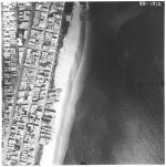 |
| Aerial survey photographs of Miami Beach between Lummus Park to Government Cut. |
|
| Publisher.Display: | |
Rader & Associates, ( Miami, Fla. : )
|
| Format: | |
5 photographs : ill. ; 23 x 23 cm.
|
| Measurements: | |
23 x 23
|
| Subjects.Display: | |
Miami Beach (Fla.)--Buildings, structures, etc.--Pictorial works.
Miami Beach (Fla.)--Aerial views.
Miami Beach (Fla.)--Aerial photographs.
Collins Avenue (Miami Beach, Fla.)--1950-1960.
Houses--1950-1960.
Parks--1950-1960.
Washington Avenue (Miami Beach, Fla.)--1950-1960.
Lincoln Road (Miami Beach, Fla.)--1950-1960.
Ocean Drive (Miami Beach, Fla.)--1950-1960.
Streets--1950-1970.
|
| Source Institution: | |
City of Miami Beach
|
| Donor: | |
Ares, Aristotle.
|
|
| Aerial survey photographs of Miami Beach between Lummus Park to Government Cut. |
|
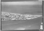 |
| Government Cut and Miami Beach aerial photographs |
|
| Format: | |
3 photographs: ill. ; xx x yy cm.
|
| Subjects.Display: | |
Miami Beach (Fla.)--Pictorial works.
Miami Beach (Fla.)--Aerial photographs.
City planning--United States--Florida--Miami Beach.
Hotels & taverns—United States--Florida—Miami Beach
Housing--United States--Florida—Miami Beach
|
| Source Institution: | |
City of Miami Beach
|
|
| Government Cut and Miami Beach aerial photographs |
|
|
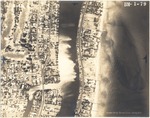 |
| Aerial views of oceanfront buildings in North Miami Beach. Views of estates, hotels, and green areas |
|
| Publisher.Display: | |
Aerial Survey Corp., ( Lansing, Mich. : )
|
| Subjects.Display: | |
Miami Beach (Fla.)
Miami Beach (Fla.)--Pictorial works.
Miami Beach (Fla.)--Aerial views.
Hotels--1950-1970.
Streets--1950-1970.
Bridges--1950-1970.
Islands--1950-1970.
Waterways--1950-1970.
City of Surfside (Fla.)--Pictorial works.
Golf--1950-1970.
Clubs--1950-1970.
Lakes & ponds--1950-1970.
Estates--1950-1970.
City of Surfside (Fla.)--Aerial views.
|
| Source Institution: | |
City of Miami Beach
|
| Donor: | |
Ares, Aristotle.
|
|
| Aerial views of oceanfront buildings in North Miami Beach. Views of estates, hotels, and green areas |
|
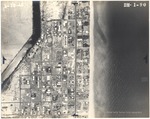 |
| Aerial views of City of Surfside, Florida, and North Miami Beach islands and buildings |
|
| Publisher.Display: | |
Aerial Survey Corp., ( Lansing, Mich. : )
|
| Subjects.Display: | |
North Miami Beach (Fla.)--Pictorial works.
Streets--1950-1970.
Islands--1950-1970.
Waterways--1950-1970.
Golf--1950-1960.
City of Surfside (Fla.)--Pictorial works.
City of Surfside (Fla.)--Aerial views.
City of Surfside, Fla.
|
| Source Institution: | |
City of Miami Beach
|
| Donor: | |
Ares, Aristotle.
|
|
| Aerial views of City of Surfside, Florida, and North Miami Beach islands and buildings |
|
|
 |
| Aerial View of North Shore Open Space Park |
|
| Format: | |
1 color photograph
|
| Subjects.Display: | |
Parks
Florida--Miami Beach
|
| Source Institution: | |
City of Miami Beach
|
|
| Aerial View of North Shore Open Space Park |
|
 |
| Aerial view of Miami Beach parking lots and structures, looking west |
|
| Publisher.Display: | |
The City of Miami Beach News Bureau
|
| Format: | |
Series includes 60 photographs : ill. ; [various sizes, largest: 12 x 18 cm.].
|
| Subjects.Display: | |
Architecture
Miami Beach (Fla.)--Pictorial works.
Golf courses--1950-1960.
Bayshore Municipal Golf Course
|
| Source Institution: | |
City of Miami Beach
|
|
| Aerial view of Miami Beach parking lots and structures, looking west |
|
|
![[1900/1920] Copy of aerial view of Biscayne Bay looking east](http://dpanther.fiu.edu/sobek/content/MB/17/12/04/42/00001/MB17072417_3018_16_001thm.jpg) |
| Copy of aerial view of Biscayne Bay looking east |
|
| Publication Date: | |
1900/1920
|
| Creator: | |
City of Miami Beach
|
| Publisher.Display: | |
City of Miami Beach
|
| Source Institution: | |
City of Miami Beach
|
|
| [1900/1920] Copy of aerial view of Biscayne Bay looking east |
|
![[1900/1920] Copy of aerial view of Biscayne Bay and Lake Pancoast](http://dpanther.fiu.edu/sobek/content/MB/17/12/04/42/00002/MB17072417_3018_16_002thm.jpg) |
| Copy of aerial view of Biscayne Bay and Lake Pancoast |
|
| Publication Date: | |
1900/1920
|
| Creator: | |
City of Miami Beach
|
| Publisher.Display: | |
City of Miami Beach
|
| Source Institution: | |
City of Miami Beach
|
|
| [1900/1920] Copy of aerial view of Biscayne Bay and Lake Pancoast |
|
|
![[1900/1920] Copy of aerial view of Miami Beach looking south](http://dpanther.fiu.edu/sobek/content/MB/17/12/04/42/00003/MB17072417_3018_16_003thm.jpg) |
| Copy of aerial view of Miami Beach looking south |
|
| Publication Date: | |
1900/1920
|
| Creator: | |
City of Miami Beach
|
| Publisher.Display: | |
City of Miami Beach
|
| Source Institution: | |
City of Miami Beach
|
|
| [1900/1920] Copy of aerial view of Miami Beach looking south |
|
![[1900/1920] Aerial view of Miami Beach looking west](http://dpanther.fiu.edu/sobek/content/MB/17/12/04/42/00010/MB17072417_3018_16_010thm.jpg) |
| Aerial view of Miami Beach looking west |
|
| Publication Date: | |
1900/1920
|
| Creator: | |
City of Miami Beach
|
| Publisher.Display: | |
City of Miami Beach
|
| Source Institution: | |
City of Miami Beach
|
|
| [1900/1920] Aerial view of Miami Beach looking west |
|
|
![[1900/1920] Aerial view of Miami Beach looking east. The National Hotel in the front. The Flamingo Hotel, the Venetian Causeway, the County Causeway and Miami's skyline in the back.](http://dpanther.fiu.edu/sobek/content/MB/17/12/04/42/00011/MB17072417_3018_16_011thm.jpg) |
| Aerial view of Miami Beach looking east. The National Hotel in the front. The Flamingo Hotel, the Venetian Causeway, the County Causeway and Miami's skyline in the back. |
|
| Publication Date: | |
1900/1920
|
| Creator: | |
City of Miami Beach
|
| Publisher.Display: | |
City of Miami Beach
|
| Source Institution: | |
City of Miami Beach
|
|
| [1900/1920] Aerial view of Miami Beach looking east. The National Hotel in the front. The Flamingo Hotel, the Venetian Causeway, the County Causeway and Miami's skyline in the back. |
|
![[1900/1920] Aerial view of Miami Beach looking north](http://dpanther.fiu.edu/sobek/content/MB/17/12/04/42/00032/MB17072417_3018_16_032thm.jpg) |
| Aerial view of Miami Beach looking north |
|
| Publication Date: | |
1900/1920
|
| Creator: | |
City of Miami Beach
|
| Publisher.Display: | |
City of Miami Beach
|
| Source Institution: | |
City of Miami Beach
|
|
| [1900/1920] Aerial view of Miami Beach looking north |
|
|
![[1900/1920] Aerial view of Miami Beach looking north](http://dpanther.fiu.edu/sobek/content/MB/17/12/04/42/00033/MB17072417_3018_16_033thm.jpg) |
| Aerial view of Miami Beach looking north |
|
| Publication Date: | |
1900/1920
|
| Creator: | |
City of Miami Beach
|
| Publisher.Display: | |
City of Miami Beach
|
| Source Institution: | |
City of Miami Beach
|
|
| [1900/1920] Aerial view of Miami Beach looking north |
|
![[1914/1980] Aerial view of oceanfront hotels and buildings](http://dpanther.fiu.edu/sobek/content/AA/00/00/00/40/00007/AA00000040_3003_7_000thm.jpg) |
| Aerial view of oceanfront hotels and buildings |
|
| Publication Date: | |
1914/1980
|
| Format: | |
Black and white photograph, various sizes
|
| Subjects.Display: | |
Miami Beach (Fla.)--Buildings, structures, etc.--Pictorial works.
|
| Source Institution: | |
Miami Beach Digital Archive
|
| Donor: | |
City of Miami Beach, Public Works Department
|
|
| [1914/1980] Aerial view of oceanfront hotels and buildings |
|
|
![[1914/1980] Slides showing aerial views of Miami Beach](http://dpanther.fiu.edu/sobek/content/AA/00/00/00/40/00014/AA00000040_3003_14_000thm.jpg) |
| Slides showing aerial views of Miami Beach |
|
| Publication Date: | |
1914/1980
|
| Creator: | |
Scale Models Unlimited
|
| Publisher.Display: | |
Miami Beach Tourist Development Auth. Publicity Dept.
|
| Format: | |
Color slides
|
| Subjects.Display: | |
Miami Beach (Fla.)--Buildings, structures, etc.--Pictorial works.
aerial photographs
Florida--Miami Beach
|
| Source Institution: | |
Miami Beach Digital Archive
|
| Donor: | |
City of Miami Beach, Public Works Department
|
|
| [1914/1980] Slides showing aerial views of Miami Beach |
|
![[1914/1980] Slides showing aerial views of Miami Beach](http://dpanther.fiu.edu/sobek/content/AA/00/00/00/40/00015/AA00000040_3003_15_000thm.jpg) |
| Slides showing aerial views of Miami Beach |
|
| Publication Date: | |
1914/1980
|
| Creator: | |
Scale Models Unlimited
|
| Publisher.Display: | |
Miami Beach Tourist Development Auth. Publicity Dept.
|
| Format: | |
Color slides
|
| Subjects.Display: | |
Miami Beach (Fla.)--Buildings, structures, etc.--Pictorial works.
aerial photographs
Florida--Miami Beach
|
| Source Institution: | |
Miami Beach Digital Archive
|
| Donor: | |
City of Miami Beach, Public Works Department
|
|
| [1914/1980] Slides showing aerial views of Miami Beach |
|
|
![[1914/1980] Slides showing aerial views of Miami Beach](http://dpanther.fiu.edu/sobek/content/AA/00/00/00/40/00016/AA00000040_3003_16_000thm.jpg) |
| Slides showing aerial views of Miami Beach |
|
| Publication Date: | |
1914/1980
|
| Creator: | |
Scale Models Unlimited
|
| Publisher.Display: | |
Miami Beach Tourist Development Auth. Publicity Dept.
|
| Format: | |
Color slides
|
| Subjects.Display: | |
Miami Beach (Fla.)--Buildings, structures, etc.--Pictorial works.
aerial photographs
Florida--Miami Beach
|
| Source Institution: | |
Miami Beach Digital Archive
|
| Donor: | |
City of Miami Beach, Public Works Department
|
|
| [1914/1980] Slides showing aerial views of Miami Beach |
|
![[1914/1980] Aerial view of the Miami Beach Municipal Golf Club](http://dpanther.fiu.edu/sobek/content/AA/00/00/00/40/00020/AA00000040_3003_20_000thm.jpg) |
| Aerial view of the Miami Beach Municipal Golf Club |
|
| Publication Date: | |
1914/1980
|
| Creator: | |
Miami Beach Tourist Development Auth. Publicity Dept.
|
| Subjects.Display: | |
Miami Beach (Fla.)--Buildings, structures, etc.--Pictorial works.
aerial photographs
Florida--Miami Beach
|
| Source Institution: | |
Miami Beach Digital Archive
|
| Donor: | |
City of Miami Beach, Public Works Department
|
|
| [1914/1980] Aerial view of the Miami Beach Municipal Golf Club |
|
|
![[1919] Aerial View of Collins Avenue](http://dpanther.fiu.edu/sobek/content/MB/00/00/00/88/00001/194_000thm.jpg) |
| Aerial View of Collins Avenue |
|
| Publication Date: | |
1919
|
| Format: | |
1 photograph : ill. ; 19 x 25 cm.
|
| Measurements: | |
19 x 25
|
| Subjects.Display: | |
Miami Beach (Fla.)--Aerial photographs.
Piers & wharves--Florida--Miami Beach--1910-1920.
Collins Avenue (Miami Beach, Fla.)--1910-1920.
Streets--United States--Florida--Miami Beach--1910-1920.
Buildings--Additions--United States--Design and construction--1910-1920.
|
| Source Institution: | |
City of Miami Beach
|
|
| [1919] Aerial View of Collins Avenue |
|
![[1920] Aerial photograph of the county causeway and power house, Star Island and the west side of Miami Beach](http://dpanther.fiu.edu/sobek/content/MB/17/07/24/18/00042/166_39_000thm.jpg) |
| Aerial photograph of the county causeway and power house, Star Island and the west side of Miami Beach |
|
| Publication Date: | |
1920
|
| Publisher.Display: | |
Miami Beach Tourist Development Authority, Publicity Department
Miami Beach Visitor and Convention Authority
|
| Subjects.Display: | |
Miami Beach (Fla.)--Pictorial works.
Fisher, Carl G. 1874-1939.
Construction--1900-1940.
Municipal buildings--Pictorial works.
Hotels--1900-1940.
|
| Source Institution: | |
Miami Beach Digital Archive
|
|
| [1920] Aerial photograph of the county causeway and power house, Star Island and the west side of Miami Beach |
|

