| |
|
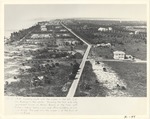 |
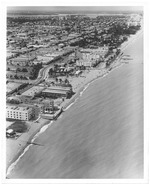
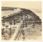
| Aerial View of Collins Avenue |
|
|
| Aerial View of Collins Avenue |
|
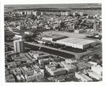 |
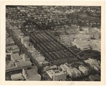
| Aerial view of Convention Center in the 1960s |
|
|
| Aerial view of Convention Center in the 1960s |
|
|
 |
| Aerial view of La Gorce golf course |
|
|
| Aerial view of La Gorce golf course |
|
 |
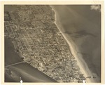
| Aerial view of Miami Beach looking north from 57th street |
|
|
| Aerial view of Miami Beach looking north from 57th street |
|
|
 |
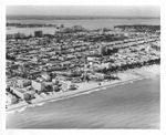
| Aerial view of Miami Beach, looking north from Seventy-first Street |
|
|
| Aerial view of Miami Beach, looking north from Seventy-first Street |
|
 |
| Aerial view of Miami Beach looking west, 1964 |
|
|
| Aerial view of Miami Beach looking west, 1964 |
|
|
 |
| Aerial view of Miami Beach South Shore area and Biscayne Bay |
|
|
| Aerial view of Miami Beach South Shore area and Biscayne Bay |
|
 |
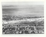
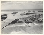
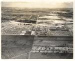
| Aerial view of North Miami Beach |
|
|
Aerial view of North Miami Beach
( 31 volumes ) |
|
|
 |
| Aerial view of North Miami Beach shopping center and Hallandale Beach Blvd, 1957 |
|
|
| Aerial view of North Miami Beach shopping center and Hallandale Beach Blvd, 1957 |
|
 |
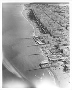
| Aerial view of Ocean Drive between Fifth and Seventh Streets in 1960s |
|
|
| Aerial view of Ocean Drive between Fifth and Seventh Streets in 1960s |
|
|
 |
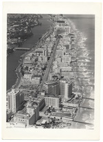
| Aerial view of oceanfront hotels looking north |
|
|
Aerial view of oceanfront hotels looking north
( 37 volumes ) |
|
 |
| Aerial view of parking lot behind Lincoln Road and Washington Avenue |
|
|
| Aerial view of parking lot behind Lincoln Road and Washington Avenue |
|
|
 |
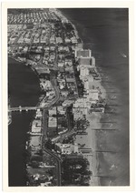
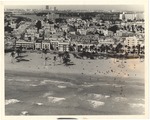
| Aerial view of South Beach |
|
|
| Aerial view of South Beach |
|
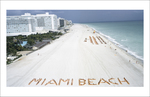 |
| Aerial view of sunbathers forming the word Miami Beach on the beach next to the Fontainebleau and Sorrento Hotel |
|
|
| Aerial view of sunbathers forming the word Miami Beach on the beach next to the Fontainebleau and Sorrento Hotel |
|
|
 |
| Aerial view of the beach looking south at Lummus Park from the vantage point of Seventeenth Street |
|
|
| Aerial view of the beach looking south at Lummus Park from the vantage point of Seventeenth Street |
|
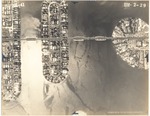 |
| Aerial view of the Di Lido, Rivo Alto and Belle Islands |
|
|
Aerial view of the Di Lido, Rivo Alto and Belle Islands
( 13 volumes ) |
|
|
 |
| Aerial view of the Firestone Estate and Pancoast House |
|
|
| Aerial view of the Firestone Estate and Pancoast House |
|
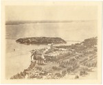 |
| Aerial view of the Flamingo Hotel and Belle Isle |
|
|
| Aerial view of the Flamingo Hotel and Belle Isle |
|
|
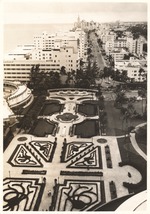 |
| Aerial view of the Fontainebleau Hotel gardens |
|
|
Aerial view of the Fontainebleau Hotel gardens
( 32 volumes ) |
|
 |
| Aerial view of the Miami Beach Electric Company (built in 1920) |
|
|
Aerial view of the Miami Beach Electric Company (built in 1920)
( 10 volumes ) |
|

