|
|
| |
|
 |
| An atlas of surface water management basins in the Everglades: THE WATER CONSERVATION AREAS AND EVERGLADES NATIONAL PARK |
|
| Creator: | |
South Florida Water Management District (Fla.) -- Dept. of Research and Evaluation
Cooper, Richard M
Roy, Joanne
|
| Publisher.Display: | |
Water Resources Engineering Division, Dept. of Research and Evaluation, South Florida Water Management District ( West Palm Beach, Fla )
|
| Format: | |
viii, 88 p. : maps ; 28 cm.
|
| Subjects.Display: | |
Everglades (Fla.)
Everglades National Park (Fla.)
Water resources development ( lcsh )
Watersheds -- Maps ( lcsh )
Watershed management ( lcsh )
|
| Source Institution: | |
Florida International University
|
|
| An atlas of surface water management basins in the Everglades: THE WATER CONSERVATION AREAS AND EVERGLADES NATIONAL PARK |
|
 |
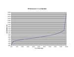
| South Beach Hypsographic Curve (Adjusted) |
|
| Creator: | |
Harlem,Peter
|
| Subjects.Display: | |
Florida
Maps
Hypsographic maps
|
| Source Institution: | |
Florida International University
|
|
| South Beach Hypsographic Curve (Adjusted) |
|
|
![[1988-06] An atlas of eastern Palm Beach County surface water management basins](http://dpanther.fiu.edu/sobek/content/FI/12/09/02/42/00001/FI12090242thm.jpg) |
| An atlas of eastern Palm Beach County surface water management basins |
|
| Publication Date: | |
1988-06
|
| Creator: | |
Lane, Jim
South Florida Water Management District (Fla.)
Cooper, Richard M
|
| Publisher.Display: | |
Water Resources Division, Resource Planning Dept., South Florida Water Management District ( West Palm Beach, Fla. )
|
| Format: | |
v, 61 p. : maps ; 28 cm.
|
| Subjects.Display: | |
Water resources development ( lcsh )
Palm Beach County (Fla.)
Watersheds -- Maps ( lcsh )
|
| Source Institution: | |
Florida International University
|
|
| [1988-06] An atlas of eastern Palm Beach County surface water management basins |
|
![[1988-11] An atlas of St. Lucie County surface water management basins](http://dpanther.fiu.edu/sobek/content/FI/12/09/02/63/00001/FI12090263thm.jpg) |
| An atlas of St. Lucie County surface water management basins |
|
| Publication Date: | |
1988-11
|
| Creator: | |
South Florida Water Management District (Fla.)
Cooper, Richard M
Ortel, Terry W
|
| Publisher.Display: | |
Water Resources Division, Resource Planning Dept., South Florida Water Management District ( West Palm Beach, Fla. )
|
| Format: | |
vi, 40 p. : maps ; 28 cm.
|
| Subjects.Display: | |
Water resources development ( lcsh )
Watersheds -- Maps ( lcsh )
Saint Lucie County (Fla.)
|
| Source Institution: | |
Florida International University
|
|
| [1988-11] An atlas of St. Lucie County surface water management basins |
|
|
![[1992-05] A Three-Dimensional Finite Difference Ground Water Flow Model of the Surficial Aquifer System, Broward County, Florida](http://dpanther.fiu.edu/sobek/content/FI/12/09/03/12/00001/FI12090312thm.jpg) |
| A Three-Dimensional Finite Difference Ground Water Flow Model of the Surficial Aquifer System, Broward County, Florida |
|
| Publication Date: | |
1992-05
|
| Creator: | |
South Florida Water Management District (Fla.)
South Florida Water Management District
Restrepo Mejia, Jorge I
Bevier, Cindy
Butler, David
|
| Publisher.Display: | |
Hydrogeology Division, Dept. of Research and Evaluation, South Florida Water Management District ( West Palm Beach, Fla )
|
| Format: | |
viii, 262 p. : ill., charts, maps ; 28 cm.
|
| Subjects.Display: | |
Broward County (Fla.)
Hydrologic models ( lcsh )
Groundwater flow -- Mathematical models ( lcsh )
Groundwater -- Mathematical models ( lcsh )
Groundwater -- Maps
Water-supply -- Maps
Aquifers -- Maps
|
| Source Institution: | |
Florida International University
|
|
| [1992-05] A Three-Dimensional Finite Difference Ground Water Flow Model of the Surficial Aquifer System, Broward County, Florida |
|
![[2000] Maps of Lands Vulnerable to Sea Level Rise](http://dpanther.fiu.edu/sobek/content/FI/15/06/09/48/00001/Titus_Richman_2001_Maps of lands vulnerable to sea level risethm.jpg) |
| Maps of Lands Vulnerable to Sea Level Rise |
|
| Publication Date: | |
2000
|
| Creator: | |
J.G. Titus
C. Richman
|
| Subjects.Display: | |
Climate change
Sea Level rise
Maps
Atlantic Region
|
| Source Institution: | |
Florida International University
|
|
| [2000] Maps of Lands Vulnerable to Sea Level Rise |
|
|
![[2010] Modeling Municipal Vulnerability to Rising Sea Level](http://dpanther.fiu.edu/sobek/content/FI/15/06/18/30/00001/Parkinson et al_2010_Modeling Municipal Vulnerability to Rising Sea Levelthm.jpg) |
| Modeling Municipal Vulnerability to Rising Sea Level |
|
| Publication Date: | |
2010
|
| Creator: | |
Parkinson, Randall W.
McCue, Tara
Day, Bob
|
| Publisher.Display: | |
Space Coast Climate Change Initiative
|
| Subjects.Display: | |
Florida
Climate change
Sea Level rise
Maps
|
| Source Institution: | |
Florida International University
|
|
| [2010] Modeling Municipal Vulnerability to Rising Sea Level |
|
|
|

