|
|
| |
|
 |
| ACQUISITION, CURATION, AND MAPPING APPLICATIONS OF PHENOTYPIC ACCESSION INFORMATION |
|
| Publication Date: | |
2013-2016
|
| Creator: | |
Daniel Gann
|
| Format: | |
FIU GIS Center Project
|
| Subjects.Display: | |
FIU, GIS, REMOTE SENSING
FIU GIS Center Project
4
|
| Source Institution: | |
Florida International University
|
|
| ACQUISITION, CURATION, AND MAPPING APPLICATIONS OF PHENOTYPIC ACCESSION INFORMATION |
|
 |
| An Application of LANDSAT Multispectral Imagery for the Classification of Hydrobiological Systems, Shark River Slough, Everglades National Park, Florida |
|
| Publication Date: | |
1979
|
| Creator: | |
South Florida Natural Resources Center/South Florida Research Center, Everglades National Park
Paul W. Rose
Peter C. Rosendahl
|
| Publisher.Display: | |
National Park Service, U.S. Department of the Interior ( Homestead, Florida )
|
| Subjects.Display: | |
Hydrology
Remote sensing
Shark River Slough (Fla.)
Wetlands
Landsat satellites
Multispectral imaging
|
| Source Institution: | |
Florida International University
|
|
| An Application of LANDSAT Multispectral Imagery for the Classification of Hydrobiological Systems, Shark River Slough, Everglades National Park, Florida |
|
|
 |
| AVHRR satellite monitoring of algal blooms and turbidity on Lake Okeechobee, Florida |
|
| Publication Date: | |
1989-08
|
| Creator: | |
Worth, Dewey F
|
| Publisher.Display: | |
South Florida Water Management District ( West Palm Beach, Fla )
|
| Format: | |
iv, 25 leaves : ill. (some col.) ; 28 cm.
|
| Subjects.Display: | |
Okeechobee, Lake (Fla.)
Algal blooms ( lcsh )
Freshwater algae ( lcsh )
Remote sensing ( lcsh )
|
| Source Institution: | |
Florida International University
|
|
| AVHRR satellite monitoring of algal blooms and turbidity on Lake Okeechobee, Florida |
|
 |
| Developing a user-friendly tool for BMP assessment model using a GIS |
|
| Publication Date: | |
1996-08
|
| Creator: | |
South Florida Water Management District ( Contributor )
Xue, Richard Z.
Bechtel, Timothy J.
Chen, Zhenquen
|
| Publisher.Display: | |
South Florida Water Management District
|
| Format: | |
PDF, 18 pages, illustrations, charts, maps
|
| Subjects.Display: | |
Environmental monitoring -- Remote sensing -- Florida
Geographic information systems -- Florida
|
| Source Institution: | |
Florida International University
|
|
| Developing a user-friendly tool for BMP assessment model using a GIS |
|
|
 |
| GIS technology for disasters and emergency management |
|
| Publication Date: | |
2000-05
|
| Creator: | |
Disaster Risk Reduction Program, Florida International University (DRR/FIU) ( summary contributor )
Johnson, Russ
|
| Publisher.Display: | |
Environmental Systems Research Institute (ESRI)
|
| Subjects.Display: | |
Disaster response and recovery
Emergency management
Geographic information systems
Remote sensing
|
| Source Institution: | |
Florida International University
|
|
| GIS technology for disasters and emergency management |
|
 |
| Land use changes in the transboundary Mara basin: a threat to pristine wildlife sanctuaries in East Africa |
|
| Publication Date: | |
2005-09-01
|
| Creator: | |
Mati, Bancy M.
Mutie, Simon
Home, Patrick
Mtalo, Felix
Gadain, Hussein
|
| Publisher.Display: | |
International River Symposium
|
| Format: | |
Article
|
| Subjects.Display: | |
Hydrology
Land use
Remote sensing
GIS
Wildlife
Wetland
Forest
|
| Source Institution: | |
Florida International University
|
|
| Land use changes in the transboundary Mara basin: a threat to pristine wildlife sanctuaries in East Africa |
|
|
 |
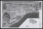
| Miniature Railroad Site Plan |
|
| Publication Date: | |
5/21/2009
|
| Creator: | |
unknown
|
| Subjects.Display: | |
Virginia Key Beach Park (Miami, Fla.)
Remote-sensing images
|
| Source Institution: | |
Virginia Key Beach Park Trust
|
|
| Miniature Railroad Site Plan |
|
 |
| A New, Robust, and Accurate Method to Extract Tide-Coordinated Shorelines from Coastal Elevation Models |
|
| Publication Date: | |
2011
|
| Creator: | |
Fernandez Luque, Ismael
Aguilar Torres, Fernando J.
Aguilar Torres, Manuel A.
Perez Garcia, Jose L.
Lopez Arenas, Andres
|
| Publisher.Display: | |
Coastal Education & Research Foundation
|
| Subjects.Display: | |
Climate change
Remote sensing
Coastal Erosion
Spain
|
| Source Institution: | |
Florida International University
|
|
| A New, Robust, and Accurate Method to Extract Tide-Coordinated Shorelines from Coastal Elevation Models |
|
|
 |
| Proceedings of GeoInformatics '95 Hong Kong International Symposium on Remote Sensing, Geographic Information Systems & Global Positioning Systems in Sustainable Development and Environmental Monitoring. Volume 2 |
|
| Publication Date: | |
1995-05
|
| Creator: | |
South Florida Water Management District ( Contributor )
Xue, Richard Z.
Lovell, John
Lahlou, Mohammed
|
| Publisher.Display: | |
South Florida Water Management District
|
| Format: | |
PDF, 11 pages, charts, maps
|
| Subjects.Display: | |
Sustainable development -- Congresses -- South Florida
Environmental monitoring -- Remote sensing -- Congresses -- South Florida
Geographic information systems -- Congresses -- South Florida
|
| Source Institution: | |
Florida International University
|
|
| Proceedings of GeoInformatics '95 Hong Kong International Symposium on Remote Sensing, Geographic Information Systems & Global Positioning Systems in Sustainable Development and Environmental Monitoring. Volume 2 |
|
 |
| Proceedings of GeoInformatics '96 International Symposium on GIS/Remote Sensing: research, development and applications. Volume II |
|
| Publication Date: | |
1996-04
|
| Creator: | |
South Florida Water Management District ( Contributor )
Xue, Richard Z.
Bechtel, Timothy J.
|
| Publisher.Display: | |
South Florida Water Management District
|
| Format: | |
PDF, 10 pages, illustrations, charts, maps
|
| Subjects.Display: | |
Geographic information systems -- Congresses -- South Florida
Remote sensing -- Congresses -- South Florida
|
| Source Institution: | |
Florida International University
|
|
| Proceedings of GeoInformatics '96 International Symposium on GIS/Remote Sensing: research, development and applications. Volume II |
|
|
 |
| Resilient disaster response |
|
| Publication Date: | |
2003
|
| Creator: | |
Disaster Risk Reduction Program, Florida International University (DRR/FIU) ( summary contributor )
Shinozuka, Masanobu
Eguchi, Ronald T.
Huyck, Charles K.
Adams, Beverly J.
Mansouri, Babak
Houshmand, Bijan
|
| Publisher.Display: | |
National Science Foundation
Multidisciplinary Center for Earthquake Engineering Research (MCEER)
|
| Subjects.Display: | |
Disaster response and recovery
Natural hazards and disasters -- Earthquakes
Remote sensing -- Technology
|
| Source Institution: | |
Florida International University
|
|
| Resilient disaster response |
|
 |
| The role of albedo and accumulation in the 2010 melting record in Greenland |
|
| Publication Date: | |
2011
|
| Creator: | |
van den Broeke, M.R.
Fettweis, X.
Box, J.E.
van de Wal, R.S.W.
Tedesco, M.
Smeets, C.J.P.P.
van de Berg, W.J.
Serreze, M.C.
|
| Publisher.Display: | |
Institute of Physics Publishing
|
| Subjects.Display: | |
Climate change
Remote sensing
Greenland
albedo
|
| Source Institution: | |
Florida International University
|
|
| The role of albedo and accumulation in the 2010 melting record in Greenland |
|
|
 |
| Satellite Image of Virginia Key Beach Site Plan for Potential Canopy Covers |
|
| Publication Date: | |
5/21/2009
|
| Creator: | |
unknown
|
| Subjects.Display: | |
Virginia Key Beach Park (Miami, Fla.)
Remote-sensing images
|
| Source Institution: | |
Virginia Key Beach Park Trust
|
|
| Satellite Image of Virginia Key Beach Site Plan for Potential Canopy Covers |
|
 |
| Satellite Images the North Beach, South Beach, Virginia Key, and Key Biscayne Coastlines |
|
| Publication Date: | |
2016-09-26
|
| Creator: | |
Florida Department of Transportation
|
| Subjects.Display: | |
Virginia Key Beach Park (Miami, Fla.)
Remote-sensing images
|
| Source Institution: | |
Virginia Key Beach Park Trust
|
|
| Satellite Images the North Beach, South Beach, Virginia Key, and Key Biscayne Coastlines |
|
|
 |
| Taking Responsibility on Publishing the Controversial Paper “On the Misdiagnosis of Surface Temperature Feedbacks from Variations in Earth’s Radiant Energy Balance” by Spencer and Braswell |
|
| Publication Date: | |
2011-09-02
|
| Creator: | |
Wolfgang Wagner
|
| Subjects.Display: | |
Climate change
Remote sensing
surface temperature
criticism
|
| Source Institution: | |
Florida International University
|
|
| Taking Responsibility on Publishing the Controversial Paper “On the Misdiagnosis of Surface Temperature Feedbacks from Variations in Earth’s Radiant Energy Balance” by Spencer and Braswell |
|
 |
| Urban damage assessment from remotely sensed images |
|
| Publication Date: | |
2001
|
| Creator: | |
Disaster Risk Reduction Program, Florida International University (DRR/FIU) ( summary contributor )
Rejaie, Ali
Shinozuka, Masanobu
|
| Publisher.Display: | |
ultidisciplinary Center for Earthquake Engineering Research (MCEER)
|
| Subjects.Display: | |
Risk management
Remote sensing -- Technologies
|
| Source Institution: | |
Florida International University
|
|
| Urban damage assessment from remotely sensed images |
|
|
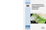 |
| The use of remote sensing data for drought assessment and monitoring in southwest Asia |
|
| Publication Date: | |
2004
|
| Creator: | |
Disaster Risk Reduction Program, Florida International University (DRR/FIU) ( summary contributor )
Thenkabail, Prasad S.
Gamage, M. S. D. Nilantha
Smakhtin, Vladimir U.
|
| Publisher.Display: | |
International Water Management Institute ( Colombo, Sri Lanka )
|
| Subjects.Display: | |
Natural hazards and disasters -- Droughts -- Middle East
Remote sensing -- Middle East
|
| Source Institution: | |
Florida International University
|
|
| The use of remote sensing data for drought assessment and monitoring in southwest Asia |
|
 |
| Vegetation Cover Types of Shark River Slough, Everglades National Park Derived from LANDSAT Thematic Mapper Data |
|
| Publication Date: | |
1986-01
|
| Creator: | |
Lance H. Gunderson
outh Florida Natural Resources Center/South Florida Research Center, Everglades National Park
David P. Brannon
Gary Irish
|
| Publisher.Display: | |
National Park Service, U.S. Department of the Interior ( Homestead, Florida )
|
| Subjects.Display: | |
Florida
Everglades National Park (Fla.)
Remote sensing
Shark River Slough (Fla.)
Botany
Landsat satellites
|
| Source Institution: | |
Florida International University
|
|
| Vegetation Cover Types of Shark River Slough, Everglades National Park Derived from LANDSAT Thematic Mapper Data |
|
|

