|
|
| |
|
 |
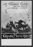
| Everglades advertising, 1929-1931 |
|
| Publication Date: | |
1931
|
| Creator: | |
Matlack, Claude Carson, 1878-1944.
|
| Format: | |
4 photos. : black and white; 18 x 13 cm.
|
| Subjects.Display: | |
Advertising
Everglades National Park (Fla.)
Everglades
Tropic Everglades National Park (Fla.)
Everglades (Fla.)--Photographs
Everglades (Fla.)--Maps.
Whitewater Bay (Fla.)
White ibis
United States--Maps
|
| Source Institution: | |
Florida International University
|
|
| Everglades advertising, 1929-1931 |
|
 |
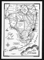
| Everglades and Big Cypress postcard. |
|
| Creator: | |
Douglas, Marjory Stoneman
|
| Format: | |
1 item.
|
| Subjects.Display: | |
Everglades (Fla.)--Maps.
|
| Source Institution: | |
Florida International University
|
|
| Everglades and Big Cypress postcard. |
|
|
![For sale Fertile Florida lands in large tracts. 19--]](http://dpanther.fiu.edu/sobek/content/MW/00/99/00/01/00001/001a_thm.jpg) |
| For sale Fertile Florida lands in large tracts. 19--] |
|
| Creator: | |
Moore-Willson, Minnie, b. 1863. ( Contributor )
Hedges, George T. ( Contributor )
|
| Publisher.Display: | |
George T. Hedges & Company.
|
| Format: | |
1 map
|
| Subjects.Display: | |
Everglades (Fla.)--Maps.
Real estate development--Florida--Everglades.
George T. Hedges & Company.
|
| Source Institution: | |
Florida International University
|
|
| For sale Fertile Florida lands in large tracts. 19--] |
|
 |
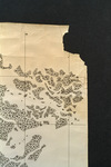
| Map made for the U.S. Coast and Geodetic Survey of Cape Sable : East Cape to Shark River, April 12, 1928 |
|
| Publication Date: | |
1928
|
| Creator: | |
U.S. Coast and Geodetic Survey.
Reading, O. S. ( contributor )
|
| Format: | |
1 map
|
| Subjects.Display: | |
Everglades (Fla.)--Maps.
Sable, Cape (Fla.)--Maps.
Shark River (Fla.)--Maps.
Whitewater Bay (Fla.)--Maps.
|
| Source Institution: | |
Florida International University
|
|
| Map made for the U.S. Coast and Geodetic Survey of Cape Sable : East Cape to Shark River, April 12, 1928 |
|
|
 |
| Map of Florida |
|
| Publication Date: | |
1910
|
| Creator: | |
Moore-Willson, Minnie, b. 1863. ( Contributor )
|
| Format: | |
1 map. : ill.
|
| Subjects.Display: | |
Drainage--Florida--Everglades.
Everglades (Fla.)--Maps.
Broward, Napoleon Bonaparte,--1857-1910.
Florida--Maps.
|
| Source Institution: | |
Florida International University
|
|
| Map of Florida |
|
 |
| Map of Florida 500,000 acres choice prairie farming lands in Florida. |
|
| Creator: | |
Moore-Willson, Minnie, b. 1863. ( Contributor )
Southern Colonization Company.
|
| Publisher.Display: | |
Southern Colonization Company
|
| Format: | |
1 map.
|
| Subjects.Display: | |
Everglades (Fla.)--Maps.
Real estate development--Florida--Everglades.
Florida--Maps.
|
| Source Institution: | |
Florida International University
|
|
| Map of Florida 500,000 acres choice prairie farming lands in Florida. |
|
|
![Map of South Florida. 19--]](http://dpanther.fiu.edu/sobek/content/MW/00/99/00/02/00001/001a_thm.jpg) |
| Map of South Florida. 19--] |
|
| Creator: | |
Moore-Willson, Minnie, b. 1863. ( Contributor )
|
| Format: | |
1 map.
|
| Subjects.Display: | |
Everglades (Fla.)--Maps.
|
| Source Institution: | |
Florida International University
|
|
| Map of South Florida. 19--] |
|
 |
| Map showing completed canals in Southern Drainage District to June 1, 1934. |
|
| Publication Date: | |
1934
|
| Creator: | |
Biscayne Engineering Company. ( Contributor )
Model Land Company. ( Contributor )
|
| Publisher.Display: | |
Biscayne Engineering Company, ( Miami, Fla. : )
|
| Subjects.Display: | |
Everglades (Fla.)--Maps.
Southern Drainage District (Fla.)
Highleyman, Locke T.,--b. 1870.
Canals--Florida--Everglades.
|
| Source Institution: | |
Florida International University
|
|
| Map showing completed canals in Southern Drainage District to June 1, 1934. |
|
|
 |
| Map showing location of game breeding grounds. |
|
| Publication Date: | |
1927
|
| Creator: | |
Moore-Willson, Minnie, b. 1863. ( Contributor )
Royall, J. B.
|
| Publisher.Display: | |
T. J. Appleyard.
|
| Format: | |
1 map.
|
| Subjects.Display: | |
Everglades (Fla.)--Maps.
|
| Source Institution: | |
Florida International University
|
|
| Map showing location of game breeding grounds. |
|
 |
| Map showing results of examination of the Tamiami Trail lands in Dade County, Florida, to accompany report dated March 23, 1917. |
|
| Publication Date: | |
1917
|
| Creator: | |
King, John W.
Jaudon, James Franklin, 1873-1938. ( contributor )
|
| Publisher.Display: | |
King ( Miami )
|
| Format: | |
1 map : blueprint.
|
| Subjects.Display: | |
Everglades (Fla.)--Maps.
Tamiami Trail (Fla.)--Maps.
|
| Source Institution: | |
Florida International University
|
|
| Map showing results of examination of the Tamiami Trail lands in Dade County, Florida, to accompany report dated March 23, 1917. |
|
|
 |
| Map showing results of exploration and examinations in Lee, Monroe and Dade Counties, Florida. |
|
| Publication Date: | |
1917
|
| Creator: | |
King, John W.
Jaudon, James Franklin, 1873-1938. ( contributor )
|
| Publisher.Display: | |
Miami: King
|
| Format: | |
1 map : blueprint.
|
| Subjects.Display: | |
Everglades (Fla.)--Maps.
Ten Thousand Islands (Fla.)--Maps.
Biscayne Bay (Fla.)--Maps.
|
| Source Institution: | |
Florida International University
|
|
| Map showing results of exploration and examinations in Lee, Monroe and Dade Counties, Florida. |
|
 |
| Map showing special road and bridges, Cape Sable District, Monroe County, 1920 |
|
| Publication Date: | |
1920
|
| Creator: | |
Livingston, A. R.
|
| Format: | |
1 map.
|
| Subjects.Display: | |
Monroe--12087--ceeus
Ingraham Highway (Fla.)
Everglades (Fla.)--Maps.
Jennings Tract (Fla.)
Monroe County (Fla.)--Maps.
Sable, Cape (Fla.)--Maps.
|
| Source Institution: | |
Florida International University
|
|
| Map showing special road and bridges, Cape Sable District, Monroe County, 1920 |
|
|
 |
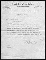
| Maps and letter relating to Cape Sable and Monroe County, Fla., 1927-1930. |
|
| Creator: | |
Model Land Company.
Bowen, Reeves. ( Contributor )
Hoffman, J. W. ( Contributor )
|
| Format: | |
3 items
|
| Subjects.Display: | |
Sable, Cape (Fla.)
Everglades (Fla.)--Maps.
|
| Source Institution: | |
Florida International University
|
|
| Maps and letter relating to Cape Sable and Monroe County, Fla., 1927-1930. |
|
 |
| Records relating to land in the Cape Sable region |
|
| Publication Date: | |
1913
|
| Creator: | |
Model Land Company
Reclaiming the Everglades ( Contributor )
|
| Format: | |
3 items. : ;
|
| Subjects.Display: | |
Sable, Cape (Fla.)
Maps -- Everglades (Fla.)
Maps -- Monroe County (Fla.)
Maps -- Sable, Cape (Fla.)
Jennings, William Sherman -- 1863-1920
Dewhurst, William W. -- (William Whitwell) -- b. 1850
|
| Source Institution: | |
Florida International University
|
|
| Records relating to land in the Cape Sable region |
|
|
 |
| Road map of Florida. |
|
| Publication Date: | |
1920
|
| Creator: | |
Moore-Willson, Minnie, b. 1863. ( Contributor )
Cold, Paul E.
Florida State Automobile Association. ( Contributor )
|
| Publisher.Display: | |
Florida State Automobile Association.
|
| Format: | |
1 map. : ill.
|
| Subjects.Display: | |
Everglades (Fla.)--Maps.
Florida--Maps.
|
| Source Institution: | |
Florida International University
|
|
| Road map of Florida. |
|
 |
| Typed copy of bill submitted in the House of Representatives, 73rd Congress |
|
| Publication Date: | |
1934
|
| Creator: | |
Reclaiming the Everglades ( Contributor )
Moore-Willson, Minnie, b. 1863
|
| Format: | |
1 item (2 p.) : ;
|
| Subjects.Display: | |
Seminole Indians -- Reservations
Everglades (Fla.) -- Maps
|
| Source Institution: | |
Florida International University
|
|
| Typed copy of bill submitted in the House of Representatives, 73rd Congress |
|
|

