| |
|
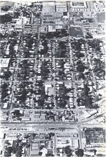 |
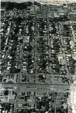
| Aerial East of Dixie Highway |
|
| Publication Date: | |
1974
|
| Creator: | |
Woodward, David ( Photographer )
|
| Format: | |
10 in x 6.75 in
|
| Subjects.Display: | |
Florida--Oakland Park (Broward County)
Aerials
|
| Source Institution: | |
Ethel M. Gordon Oakland Park Library
|
|
| Aerial East of Dixie Highway |
|
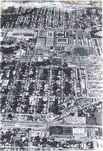 |
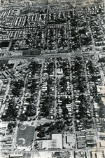
| Aerial of 38th Street |
|
| Publication Date: | |
1974
|
| Creator: | |
Woodward, David ( Photographer )
|
| Format: | |
10 in x 6.75 in
|
| Subjects.Display: | |
Florida--Oakland Park (Broward County)
Aerials
|
| Source Institution: | |
Ethel M. Gordon Oakland Park Library
|
|
| Aerial of 38th Street |
|
|
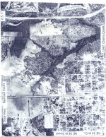 |
| Aerial of Cherry Creek |
|
| Publication Date: | |
1947
|
| Format: | |
8 in x 10 in
|
| Subjects.Display: | |
Florida--Oakland Park (Broward County)
Aerials
|
| Source Institution: | |
Ethel M. Gordon Oakland Park Library
|
|
| Aerial of Cherry Creek |
|
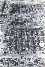 |
| Dixie Highway to west of Andrews Ave |
|
| Publication Date: | |
1974
|
| Creator: | |
Woodward, David ( Photographer )
|
| Format: | |
10 in x 6.75 in
|
| Subjects.Display: | |
Florida--Oakland Park (Broward County)
Aerials
|
| Source Institution: | |
Ethel M. Gordon Oakland Park Library
|
|
| Dixie Highway to west of Andrews Ave |
|
|
 |
| From 34th Street to 38th Street |
|
| Publication Date: | |
1974
|
| Creator: | |
Woodward, David ( Photographer )
|
| Format: | |
10 in x 6.75 in
|
| Subjects.Display: | |
Florida--Oakland Park (Broward County)
Aerials
|
| Source Institution: | |
Ethel M. Gordon Oakland Park Library
|
|
| From 34th Street to 38th Street |
|
 |
| Looking east to Federal Highway |
|
| Publication Date: | |
1974
|
| Creator: | |
Woodward, David ( Photographer )
|
| Format: | |
10 in x 6.75 in
|
| Subjects.Display: | |
Florida--Oakland Park (Broward County)
Aerials
|
| Source Institution: | |
Ethel M. Gordon Oakland Park Library
|
|
| Looking east to Federal Highway |
|

