| |
|
 |
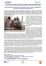
| USAID WA-WASH GIS Department Interns' Experiences Collecting PoU Information Iin Three Intervention Regions in Burkina Faso |
|
| Creator: | |
West Africa Water Supply, Sanitation and Hygiene Program (WA-WASH)
|
| Publisher.Display: | |
Florida International University
|
| Format: | |
1p.
|
| Subjects.Display: | |
Geographic information systems
Africa, West
water-supply
Interns
Education, Higher
|
| Source Institution: | |
Florida International University
|
|
| USAID WA-WASH GIS Department Interns' Experiences Collecting PoU Information Iin Three Intervention Regions in Burkina Faso |
|
 |
| Assessing future risk |
|
| Creator: | |
Christine C. Shepard
Vera N. Agostini
Ben Gilmer
Tashya Allen
Jeff Stone
William Brooks
Michael W. Beck
|
| Subjects.Display: | |
Climate change
Geographic information systems
Sea Level rise
Storm surges
Long Island (N.Y.)
|
| Source Institution: | |
Florida International University
|
|
| Assessing future risk |
|
|
 |
| A framework for using GIS and stakeholder input to assess vulnerability to coastal-inundation hazards |
|
| Creator: | |
Wood, Nathan
Yarnal, Brent
Frazier, Tim
|
| Subjects.Display: | |
Florida
Climate change
Geographic information systems
Sarasota County (Fla.)
|
| Source Institution: | |
Florida International University
|
|
| A framework for using GIS and stakeholder input to assess vulnerability to coastal-inundation hazards |
|
![[1995-05] Proceedings of GeoInformatics '95 Hong Kong International Symposium on Remote Sensing, Geographic Information Systems & Global Positioning Systems in Sustainable Development and Environmental Monitoring. Volume 2](http://dpanther.fiu.edu/sobek/content/FI/12/09/04/36/00001/FI12090436thm.jpg) |
| Proceedings of GeoInformatics '95 Hong Kong International Symposium on Remote Sensing, Geographic Information Systems & Global Positioning Systems in Sustainable Development and Environmental Monitoring. Volume 2 |
|
| Publication Date: | |
1995-05
|
| Creator: | |
South Florida Water Management District ( Contributor )
Xue, Richard Z.
Lovell, John
Lahlou, Mohammed
|
| Publisher.Display: | |
South Florida Water Management District
|
| Format: | |
PDF, 11 pages, charts, maps
|
| Subjects.Display: | |
Sustainable development -- Congresses -- South Florida
Environmental monitoring -- Remote sensing -- Congresses -- South Florida
Geographic information systems -- Congresses -- South Florida
|
| Source Institution: | |
Florida International University
|
|
| [1995-05] Proceedings of GeoInformatics '95 Hong Kong International Symposium on Remote Sensing, Geographic Information Systems & Global Positioning Systems in Sustainable Development and Environmental Monitoring. Volume 2 |
|
|
![[1996-02] Modeling Aquifer Recharge with GIS](http://dpanther.fiu.edu/sobek/content/FI/12/09/04/30/00001/FI12090430thm.jpg) |
| Modeling Aquifer Recharge with GIS |
|
| Publication Date: | |
1996-02
|
| Creator: | |
South Florida Water Management District ( Contributor )
Hohner, Susan M.
Fairbank, Philip K.
|
| Publisher.Display: | |
South Florida Water Management District
|
| Format: | |
PDF, 7 pages, illustrations, charts, maps
|
| Subjects.Display: | |
Geographic information systems--Florida
Ground-water management
Aquifers--Florida--Biscayne Aquifer.
|
| Source Institution: | |
Florida International University
|
|
| [1996-02] Modeling Aquifer Recharge with GIS |
|
![[1996-04] Proceedings of GeoInformatics '96 International Symposium on GIS/Remote Sensing: research, development and applications. Volume II](http://dpanther.fiu.edu/sobek/content/FI/12/09/04/37/00001/FI12090437thm.jpg) |
| Proceedings of GeoInformatics '96 International Symposium on GIS/Remote Sensing: research, development and applications. Volume II |
|
| Publication Date: | |
1996-04
|
| Creator: | |
South Florida Water Management District ( Contributor )
Xue, Richard Z.
Bechtel, Timothy J.
|
| Publisher.Display: | |
South Florida Water Management District
|
| Format: | |
PDF, 10 pages, illustrations, charts, maps
|
| Subjects.Display: | |
Geographic information systems -- Congresses -- South Florida
Remote sensing -- Congresses -- South Florida
|
| Source Institution: | |
Florida International University
|
|
| [1996-04] Proceedings of GeoInformatics '96 International Symposium on GIS/Remote Sensing: research, development and applications. Volume II |
|
|
![[1996-08] Developing a user-friendly tool for BMP assessment model using a GIS](http://dpanther.fiu.edu/sobek/content/FI/12/09/04/40/00001/FI12090440thm.jpg) |
| Developing a user-friendly tool for BMP assessment model using a GIS |
|
| Publication Date: | |
1996-08
|
| Creator: | |
South Florida Water Management District ( Contributor )
Xue, Richard Z.
Bechtel, Timothy J.
Chen, Zhenquen
|
| Publisher.Display: | |
South Florida Water Management District
|
| Format: | |
PDF, 18 pages, illustrations, charts, maps
|
| Subjects.Display: | |
Environmental monitoring -- Remote sensing -- Florida
Geographic information systems -- Florida
|
| Source Institution: | |
Florida International University
|
|
| [1996-08] Developing a user-friendly tool for BMP assessment model using a GIS |
|
![[2000-05] GIS technology for disasters and emergency management](http://dpanther.fiu.edu/sobek/content/FI/13/04/25/59/00001/FI13042559_thm.jpg) |
| GIS technology for disasters and emergency management |
|
| Publication Date: | |
2000-05
|
| Creator: | |
Disaster Risk Reduction Program, Florida International University (DRR/FIU) ( summary contributor )
Johnson, Russ
|
| Publisher.Display: | |
Environmental Systems Research Institute (ESRI)
|
| Subjects.Display: | |
Disaster response and recovery
Emergency management
Geographic information systems
Remote sensing
|
| Source Institution: | |
Florida International University
|
|
| [2000-05] GIS technology for disasters and emergency management |
|
|
![[2001] Damage assessment using high resolution satellite imagery](http://dpanther.fiu.edu/sobek/content/FI/13/04/25/36/00001/FI13042536_thm.jpg) |
| Damage assessment using high resolution satellite imagery |
|
| Publication Date: | |
2001
|
| Creator: | |
Disaster Risk Reduction Program, Florida International University (DRR/FIU) ( summary contributor )
Chiroiu, Lucian
Andre, Gilles
|
| Publisher.Display: | |
RiskWorld
|
| Subjects.Display: | |
Vulnerable populations
Natural hazards and disasters -- Earthquakes
Geographic information systems
|
| Source Institution: | |
Florida International University
|
|
| [2001] Damage assessment using high resolution satellite imagery |
|
![[2005] Role of internet-based GIS in effective natural disaster management](http://dpanther.fiu.edu/sobek/content/FI/13/04/25/62/00001/FI13042562_thm.jpg) |
| Role of internet-based GIS in effective natural disaster management |
|
| Publication Date: | |
2005
|
| Creator: | |
Disaster Risk Reduction Program, Florida International University (DRR/FIU) ( summary contributor )
Raheja, Naresh
Ojha, Ruby
Mallik, Sunil R
|
| Publisher.Display: | |
R. M. Software India Pvt. Ltd. (RMSI)
|
| Subjects.Display: | |
Natural hazards and disasters
Geographic information systems
|
| Source Institution: | |
Florida International University
|
|
| [2005] Role of internet-based GIS in effective natural disaster management |
|
|
![[2006-02] Global flood modelling](http://dpanther.fiu.edu/sobek/content/FI/13/04/25/35/00001/FI13042535_coverthm.jpg) |
| Global flood modelling |
|
| Publication Date: | |
2006-02
|
| Creator: | |
Disaster Risk Reduction Program, Florida International University (DRR/FIU) ( summary contributor )
Herold, Christian
Mouton, Dr Frédéric
|
| Publisher.Display: | |
UNEP/GRID-Europe ( Geneva, Switzerland )
World Bank Development Research Group
|
| Subjects.Display: | |
Natural hazards and disasters -- Floods
Geographic information systems
|
| Source Institution: | |
Florida International University
|
|
| [2006-02] Global flood modelling |
|
![[2007] Climate simulations for 1880-2003 with GISS modelE](http://dpanther.fiu.edu/sobek/content/FI/15/06/03/30/00001/FI15060330_thm.jpg) |
| Climate simulations for 1880-2003 with GISS modelE |
|
| Publication Date: | |
2007
|
| Creator: | |
J. Hansen
T. Hall
M. Sato
R. Ruedy
P. Kharecha
A. Lacis
R. Miller
L. Nazarenko
K. Lo
G.A. Schmidt
G. Russell
I. Aleinov
S. Bauer
E. Baum
B. Cairns
V. Canuto
M. Chandler
Y. Cheng
A. Cohen
A. Del Genio
G. Faluvegi
E. Fleming
A. Friend
C. Jackman
J. Jonas
M. Kelley
N.Y. Kiang
D. Koch
G. Labow
J. Lerner
S. Menon
T. Novakov
V. Oinas
Ja. Perlwitz
Ju. Perlwitz
D. Rind
A. Romanou
R. Schmunk
D. Shindell
P. Stone
S. Sun
D. Streets
N. Tausnev
D. Thresher
N. Unger
M. Yao
S. Zhang
|
| Publisher.Display: | |
Springer
|
| Subjects.Display: | |
Climate change
Global warming
Geographic information systems
|
| Source Institution: | |
Florida International University
|
|
| [2007] Climate simulations for 1880-2003 with GISS modelE |
|
|
![[2008-05] Background Documents Supporting Climate Change Science Program Synthesis and Assessment Prdouct 4.1](http://dpanther.fiu.edu/sobek/content/FI/15/06/20/59/00001/FI15062059thm.jpg) |
| Background Documents Supporting Climate Change Science Program Synthesis and Assessment Prdouct 4.1 |
|
| Publication Date: | |
2008-05
|
| Creator: | |
Titus, J.G.
Strange, E.M.
|
| Publisher.Display: | |
United States Environmental Protection Agency
|
| Subjects.Display: | |
Climate change
Geographic information systems
Sea Level rise
|
| Source Institution: | |
Florida International University
|
|
| [2008-05] Background Documents Supporting Climate Change Science Program Synthesis and Assessment Prdouct 4.1 |
|
![[2008-11] GIS for Climate Change](http://dpanther.fiu.edu/sobek/content/FI/15/06/10/30/00001/FI15061030_thm.jpg) |
| GIS for Climate Change |
|
| Publication Date: | |
2008-11
|
| Creator: | |
ESRI (Environmental Systems Research Institute)
|
| Publisher.Display: | |
ESRI (Environmental Systems Research Institute)
|
| Subjects.Display: | |
Climate change
Geographic information systems
Maps
geography
|
| Source Institution: | |
Florida International University
|
|
| [2008-11] GIS for Climate Change |
|
|
![[2009] State and local governments plan for development of most land vulnerable to rising sea level along the US Atlantic coast](http://dpanther.fiu.edu/sobek/content/FI/15/06/09/54/00001/Titus et al_2009_State and local governments plan for development of most land vulnerable to2thm.jpg) |
| State and local governments plan for development of most land vulnerable to rising sea level along the US Atlantic coast |
|
| Publication Date: | |
2009
|
| Creator: | |
Titus, James G.
|
| Subjects.Display: | |
Climate change
Geographic information systems
Wetlands
Maps
|
| Source Institution: | |
Florida International University
|
|
| [2009] State and local governments plan for development of most land vulnerable to rising sea level along the US Atlantic coast |
|
![[2009] Assessment of Coastal Vulnerability Through the Use of GIS Tools in South Sicily (Italy)](http://dpanther.fiu.edu/sobek/content/FI/15/06/20/49/00001/FI15062049thm.jpg) |
| Assessment of Coastal Vulnerability Through the Use of GIS Tools in South Sicily (Italy) |
|
| Publication Date: | |
2009
|
| Creator: | |
Anfuso, Giorgio
Martinez Del Pozo, Josel Angel
|
| Publisher.Display: | |
Springer
|
| Subjects.Display: | |
Climate change
Geographic information systems
coastal management
Erosion
Italy
|
| Source Institution: | |
Florida International University
|
|
| [2009] Assessment of Coastal Vulnerability Through the Use of GIS Tools in South Sicily (Italy) |
|
|
![[2010-01] SLAMM 6.0.1 beta](http://dpanther.fiu.edu/sobek/content/FI/15/06/20/55/00001/FI15062055thm.jpg) |
| SLAMM 6.0.1 beta |
|
| Publication Date: | |
2010-01
|
| Creator: | |
Clough, Jonathan S.
Larson, Evan C.
|
| Publisher.Display: | |
Warren Pinnacle Consulting
|
| Subjects.Display: | |
Geographic information systems
Sea Level rise
Salinity
|
| Source Institution: | |
Florida International University
|
|
| [2010-01] SLAMM 6.0.1 beta |
|
![[2010] Edge Atlas](http://dpanther.fiu.edu/sobek/content/FI/15/06/09/82/00001/Seavitt_Yarinsky_2010_Edge Atlasthm.jpg) |
| Edge Atlas |
|
| Publication Date: | |
2010
|
| Creator: | |
Catherine Seavitt
Adam Yarinsky
|
| Subjects.Display: | |
Climate change
Geographic information systems
coastal management
New Jersey
New York
|
| Source Institution: | |
Florida International University
|
|
| [2010] Edge Atlas |
|
|
![[2010] Weather extremes in a changing climate](http://dpanther.fiu.edu/sobek/content/FI/13/04/24/31/00001/FI13042431_thm.jpg) |
| Weather extremes in a changing climate |
|
| Publication Date: | |
2010
|
| Creator: | |
Disaster Risk Reduction Program, Florida International University (DRR/FIU) ( summary contributor )
World Meteorological Organization (WMO)
|
| Publisher.Display: | |
World Meteorological Organization (WMO) ( Geneva, Switzerland )
|
| Subjects.Display: | |
Climate change
Natural hazards and disasters -- Floods
Natural hazards and disasters -- Cold waves (Meteorology)
Natural hazards and disasters -- Cyclones
Natural hazards and disasters -- Droughts
Natural hazards and disasters -- Heat waves (Meteorology)
Geographic information systems
|
| Source Institution: | |
Florida International University
|
|
| [2010] Weather extremes in a changing climate |
|
![[2012] Our disappearing past](http://dpanther.fiu.edu/sobek/content/FI/15/06/18/06/00001/Reeder et al_2012_Our disappearing pastthm.jpg) |
| Our disappearing past |
|
| Publication Date: | |
2012
|
| Creator: | |
Reeder, Leslie A.
Rick, Torben C.
Erlandson, Jon M.
|
| Publisher.Display: | |
Springer
|
| Subjects.Display: | |
Climate change
Urban development
Geographic information systems
Sea Level rise
California
|
| Source Institution: | |
Florida International University
|
|
| [2012] Our disappearing past |
|

