| |
|
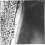 |
| Aerial survey photographs of Miami Beach between Lummus Park to Government Cut. |
|
| Publisher.Display: | |
Rader & Associates, ( Miami, Fla. : )
|
| Format: | |
5 photographs : ill. ; 23 x 23 cm.
|
| Measurements: | |
23 x 23
|
| Subjects.Display: | |
Miami Beach (Fla.)--Buildings, structures, etc.--Pictorial works.
Miami Beach (Fla.)--Aerial views.
Miami Beach (Fla.)--Aerial photographs.
Collins Avenue (Miami Beach, Fla.)--1950-1960.
Houses--1950-1960.
Parks--1950-1960.
Washington Avenue (Miami Beach, Fla.)--1950-1960.
Lincoln Road (Miami Beach, Fla.)--1950-1960.
Ocean Drive (Miami Beach, Fla.)--1950-1960.
Streets--1950-1970.
|
| Source Institution: | |
City of Miami Beach
|
| Donor: | |
Ares, Aristotle.
|
|
| Aerial survey photographs of Miami Beach between Lummus Park to Government Cut. |
|
![[1958] Aerial survey photographs of Miami Beach along coast and A1A Collins Ave](http://dpanther.fiu.edu/sobek/content/AA/00/00/00/23/00001/1367_1_000thm.jpg) |
| Aerial survey photographs of Miami Beach along coast and A1A Collins Ave |
|
| Publication Date: | |
1958
|
| Publisher.Display: | |
Rader & Associates Engineers & Architects ( Miami, Fla. )
|
| Format: | |
7 photographs : ill. ; 23 x 23 cm.
|
| Measurements: | |
23 x 23
|
| Subjects.Display: | |
Miami Beach (Fla.)--Aerial views.
Miami Beach (Fla.)--Aerial photographs.
Collins Avenue (Miami Beach, Fla.)--1950-1960.
Houses--1950-1960.
Beaches--1950-1960.
Indian Creek Drive (Miami Beach, Fla.)--1950-1960.
|
| Source Institution: | |
City of Miami Beach
|
|
| [1958] Aerial survey photographs of Miami Beach along coast and A1A Collins Ave |
|
|
![[1958] Aerial views of Miami Beach, December 1958](http://dpanther.fiu.edu/sobek/content/MB/00/00/13/71/00001/1371_10_000thm.jpg) |
| Aerial views of Miami Beach, December 1958 |
|
| Publication Date: | |
1958
|
| Creator: | |
Rader & Associates ( Engineers, Architects )
|
| Publisher.Display: | |
Miami Beach Public Works Department, ( Miami Beach, Fla. : )
Rader & Associates Engineers and Architects, ( Miami, Fla. : )
|
| Subjects.Display: | |
Miami Beach (Fla.)
Miami Beach (Fla.)--Pictorial works.
Miami Beach (Fla.)--Aerial views.
Lakes & ponds--United States--Florida--Miami Beach--1950-1960.
Islands---United States--Florida--Miami Beach--1950-1960.
Bridges--1950-1960.-United States--Florida--Miami Beach--1950-1960.
Causeways---United States--Florida--Miami Beach--1950-1960.
Streets-United States--Florida--Miami Beach--1950-1960.
|
| Source Institution: | |
City of Miami Beach
|
| Donor: | |
Ares, Aristotle.
|
|
| [1958] Aerial views of Miami Beach, December 1958 |
|
![[1958] Aerial view of man-made islands in Biscayne Bay, Florida](http://dpanther.fiu.edu/sobek/content/MB/00/00/13/71/00004/1371_4_10_000thm.jpg) |
| Aerial view of man-made islands in Biscayne Bay, Florida |
|
| Publication Date: | |
1958
|
| Publisher.Display: | |
Rader & Associates, Engineers & Architects, ( Miami, Fla. : )
|
| Subjects.Display: | |
Miami Beach (Fla.)
Biscayne Bay (Fla.)
Islands--1950-1960.
Causeways--1950-1960.
Monuments & memorials--1950-1960.
|
| Source Institution: | |
City of Miami Beach
|
| Donor: | |
Ares, Aristotle.
|
|
| [1958] Aerial view of man-made islands in Biscayne Bay, Florida |
|
|
![[1958] Aerial views of Normandy Isle, North Bay Village and John F. Kennedy Causeway](http://dpanther.fiu.edu/sobek/content/MB/00/00/13/71/00005/1371_5_1_000thm.jpg) |
| Aerial views of Normandy Isle, North Bay Village and John F. Kennedy Causeway |
|
| Publication Date: | |
1958
|
| Publisher.Display: | |
Rader & Associates, Engineers & Architects, ( Miami, Fla. : )
|
| Subjects.Display: | |
Miami Beach (Fla.)
Islands--1950-1960.
Causeways--1950-1960.
|
| Source Institution: | |
City of Miami Beach
|
| Donor: | |
Ares, Aristotle.
|
|
| [1958] Aerial views of Normandy Isle, North Bay Village and John F. Kennedy Causeway |
|
![[1958] Aerial view of Biscaya Island](http://dpanther.fiu.edu/sobek/content/AA/00/00/00/21/00001/AA00000021_1369_1_000thm.jpg) |
| Aerial view of Biscaya Island |
|
| Publication Date: | |
1958
|
| Publisher.Display: | |
Rader & Associates Engineers & Architects
|
| Format: | |
Series includes 22 photographs : ill. ; 23 x 23 cm.
|
| Subjects.Display: | |
Miami Beach (Fla.)--Aerial views.
|
| Source Institution: | |
City of Miami Beach
|
|
| [1958] Aerial view of Biscaya Island |
|
|
![[1958] Aerial view of Biscaya Island and Tantum Waterway](http://dpanther.fiu.edu/sobek/content/AA/00/00/00/21/00002/AA00000021_1369_2_000thm.jpg) |
| Aerial view of Biscaya Island and Tantum Waterway |
|
| Publication Date: | |
1958
|
| Publisher.Display: | |
Rader & Associates Engineers & Architects
|
| Format: | |
Series includes 22 photographs : ill. ; 23 x 23 cm.
|
| Subjects.Display: | |
Miami Beach (Fla.)--Aerial views.
|
| Source Institution: | |
City of Miami Beach
|
|
| [1958] Aerial view of Biscaya Island and Tantum Waterway |
|
![[1958] Aerial view of the Tantum Waterway](http://dpanther.fiu.edu/sobek/content/AA/00/00/00/21/00003/AA00000021_1369_3_000thm.jpg) |
| Aerial view of the Tantum Waterway |
|
| Publication Date: | |
1958
|
| Publisher.Display: | |
Rader & Associates Engineers & Architects
|
| Format: | |
Series includes 22 photographs : ill. ; 23 x 23 cm.
|
| Subjects.Display: | |
Miami Beach (Fla.)--Aerial views.
|
| Source Institution: | |
City of Miami Beach
|
|
| [1958] Aerial view of the Tantum Waterway |
|
|
![[1958] Aerial view of Park View Island](http://dpanther.fiu.edu/sobek/content/AA/00/00/00/21/00004/AA00000021_1369_4_000thm.jpg) |
| Aerial view of Park View Island |
|
| Publication Date: | |
1958
|
| Publisher.Display: | |
Rader & Associates Engineers & Architects
|
| Format: | |
Series includes 22 photographs : ill. ; 23 x 23 cm.
|
| Subjects.Display: | |
Miami Beach (Fla.)--Aerial views.
|
| Source Institution: | |
City of Miami Beach
|
|
| [1958] Aerial view of Park View Island |
|
![[1958] Aerial view of Park View Island](http://dpanther.fiu.edu/sobek/content/AA/00/00/00/21/00005/AA00000021_1369_5_000thm.jpg) |
| Aerial view of Park View Island |
|
| Publication Date: | |
1958
|
| Publisher.Display: | |
Rader & Associates Engineers & Architects
|
| Format: | |
Series includes 22 photographs : ill. ; 23 x 23 cm.
|
| Subjects.Display: | |
Miami Beach (Fla.)--Aerial views.
|
| Source Institution: | |
City of Miami Beach
|
|
| [1958] Aerial view of Park View Island |
|
|
![[1958] Aerial view of Normandy Isle and Allison Island](http://dpanther.fiu.edu/sobek/content/AA/00/00/00/21/00006/AA00000021_1369_6_000thm.jpg) |
| Aerial view of Normandy Isle and Allison Island |
|
| Publication Date: | |
1958
|
| Publisher.Display: | |
Rader & Associates Engineers & Architects
|
| Format: | |
Series includes 22 photographs : ill. ; 23 x 23 cm.
|
| Subjects.Display: | |
Miami Beach (Fla.)--Aerial views.
|
| Source Institution: | |
City of Miami Beach
|
|
| [1958] Aerial view of Normandy Isle and Allison Island |
|
![[1958] Aerial view of Allison Island and Normandy Isle](http://dpanther.fiu.edu/sobek/content/AA/00/00/00/21/00007/AA00000021_1369_7_000thm.jpg) |
| Aerial view of Allison Island and Normandy Isle |
|
| Publication Date: | |
1958
|
| Publisher.Display: | |
Rader & Associates Engineers & Architects
|
| Format: | |
Series includes 22 photographs : ill. ; 23 x 23 cm.
|
| Subjects.Display: | |
Miami Beach (Fla.)--Aerial views.
|
| Source Institution: | |
City of Miami Beach
|
|
| [1958] Aerial view of Allison Island and Normandy Isle |
|
|
![[1958] Aerial view of Allison Island](http://dpanther.fiu.edu/sobek/content/AA/00/00/00/21/00008/AA00000021_1369_8_000thm.jpg) |
| Aerial view of Allison Island |
|
| Publication Date: | |
1958
|
| Publisher.Display: | |
Rader & Associates Engineers & Architects
|
| Format: | |
Series includes 22 photographs : ill. ; 23 x 23 cm.
|
| Subjects.Display: | |
Miami Beach (Fla.)--Aerial views.
|
| Source Institution: | |
City of Miami Beach
|
|
| [1958] Aerial view of Allison Island |
|
![[1958] Allison Island and La Gorce Golf Course](http://dpanther.fiu.edu/sobek/content/AA/00/00/00/21/00009/AA00000021_1369_9_000thm.jpg) |
| Allison Island and La Gorce Golf Course |
|
| Publication Date: | |
1958
|
| Publisher.Display: | |
Rader & Associates Engineers & Architects
|
| Format: | |
Series includes 22 photographs : ill. ; 23 x 23 cm.
|
| Subjects.Display: | |
Miami Beach (Fla.)--Aerial views.
|
| Source Institution: | |
City of Miami Beach
|
|
| [1958] Allison Island and La Gorce Golf Course |
|
|
![[1958] Aerial view of Allison Island and part of La Gorce Golf Course](http://dpanther.fiu.edu/sobek/content/AA/00/00/00/21/00010/AA00000021_1369_10_000thm.jpg) |
| Aerial view of Allison Island and part of La Gorce Golf Course |
|
| Publication Date: | |
1958
|
| Publisher.Display: | |
Rader & Associates Engineers & Architects
|
| Format: | |
Series includes 22 photographs : ill. ; 23 x 23 cm.
|
| Subjects.Display: | |
Miami Beach (Fla.)--Aerial views.
|
| Source Institution: | |
City of Miami Beach
|
|
| [1958] Aerial view of Allison Island and part of La Gorce Golf Course |
|
![[1958] La Gorce Golf Course and Indian Creek](http://dpanther.fiu.edu/sobek/content/AA/00/00/00/21/00011/AA00000021_1369_11_000thm.jpg) |
| La Gorce Golf Course and Indian Creek |
|
| Publication Date: | |
1958
|
| Publisher.Display: | |
Rader & Associates Engineers & Architects
|
| Format: | |
Series includes 22 photographs : ill. ; 23 x 23 cm.
|
| Subjects.Display: | |
Miami Beach (Fla.)--Aerial views.
|
| Source Institution: | |
City of Miami Beach
|
|
| [1958] La Gorce Golf Course and Indian Creek |
|
|
![[1958] Aerial view of the La Gorce Golf Course and Indian Creek](http://dpanther.fiu.edu/sobek/content/AA/00/00/00/21/00012/AA00000021_1369_12_000thm.jpg) |
| Aerial view of the La Gorce Golf Course and Indian Creek |
|
| Publication Date: | |
1958
|
| Publisher.Display: | |
Rader & Associates Engineers & Architects
|
| Format: | |
Series includes 22 photographs : ill. ; 23 x 23 cm.
|
| Subjects.Display: | |
Miami Beach (Fla.)--Aerial views.
|
| Source Institution: | |
City of Miami Beach
|
|
| [1958] Aerial view of the La Gorce Golf Course and Indian Creek |
|
![[1958] Aerial view of La Gorce Golf Course and Indian Creek](http://dpanther.fiu.edu/sobek/content/AA/00/00/00/21/00013/AA00000021_1369_13_000thm.jpg) |
| Aerial view of La Gorce Golf Course and Indian Creek |
|
| Publication Date: | |
1958
|
| Publisher.Display: | |
Rader & Associates Engineers & Architects
|
| Format: | |
Series includes 22 photographs : ill. ; 23 x 23 cm.
|
| Subjects.Display: | |
Miami Beach (Fla.)--Aerial views.
|
| Source Institution: | |
City of Miami Beach
|
|
| [1958] Aerial view of La Gorce Golf Course and Indian Creek |
|
|
![[1958] Southern part of the La Gorce Golf Course and Indian Creek](http://dpanther.fiu.edu/sobek/content/AA/00/00/00/21/00014/AA00000021_1369_14_000thm.jpg) |
| Southern part of the La Gorce Golf Course and Indian Creek |
|
| Publication Date: | |
1958
|
| Publisher.Display: | |
Rader & Associates Engineers & Architects
|
| Format: | |
Series includes 22 photographs : ill. ; 23 x 23 cm.
|
| Subjects.Display: | |
Miami Beach (Fla.)--Aerial views.
|
| Source Institution: | |
City of Miami Beach
|
|
| [1958] Southern part of the La Gorce Golf Course and Indian Creek |
|
![[1958] Aerial view of Surprise Lake and Indian Creek](http://dpanther.fiu.edu/sobek/content/AA/00/00/00/21/00015/AA00000021_1369_15_000thm.jpg) |
| Aerial view of Surprise Lake and Indian Creek |
|
| Publication Date: | |
1958
|
| Publisher.Display: | |
Rader & Associates Engineers & Architects
|
| Format: | |
Series includes 22 photographs : ill. ; 23 x 23 cm.
|
| Subjects.Display: | |
Miami Beach (Fla.)--Aerial views.
|
| Source Institution: | |
City of Miami Beach
|
|
| [1958] Aerial view of Surprise Lake and Indian Creek |
|

