| |
|
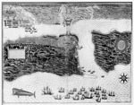 |
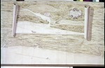
| S. Augustini pars et terrae Florida sub latitudnae 30 grandora vera maritima humilior est, lancinata et insulosa |
|
| Creator: | |
Baptista Boazio
|
| Format: | |
map
|
| Subjects.Display: | |
Plan View
|
| Source Institution: | |
University of Florida
|
|
| S. Augustini pars et terrae Florida sub latitudnae 30 grandora vera maritima humilior est, lancinata et insulosa |
|
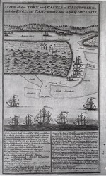 |
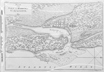
| A View of the Town and Castle of St. Augustine and the English Camp Before June 20, 1740 |
|
| Creator: | |
Thomas Silver
|
| Format: | |
map
|
| Subjects.Display: | |
Plan
|
| Source Institution: | |
University of Florida
|
|
| A View of the Town and Castle of St. Augustine and the English Camp Before June 20, 1740 |
|
|
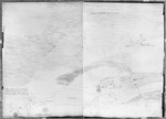 |
| Part of the Florida Inlet of Matanza |
|
| Creator: | |
Live Todiman
|
| Format: | |
map
|
| Subjects.Display: | |
Coastal chart
|
| Source Institution: | |
University of Florida
|
|
| Part of the Florida Inlet of Matanza |
|
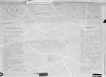 |
| The East of St. Augustine Town Castle and Forces before it on the Island of Anastasia |
|
| Creator: | |
Anon.
|
| Format: | |
map
|
| Subjects.Display: | |
Plan
|
| Source Institution: | |
University of Florida
|
|
| The East of St. Augustine Town Castle and Forces before it on the Island of Anastasia |
|
|
![Scetch [sic.] of the City and Environs of St. Augustine](http://dpanther.fiu.edu/sobek/content/US/AC/H0/02/11/00001/USACH00211_00001_00002thm.jpg) |
| Scetch [sic.] of the City and Environs of St. Augustine |
|
| Creator: | |
[Copyist] William Brasier
|
| Format: | |
map
|
| Subjects.Display: | |
Plan
|
| Source Institution: | |
University of Florida
|
|
| Scetch [sic.] of the City and Environs of St. Augustine |
|
 |
| A Survey of the Coast from Fort William near St. Ivans River to Mosquito River |
|
| Creator: | |
Justly Watson
|
| Format: | |
map
|
| Subjects.Display: | |
Map
|
| Source Institution: | |
University of Florida
|
|
| A Survey of the Coast from Fort William near St. Ivans River to Mosquito River |
|
|
 |
| Sketch of the Castle of St. Augustin |
|
| Creator: | |
Anon.
|
| Format: | |
map
|
| Subjects.Display: | |
Plan
|
| Source Institution: | |
University of Florida
|
|
| Sketch of the Castle of St. Augustin |
|
 |
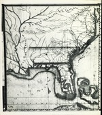
| A New and Accurate Map of East and West Florida Drawn from the Best Authorities |
|
| Creator: | |
Thomas Kitchen
|
| Source Institution: | |
University of Florida
|
|
| A New and Accurate Map of East and West Florida Drawn from the Best Authorities |
|
|
 |
| Plan of the Town and Harbour of St. Augustine |
|
| Creator: | |
Thomas Jefferys
|
| Format: | |
map
|
| Subjects.Display: | |
Plan
|
| Source Institution: | |
University of Florida
|
|
| Plan of the Town and Harbour of St. Augustine |
|
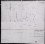 |
| Plan of the Fort, St. Augustine |
|
| Creator: | |
Phillip Pittman
|
| Format: | |
map
|
| Subjects.Display: | |
Plan
|
| Source Institution: | |
University of Florida
|
|
| Plan of the Fort, St. Augustine |
|
|
 |
| A New & Accurate Plan of the Town of St. Augustine |
|
| Creator: | |
John de Solis
|
| Format: | |
map
|
| Subjects.Display: | |
Plan
|
| Source Institution: | |
University of Florida
|
|
| A New & Accurate Plan of the Town of St. Augustine |
|
|
| Scetch Shewing the Kings ground at St. Augustine |
|
| Creator: | |
William Brasier
|
| Format: | |
map
|
| Subjects.Display: | |
Plan
|
| Source Institution: | |
University of Florida
|
|
| Scetch Shewing the Kings ground at St. Augustine |
|
|
|
| Plan of the Castle + Barr at Matansas |
|
| Creator: | |
Anon.
|
| Format: | |
map
|
| Subjects.Display: | |
Plan
|
| Source Institution: | |
University of Florida
|
|
| Plan of the Castle + Barr at Matansas |
|
|
| Plan of the New Town of Pensacola and Country Adjacent |
|
| Creator: | |
Elias Durnford
|
| Format: | |
map
|
| Subjects.Display: | |
Plan
|
| Source Institution: | |
University of Florida
|
|
| Plan of the New Town of Pensacola and Country Adjacent |
|
|
|
| A Plan + Section of Fort St. Marks St. Augustine |
|
| Creator: | |
James Moncrief
|
| Format: | |
map
|
| Subjects.Display: | |
Plan
|
| Source Institution: | |
University of Florida
|
|
| A Plan + Section of Fort St. Marks St. Augustine |
|
|
| Plan of St. Augustine |
|
| Creator: | |
James Moncrief
|
| Format: | |
map
|
| Subjects.Display: | |
Plan
|
| Source Institution: | |
University of Florida
|
|
| Plan of St. Augustine |
|
|
|
| Spanish Land Holdings |
|
| Creator: | |
James Moncrief
|
| Format: | |
map
|
| Subjects.Display: | |
Plan
|
| Source Institution: | |
University of Florida
|
|
| Spanish Land Holdings |
|
|
| New Map of East Florida |
|
| Creator: | |
William Stork
P. Andrews ( contributor )
|
| Format: | |
map
|
| Subjects.Display: | |
Map
|
| Source Institution: | |
University of Florida
|
|
| New Map of East Florida |
|
|
|
| A Plan of the Fort Harbour of Matanzas |
|
| Creator: | |
James Moncrief
|
| Format: | |
map
|
| Subjects.Display: | |
Plan
|
| Source Institution: | |
University of Florida
|
|
| A Plan of the Fort Harbour of Matanzas |
|
|
| Plan of Fort Picolata on St. Johns River |
|
| Creator: | |
James Moncrief
|
| Format: | |
map
|
| Subjects.Display: | |
Plan
|
| Source Institution: | |
University of Florida
|
|
| Plan of Fort Picolata on St. Johns River |
|

