|
|
| |
|
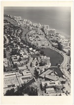 |
| Aerial views of Miami Beach, 1960s |
|
| Publication Date: | |
1965
|
| Creator: | |
Hansen, Chris ( Photographer )
|
| Format: | |
50 photographs : ill. ; [Various sizes, largest: 14 x 19 cm.].
|
| Measurements: | |
Various sizes, largest 14 x 19
|
| Subjects.Display: | |
Miami Beach (Fla.)--Aerial photographs.
Hotels--1960-1970.
Golf courses--1960-1970.
Apartment buildings--1960-1970.
|
| Source Institution: | |
City of Miami Beach
|
|
| Aerial views of Miami Beach, 1960s |
|
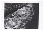 |
| Aerial views of Miami Beach and surrounding islands, 1960-1970 |
|
| Publication Date: | |
1960/1970
|
| Creator: | |
Hansen, Chris. ( Photographer )
Hamilton, George. ( Photographer )
|
| Format: | |
34 photographs : col. ill. ; 17 x 13 cm.
|
| Measurements: | |
17 x 13
|
| Subjects.Display: | |
Miami Beach (Fla.)
Miami Beach (Fla.)--Buildings, structures, etc.--Pictorial works.
Miami Beach (Fla.)--Aerial views.
Miami Beach (Fla.)--Aerial photographs.
Fontainebleau (Miami Beach, Fla.)
Government Cut--Pictorial works.
South Pointe Park (Miami Beach, Fla.).
Streets--United States--Florida--Miami Beach--1960-1970.
Apartment buildings--United States--Florida--Miami Beach--1960-1970.
Islands--United States--Florida--Miami Beach--1960-1970.
Beaches--United States--Florida--Miami Beach--1960-1970.
Swimming pools--United States--Florida--Miami Beach--1960-1970.
Parks--United States--Florida--Miami Beach--1960-1970.
Hotels--United States--Florida--Miami Beach--1960-1970.
Palms--United States--Florida--Miami Beach--1960-1970.
Causeways--1960-1970.
Lummus Park (Miami Beach, Fla.).
Ocean Drive (Miami Beach, Fla.)--1960-1970.
Boats--United States--Florida--Miami Beach--1960-1970.
Collins Avenue (Miami Beach, Fla.)--1960-1970.
|
| Source Institution: | |
City of Miami Beach
|
|
| Aerial views of Miami Beach and surrounding islands, 1960-1970 |
|
|
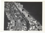 |
| Aerial Views of Miami Beach,1960-1980 |
|
| Publication Date: | |
1980
|
| Creator: | |
Hansen, Chris ( Photographer )
|
| Format: | |
32 photographs : col. ill. ; 18 x 13 cm.
|
| Measurements: | |
18 x 13
|
| Subjects.Display: | |
Miami Beach (Fla.)
Indian Creek (Miami Beach, Fla.)
Miami Beach (Fla.)--Buildings, structures, etc.--Pictorial works.
Miami Beach (Fla.)--Aerial views.
Miami Beach (Fla.)--Aerial photographs.
Miami (Fla.)--Pictorial works.
Construction--1960-1980.
Clearing of land--United States--Florida--Miami Beach--1960-1980.
Hotels--United States--Florida--Miami Beach--1960-1980.
Golf courses--1960-1980.
Streets--United States--Florida--Miami Beach--1960-1980.
Street lights--1960-1980.
Causeways--1960-1980.
Bridges--1960-1980.
Lincoln Road (Miami Beach, Fla.)--1960-1980.
Dade Boulevard (Miami Beach, Fla.)--1960-1980.
Collins Avenue (Miami Beach, Fla.)--1960-1980.
Beaches--United States--Florida--Miami Beach--1960-1980.
Waterways--1960-1980.
Canals--1960-1980.
|
| Source Institution: | |
City of Miami Beach
|
|
| Aerial Views of Miami Beach,1960-1980 |
|
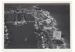 |
| Aerial views of the City of Miami Beach and the City of Miami 1960-1970 |
|
| Publication Date: | |
1966
|
| Creator: | |
Chris Hansen ( Photographer )
|
| Format: | |
30 photographs : col. ill. ; 18 x 13 cm.
|
| Measurements: | |
18 x 13
|
| Subjects.Display: | |
Miami Beach (Fla.)
Miami (Fla.)
Indian Creek (Miami Beach, Fla.)
Miami Beach (Fla.)--Buildings, structures, etc.--Pictorial works.
Miami Beach (Fla.)--Aerial views.
Miami Beach (Fla.)--Aerial photographs.
Miami (Fla.)--Pictorial works.
Fontainebleau (Miami Beach, Fla.)
Government Cut--Pictorial works.
Streets--United States--Florida--Miami Beach--1960-1970.
Beaches--United States--Florida--Miami Beach--1960-1970.
Parks--United States--Florida--Miami Beach--1960-1970.
Hotels--United States--Florida--Miami Beach--1960-1970.
Causeways--1960-1970.
Bridges--1960-1970.
Construction--1960-1970.
Collins Avenue (Miami Beach, Fla.)--1960-1970.
Real estate development--United States--Florida--Miami Beach--1960-1970.
Eden Roc Hotel (Miami Beach, Fla.)
Lakes & ponds--United States--Florida--Miami Beach--1960-1970.
Roads--Florid--Miami Beach--1960-1970.
|
| Source Institution: | |
Miami Beach Digital Archive
|
|
| Aerial views of the City of Miami Beach and the City of Miami 1960-1970 |
|
|
 |
| Aerial views of the Nautilus Hotel area |
|
| Publication Date: | |
1929
|
| Publisher.Display: | |
City of Miami Beach
|
| Format: | |
2 photographs : ill. ; [various sizes, largest: 12 x 18 cm.].
|
| Measurements: | |
Various sizes, largest: 12 x 18
|
| Subjects.Display: | |
Miami Beach (Fla.)--Aerial photographs.
Nautilus Hotel (Miami Beach, Fla.)
Causeways--1920-1930.
Islands--1920-1930.
Hotels--1920-1930.
|
| Source Institution: | |
City of Miami Beach
|
|
| Aerial views of the Nautilus Hotel area |
|
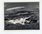 |
| Airport and eastern end of Key West looking north to Sigsbee |
|
| Publication Date: | |
1943
|
| Creator: | |
Monroe County Public Library System
May Hill Russell Library -- History Dept
Ida Woodward Barron Collection
|
| Format: | |
1 photograph : b&w ; 8 x 10 in.
|
| Subjects.Display: | |
Monroe -- 12087
Aerial photographs -- Monroe County (Fla.)
Buildings, structures, etc -- Aerial photographs -- Key West (Fla.)
Aerial photographs -- Key West (Fla.)
Airports -- Aerial photographs -- Florida -- Key West
Parks -- Aerial photographs -- Florida -- Key West
|
| Source Institution: | |
Florida International University
|
|
| Airport and eastern end of Key West looking north to Sigsbee |
|
|
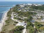 |
| Alta Systems March |
|
| Publication Date: | |
2016-03-07
|
| Subjects.Display: | |
aerial photographs
Virginia Key Beach Park (Miami, Fla.)
|
| Source Institution: | |
Virginia Key Beach Park Trust
|
|
Alta Systems March
( 8 volumes ) |
|
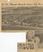 |
| At 35, Miami Beach lives up to its pioneers' dream |
|
| Publication Date: | |
1950
|
| Creator: | |
Marschale Rothe
|
| Publisher.Display: | |
The Miami Herald ( Miami, Fla. )
|
| Subjects.Display: | |
Miami Beach (Fla.)--Pictorial works.
Miami Beach (Fla.)--Aerial photographs.
Miami Beach (Fla.)--History--20th century--Pictorial works.
Beaches--United States--Florida--Miami Beach--1950-1960.
|
| Source Institution: | |
City of Miami Beach
|
|
| At 35, Miami Beach lives up to its pioneers' dream |
|
|
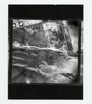 |
| Atlantic & Bertha Avenues from overhead |
|
| Publication Date: | |
1950
|
| Creator: | |
Monroe County Public Library System
May Hill Russell Library -- History Dept
|
| Format: | |
1 photograph : b&w ; 8 x 10 in.
|
| Subjects.Display: | |
Monroe -- 12087
Aerial photographs -- Monroe County (Fla.)
Streets -- Aerial photographs -- Florida
Aerial photographs -- Key West
|
| Source Institution: | |
Florida International University
|
| Donor: | |
Westray, Bill
|
|
| Atlantic & Bertha Avenues from overhead |
|
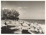 |
| Beach scenes, sunbathers, and hotels from Lummus Park to 15th Street, 1953-1956 |
|
| Publication Date: | |
1954
|
| Creator: | |
Hansen, Chris ( Photographer )
Duffy, Don ( Photographer )
Meyer, Han ( Photographer )
|
| Publisher.Display: | |
City of Miami Beach News Bureau, ( Miami Beach, Fla. )
|
| Format: | |
30 photographs: ill. ; 12 x 17 cm.
|
| Measurements: | |
12 x 17
|
| Subjects.Display: | |
Miami Beach (Fla.)--Pictorial works.
Miami Beach (Fla.)--Aerial photographs.
Models--1960-1970.
Bathing beaches--United States--Florida--Miami Beach--History--20th century--Pictorial works.
Beaches--United States--Florida--Miami Beach--1960-1970.
Tourism--1960-1970.
Ocean Drive (Miami Beach, Fla.)--1960-1970.
|
| Source Institution: | |
City of Miami Beach
|
|
| Beach scenes, sunbathers, and hotels from Lummus Park to 15th Street, 1953-1956 |
|
|
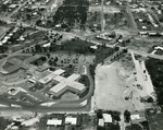 |
| Bethesda Memorial Hospital, Boynton Beach, 1963 |
|
| Publication Date: | |
1963
|
| Creator: | |
Stan Sheets ( Photographer )
|
| Publisher.Display: | |
Boynton Beach Star
|
| Format: | |
1 black and white print; 6 x 7 inches
|
| Subjects.Display: | |
Hospitals
aerial photographs
Buildings
Bethesda Memorial Hospital (Boynton Beach, Fla.)
Boynton Beach Photograph Collection
|
| Source Institution: | |
Boynton Beach City Library Local History Archives
|
|
| Bethesda Memorial Hospital, Boynton Beach, 1963 |
|
 |
| Boynton Beach aerial view, c. 1960 |
|
| Publication Date: | |
1955/1965
|
| Creator: | |
Larry Win ( Photographer )
|
| Publisher.Display: | |
D & M Post Cards & Records Co. (West Palm Beach, Fla.)
|
| Format: | |
1 color postcard; 5.5 x 35 inches
|
| Subjects.Display: | |
Beaches
aerial photographs
Landscapes
Photographic postcards
Janet DeVries Naughton Collection
|
| Source Institution: | |
Boynton Beach City Library Local History Archives
|
| Donor: | |
Gift of Janet DeVries Naughton.
|
|
| Boynton Beach aerial view, c. 1960 |
|
|
 |
| Boynton Harbor Marina, 2001 |
|
| Publication Date: | |
2001-08
|
| Format: | |
1 color print; 6 x 4 inches
|
| Subjects.Display: | |
Restaurants
aerial photographs
Boats
Buildings
Marinas
Boynton Harbor Marina (Boynton Beach, Fla.)
Two Georges Waterfront Café (Boynton Beach, Fla.)
Boynton Beach Photograph Collection
|
| Source Institution: | |
Boynton Beach City Library Local History Archives
|
|
| Boynton Harbor Marina, 2001 |
|
 |
| Boynton Inlet Docks, c. 1965 |
|
| Publication Date: | |
1960/1969
|
| Publisher.Display: | |
Parlin Color Co. (Toms River NJ and Boynton Beach FL)
|
| Format: | |
1 color print postcard; 5.5 x 3.5 inches
|
| Subjects.Display: | |
Waterways
aerial photographs
Boats
Marinas
Boynton Beach Inlet (Boynton Beach, Fla.)
Advertising--Tourism
Postcard Collection
|
| Source Institution: | |
Boynton Beach City Library Local History Archives
|
|
| Boynton Inlet Docks, c. 1965 |
|
|
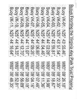 |
| Buoy Lines at HVKBP |
|
| Publication Date: | |
2008-05-21
|
| Subjects.Display: | |
Virginia Key Beach Park (Miami, Fla.)
Buoys
|
| Source Institution: | |
Virginia Key Beach Park Trust
|
|
Buoy Lines at HVKBP
( 21 volumes ) |
|
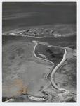 |
| Bush Key with Fort Jefferson in the background |
|
| Publication Date: | |
1940/1949
|
| Creator: | |
Monroe County Public Library System
May Hill Russell Library -- History Dept
Ida Woodward Barron Collection
|
| Format: | |
1 photograph : b&w ; 8 x 10 in.
|
| Subjects.Display: | |
Monroe -- 12087
Aerial photographs -- Monroe County (Fla.)
Fortification -- Aerial photographs -- Florida
Aerial photographs -- Fort Jefferson (Fla.)
Aerial photographs -- Dry Tortugas (Fla.)
|
| Source Institution: | |
Florida International University
|
|
| Bush Key with Fort Jefferson in the background |
|
|
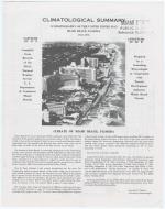 |
| Climatological Summary (Climatography of the United States 20-8) Miami Beach, Florida 1941-1976 |
|
| Publication Date: | |
1976
|
| Creator: | |
Pardue, Leonard G.
|
| Publisher.Display: | |
Miami Beach Tourist Development Authority ( Miami Beach, Fla. : )
|
| Format: | |
1 leaflet, 4p. : ill. ; 28 x 22 cm.
|
| Measurements: | |
28 x 22
|
| Subjects.Display: | |
Miami Beach (Fla.)--Aerial photographs.
Miami Beach (Fla.)--History--20th century.
Climatology--United States--Florida--Miami Beach.
|
| Source Institution: | |
City of Miami Beach
|
| Donor: | |
Miami Beach Public Library Reference Department
|
|
| Climatological Summary (Climatography of the United States 20-8) Miami Beach, Florida 1941-1976 |
|
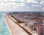 |
| Color aerial of Miami Beach |
|
| Publication Date: | |
2003
|
| Subjects.Display: | |
Miami Beach (Fla.)--Pictorial works
aerial photographs
|
| Source Institution: | |
City of Miami Beach
|
|
| Color aerial of Miami Beach |
|
|
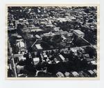 |
| Convent and St. Mary's Church on Truman Avenue |
|
| Publication Date: | |
1950/1959
|
| Creator: | |
Monroe County Public Library System
May Hill Russell Library -- History Dept
Key West Art & Historical Society
|
| Format: | |
1 photograph : b&w ; 8 x 10 in.
|
| Subjects.Display: | |
Monroe -- 12087
Aerial photographs -- Monroe County (Fla.)
Buildings, structures, etc -- Aerial photographs -- Key West (Fla.)
Aerial photographs -- Key West (Fla.)
Catholic church buildings -- Aerial photographs -- Florida -- Key West
|
| Source Institution: | |
Florida International University
|
|
| Convent and St. Mary's Church on Truman Avenue |
|
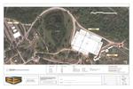 |
| COPA Miami |
|
| Subjects.Display: | |
aerial photographs
Virginia Key Beach Park (Miami, Fla.)
|
| Source Institution: | |
Virginia Key Beach Park Trust
|
|
| COPA Miami |
|
|

