|
|
| |
|
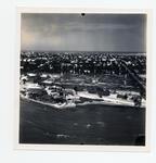 |
| Aerial of Casa Marina Court |
|
| Publication Date: | |
1945
|
| Creator: | |
Monroe County Public Library System
May Hill Russell Library -- History Dept
Ida Woodward Barron Collection
|
| Format: | |
1 photograph : b&w ; 7 x 7 in.
|
| Subjects.Display: | |
Monroe -- 12087
Aerial photographs -- Monroe County (Fla.)
Buildings, structures, etc -- Aerial photographs -- Key West (Fla.)
Aerial photographs -- Key West (Fla.)
Shorelines -- Aerial Photographs -- Key West (Fla.)
Beaches -- Aerial Photographs -- Florida -- Key West
|
| Source Institution: | |
Florida International University
|
|
| Aerial of Casa Marina Court |
|
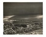 |
| An aerial photo of Key West from North Flagler across Fleming Key |
|
| Publication Date: | |
1942
|
| Creator: | |
Monroe County Public Library System
May Hill Russell Library -- History Dept
Ida Woodward Barron Collection
|
| Format: | |
1 photograph : b&w ; 8 x 10 in.
|
| Subjects.Display: | |
Monroe -- 12087
Aerial photographs -- Monroe County (Fla.)
Buildings, structures, etc -- Aerial photographs -- Key West (Fla.)
Aerial photographs -- Key West (Fla.)
Streets -- Aerial photographs -- Florida -- Key West
Bays -- Aerial photographs -- Florida -- Key West
Aerial photographs -- Naval station Key West (Fla.)
|
| Source Institution: | |
Florida International University
|
|
| An aerial photo of Key West from North Flagler across Fleming Key |
|
|
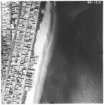 |
| Aerial survey photographs of Miami Beach between Lummus Park to Government Cut. |
|
| Publisher.Display: | |
Rader & Associates, ( Miami, Fla. : )
|
| Format: | |
5 photographs : ill. ; 23 x 23 cm.
|
| Measurements: | |
23 x 23
|
| Subjects.Display: | |
Miami Beach (Fla.)--Buildings, structures, etc.--Pictorial works.
Miami Beach (Fla.)--Aerial views.
Miami Beach (Fla.)--Aerial photographs.
Collins Avenue (Miami Beach, Fla.)--1950-1960.
Houses--1950-1960.
Parks--1950-1960.
Washington Avenue (Miami Beach, Fla.)--1950-1960.
Lincoln Road (Miami Beach, Fla.)--1950-1960.
Ocean Drive (Miami Beach, Fla.)--1950-1960.
Streets--1950-1970.
|
| Source Institution: | |
City of Miami Beach
|
| Donor: | |
Ares, Aristotle.
|
|
| Aerial survey photographs of Miami Beach between Lummus Park to Government Cut. |
|
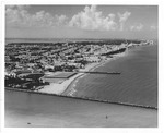 |
| Aerial view looking north from Government Cut showing Greyhound Racetrack in South Shore, 1964 |
|
| Publication Date: | |
1964
|
| Creator: | |
Hansen, Chris ( Photographer )
|
| Publisher.Display: | |
City of Miami Beach News Bureau, ( Miami Beach, Fla. : )
|
| Format: | |
1 photograph : ill. ; 21 x 26 cm.
|
| Subjects.Display: | |
Miami Beach (Fla.)--Pictorial works.
Miami Beach (Fla.)--Buildings, structures, etc.--Pictorial works.
Miami Beach (Fla.)--Aerial photographs.
Beaches--United States--Florida--Miami Beach--1960-1970.
Lummus Park (Miami Beach, Fla.)
Channels--1960-1970.
Racetracks--1960-1970.
Jetties--1960-1970
Government Cut (Miami Beach (Fla.)
|
| Source Institution: | |
City of Miami Beach
|
|
| Aerial view looking north from Government Cut showing Greyhound Racetrack in South Shore, 1964 |
|
|
 |
| Aerial view looking south on Duval Street |
|
| Publication Date: | |
1970
|
| Creator: | |
Monroe County Public Library System
May Hill Russell Library -- History Dept
United States -- Navy
|
| Format: | |
1 photograph : b&w ; 8 x 10 in.
|
| Subjects.Display: | |
Monroe -- 12087
Aerial photographs -- Monroe County (Fla.)
Buildings, structures, etc -- Aerial photographs -- Key West (Fla.)
Aerial photographs -- Key West (Fla.)
|
| Source Institution: | |
Florida International University
|
|
| Aerial view looking south on Duval Street |
|
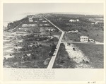 |
| Aerial View of Collins Avenue |
|
| Publication Date: | |
1919
|
| Format: | |
1 photograph : ill. ; 19 x 25 cm.
|
| Measurements: | |
19 x 25
|
| Subjects.Display: | |
Miami Beach (Fla.)--Aerial photographs.
Piers & wharves--Florida--Miami Beach--1910-1920.
Collins Avenue (Miami Beach, Fla.)--1910-1920.
Streets--United States--Florida--Miami Beach--1910-1920.
Buildings--Additions--United States--Design and construction--1910-1920.
|
| Source Institution: | |
City of Miami Beach
|
|
| Aerial View of Collins Avenue |
|
|
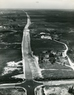 |
| Aerial view of Congress Avenue, c. 1962 |
|
| Publication Date: | |
1960/1965
|
| Creator: | |
Stan Sheets ( Photographer )
|
| Format: | |
1 black and white print; 9 x 8 inches
|
| Subjects.Display: | |
aerial photographs
Buildings
Boynton Beach Photograph Collection
Boynton Beach (Fla.) -- Aerial views
Dairy farming
|
| Source Institution: | |
Boynton Beach City Library Local History Archives
|
|
| Aerial view of Congress Avenue, c. 1962 |
|
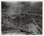 |
| Aerial view of Coral Gables, Florida, Biltmore Hotel in center |
|
| Publication Date: | |
1931-04-25
|
| Format: | |
8 X 10 in.
|
| Subjects.Display: | |
Coral Gables (Fla.)--History--Pictorial works
Coral Gables (Fla.)--Buildings, structures, etc.--Pictorial works.
Aerial views
Historic sites--Florida
Miami Biltmore Hotel & Country Club (Coral Gables, Fla.)
|
| Source Institution: | |
Florida International University
|
|
| Aerial view of Coral Gables, Florida, Biltmore Hotel in center |
|
|
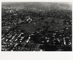 |
| Aerial view of Coral Gables, Florida, Biltmore Hotel in center-upper left |
|
| Format: | |
8 X 10 in.
|
| Subjects.Display: | |
Coral Gables (Fla.)--History--Pictorial works
Coral Gables (Fla.)--Buildings, structures, etc.--Pictorial works
Aerial views
Historic sites--Florida
Miami Biltmore Hotel & Country Club (Coral Gables, Fla)
|
| Source Institution: | |
Florida International University
|
|
| Aerial view of Coral Gables, Florida, Biltmore Hotel in center-upper left |
|
 |
| Aerial view of Fort Taylor looking northeast across Key West |
|
| Publication Date: | |
1936
|
| Creator: | |
Monroe County Public Library System
Aero-Graphic Corp
Thompson Family Collection
May Hill Russell Library -- History Dept
|
| Format: | |
1 photograph : b&w ; 8 x 10 in.
|
| Subjects.Display: | |
Monroe -- 12087
Aerial photographs -- Monroe County (Fla.)
Buildings, structures, etc -- Aerial photographs -- Key West (Fla.)
Aerial photographs -- Key West (Fla.)
Aerial photographs -- Fort Zachary Taylor (Key West, Fla.)
|
| Source Institution: | |
Florida International University
|
|
| Aerial view of Fort Taylor looking northeast across Key West |
|
|
 |
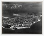
| Aerial view of Hotel Casa Marina looking northeast to Garrison Bight |
|
| Publication Date: | |
1930
|
| Creator: | |
Monroe County Public Library System
May Hill Russell Library -- History Dept
Warren Family Collection
|
| Format: | |
1 photograph : b&w ; 8 x 10 in.
|
| Subjects.Display: | |
Monroe -- 12087
Aerial photographs -- Monroe County (Fla.)
Buildings, structures, etc -- Aerial photographs -- Key West (Fla.)
Aerial photographs -- Key West (Fla.)
Hotels -- Aerial photographs -- Florida -- Key West
Streets -- Aerial photographs -- Florida -- Key West
|
| Source Institution: | |
Florida International University
|
|
| Aerial view of Hotel Casa Marina looking northeast to Garrison Bight |
|
 |
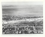
| An aerial view of Key West looking northeast past Sigbee Park |
|
| Publication Date: | |
1950
|
| Creator: | |
Monroe County Public Library System
May Hill Russell Library -- History Dept
|
| Format: | |
1 photograph : b&w ; 8 x 10 in.
|
| Subjects.Display: | |
Monroe -- 12087
Aerial photographs -- Monroe County (Fla.)
Buildings, structures, etc -- Aerial photographs -- Key West (Fla.)
Aerial photographs -- Key West (Fla.)
Aerial photographs -- Fort Zachary Taylor (Key West, Fla.)
|
| Source Institution: | |
Florida International University
|
| Donor: | |
Simmons, John, 1942-1987, 1942-1987, 1942-1987, 1942-1987, 1942-1987
|
|
| An aerial view of Key West looking northeast past Sigbee Park |
|
|
 |
| Aerial view of La Gorce golf course |
|
| Publication Date: | |
1930
|
| Creator: | |
Miami Beach Visitor & Convention Authority
|
| Publisher.Display: | |
Miami Beach Visitor and Convention Authority, ( Miami Beach, Fla. : )
|
| Format: | |
1 photograph: ill, ; 20 x 24 cm.
|
| Measurements: | |
20 x 24
|
| Subjects.Display: | |
Miami Beach (Fla.)--Buildings, structures, etc.--Pictorial works.
Miami Beach (Fla.)--Aerial photographs.
Houses--1920-1930.
Streets--1930-1940.
Golf courses--1930-1940.
Lakes and ponds--1920-1930.
|
| Source Institution: | |
City of Miami Beach
|
|
| Aerial view of La Gorce golf course |
|
 |
| Aerial view of Lantana State Tuberculosis Sanitarium, c. 1955 |
|
| Publication Date: | |
1950/1959
|
| Publisher.Display: | |
Parlin Color Co. (Tom's River, N.J. & Boynton Beach, Fla.)
|
| Format: | |
1 color postcard; 5.5 x 3.5 inches
|
| Subjects.Display: | |
Hospitals
aerial photographs
Buildings
Landscapes
Mary Linehan Postcard Collection
Sanatoriums
|
| Source Institution: | |
Boynton Beach City Library Local History Archives
|
| Donor: | |
Gift of Lantana Public Library.
|
|
| Aerial view of Lantana State Tuberculosis Sanitarium, c. 1955 |
|
|
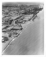 |
| Aerial view of Miami Beach, looking north from Seventy-first Street |
|
| Publication Date: | |
1964
|
| Creator: | |
Hansen, Chris ( Photographer )
|
| Publisher.Display: | |
The City of Miami Beach News Bureau, ( Miami Beach, Fla. : )
|
| Format: | |
1 photograph : ill. ; 26 x 21 cm.
|
| Measurements: | |
26 x 21
|
| Subjects.Display: | |
Miami Beach (Fla.)--Buildings, structures, etc.--Pictorial works.
Miami Beach (Fla.)--Aerial photographs.
Beaches--United States--Florida--Miami Beach--1960-1970.
Parks--United States--Florida--Miami Beach--1960-1970.
Lummus Park (Miami Beach, Fla. )
|
| Source Institution: | |
City of Miami Beach
|
|
| Aerial view of Miami Beach, looking north from Seventy-first Street |
|
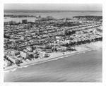 |
| Aerial view of Miami Beach looking west, 1964 |
|
| Publication Date: | |
1964
|
| Creator: | |
Hansen, Chris ( Photographer )
|
| Publisher.Display: | |
City of Miami Beach News Bureau, ( Miami Beach, Fla. : )
|
| Format: | |
1 photograph : ill. ; 20 x 25 cm.
|
| Measurements: | |
20 x 25
|
| Subjects.Display: | |
Miami Beach (Fla.)--Pictorial works.
Miami Beach (Fla.)--Buildings, structures, etc.--Pictorial works.
Miami Beach (Fla.)--Aerial views.
Beaches--United States--Florida--Miami Beach--1960-1970.
Ocean Drive (Miami Beach, Fla.)--1960-1970.
Aerial photographs.
|
| Source Institution: | |
City of Miami Beach
|
|
| Aerial view of Miami Beach looking west, 1964 |
|
|
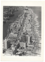 |
| Aerial view of North Miami Beach |
|
| Publication Date: | |
1940
|
| Publisher.Display: | |
City of Miami Beach News Bureau
|
| Format: | |
Series includes 32 photographs : ill. ; 18 x 13 cm.
|
| Subjects.Display: | |
Swimming pools
Miami Beach (Fla.)--Buildings, structures, etc.--Pictorial works.
|
| Source Institution: | |
City of Miami Beach
|
|
Aerial view of North Miami Beach
( 31 volumes ) |
|
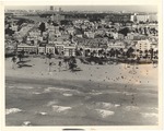 |
| Aerial view of Ocean Drive between Fifth and Seventh Streets in 1960s |
|
| Publication Date: | |
1960
|
| Format: | |
1 photograph : ill. ; 19 x 24 cm.
|
| Measurements: | |
19 x 24
|
| Subjects.Display: | |
Miami Beach (Fla.)--Buildings, structures, etc.--Pictorial works.
Miami Beach (Fla.)--Aerial views.
Bathing beaches--United States--Florida--Miami Beach--History--20th century--Pictorial works.
Beaches--United States--Florida--Miami Beach--1960-1970.
Palms--United States--Florida--Miami Beach--1960-1970.
Causeways--1960-1970.
Ocean waves--United States--Florida--Miami Beach--Pictorial works.
|
| Source Institution: | |
City of Miami Beach
|
|
| Aerial view of Ocean Drive between Fifth and Seventh Streets in 1960s |
|
|
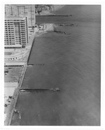 |
| Aerial view of oceanfront hotels looking north |
|
| Publication Date: | |
1972/1974
|
| Creator: | |
Chris Hansen
Miami Beach Tourist Development Auth. Publicity Dept
|
| Publisher.Display: | |
The City of Miami Beach Tourist Development Authority, Publicity Department
|
| Format: | |
8 x 10 cm
|
| Subjects.Display: | |
Miami Beach (Fla.)--Pictorial works.
Miami Beach (Fla.)--Buildings, structures, etc.--Pictorial works.
Miami Beach (Fla.)--Aerial views.
Miami Beach (Fla.)--Aerial photographs.
Beaches--1970-1980.
Hotels--1970-1980.
|
| Source Institution: | |
City of Miami Beach
|
| Donor: | |
Miami Beach Public Works Department
|
|
Aerial view of oceanfront hotels looking north
( 37 volumes ) |
|
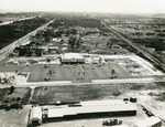 |
| Aerial view of Publix, c. 1965 |
|
| Publication Date: | |
1965
|
| Creator: | |
Stan Sheets ( Photographer )
|
| Format: | |
1 black and white print; 5.5 x 7.5 inches
|
| Subjects.Display: | |
aerial photographs
Buildings
Boynton Beach Photograph Collection
Woodbright Road (Boynton Beach, Fla.)
|
| Source Institution: | |
Boynton Beach City Library Local History Archives
|
|
| Aerial view of Publix, c. 1965 |
|
|

