| |
|
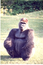 |
| Adult male lowland gorilla crouched in its habitat at Miami Metrozoo |
|
| Publication Date: | |
1980/2000
|
| Creator: | |
Zoo Miami
|
| Format: | |
1 color photograph, 15 x 10 cm
|
| Subjects.Display: | |
Miami Metrozoo
Gorilla
Zoo animals
Zoo Miami
Zoos -- Exhibitions
|
| Source Institution: | |
Florida International University
|
|
| Adult male lowland gorilla crouched in its habitat at Miami Metrozoo |
|
 |
| Adult male lowland gorilla holding a stick while seated in its habitat at Miami Metrozoo |
|
| Publication Date: | |
1980/2000
|
| Creator: | |
Zoo Miami
|
| Format: | |
1 color photograph, 15 x 10 cm
|
| Subjects.Display: | |
Miami Metrozoo
Gorilla
Zoo animals
Zoo Miami
Zoos -- Exhibitions
|
| Source Institution: | |
Florida International University
|
|
| Adult male lowland gorilla holding a stick while seated in its habitat at Miami Metrozoo |
|
|
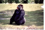 |
| Adult male lowland gorilla howling in its habitat at Miami Metrozoo |
|
| Publication Date: | |
1980/2000
|
| Creator: | |
Zoo Miami
|
| Format: | |
1 color photograph, 15 x 10 cm
|
| Subjects.Display: | |
Miami Metrozoo
Gorilla
Zoo animals
Zoo Miami
Zoos -- Exhibitions
|
| Source Institution: | |
Florida International University
|
|
| Adult male lowland gorilla howling in its habitat at Miami Metrozoo |
|
 |
| Adult male lowland gorilla on its hands and feet in its habitat at Miami Metrozoo |
|
| Publication Date: | |
1980/2000
|
| Creator: | |
Zoo Miami
|
| Format: | |
1 color photograph, 15 x 10 cm
|
| Subjects.Display: | |
Miami Metrozoo
Gorilla
Zoo animals
Zoo Miami
Zoos -- Exhibitions
|
| Source Institution: | |
Florida International University
|
|
| Adult male lowland gorilla on its hands and feet in its habitat at Miami Metrozoo |
|
|
 |
| Adult male lowland gorilla putting its fists to its chest at Miami Metrozoo |
|
| Publication Date: | |
1980/2000
|
| Creator: | |
Zoo Miami
|
| Format: | |
1 color photograph, 15 x 10 cm
|
| Subjects.Display: | |
Miami Metrozoo
Gorilla
Zoo animals
Zoo Miami
Zoos -- Exhibitions
|
| Source Institution: | |
Florida International University
|
|
| Adult male lowland gorilla putting its fists to its chest at Miami Metrozoo |
|
 |
| Adult male Lowland gorilla raising its hands to its chest at Miami Metrozoo |
|
| Publication Date: | |
1980/2000
|
| Creator: | |
Zoo Miami
|
| Format: | |
1 color photograph, 15 x 10 cm
|
| Subjects.Display: | |
Miami Metrozoo
Gorilla
Zoo animals
Zoo Miami
Zoos -- Exhibitions
|
| Source Institution: | |
Florida International University
|
|
| Adult male Lowland gorilla raising its hands to its chest at Miami Metrozoo |
|
|
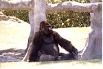 |
| Adult male lowland gorilla seated against a tree in its habitat at Miami Metrozoo |
|
| Publication Date: | |
1980/2000
|
| Creator: | |
Zoo Miami
|
| Format: | |
1 color photograph, 15 x 10 cm
|
| Subjects.Display: | |
Miami Metrozoo
Gorilla
Zoo animals
Zoo Miami
Zoos -- Exhibitions
|
| Source Institution: | |
Florida International University
|
|
| Adult male lowland gorilla seated against a tree in its habitat at Miami Metrozoo |
|
 |
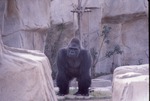
| Adult male Lowland gorilla seated in habitat being viewed by visitors at the Miami Metrozoo |
|
| Publication Date: | |
1970/1990
|
| Creator: | |
Zoo Miami
|
| Format: | |
1 b&w photograph, 25.5 x 20.5 cm
|
| Subjects.Display: | |
Miami Metrozoo
Gorilla
Zoo animals
Zoo Miami
Zoos -- Exhibitions
Zoo visitors
|
| Source Institution: | |
Florida International University
|
|
| Adult male Lowland gorilla seated in habitat being viewed by visitors at the Miami Metrozoo |
|
|
 |
| Adult male lowland gorilla seated in its habitat at Miami Metrozoo |
|
| Publication Date: | |
1980/2000
|
| Creator: | |
Zoo Miami
|
| Format: | |
1 color photograph, 15 x 10 cm
|
| Subjects.Display: | |
Miami Metrozoo
Gorilla
Zoo animals
Zoo Miami
Zoos -- Exhibitions
|
| Source Institution: | |
Florida International University
|
|
| Adult male lowland gorilla seated in its habitat at Miami Metrozoo |
|
 |
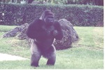
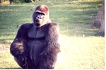
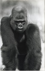
| Adult male Lowland gorilla standing within his habitat at the Miami Metrozoo |
|
| Publication Date: | |
1970/1990
|
| Creator: | |
Zoo Miami
|
| Format: | |
1 b&w photograph, 25.5 x 20.5 cm
|
| Subjects.Display: | |
Miami Metrozoo
Gorilla
Zoo animals
Zoo Miami
Zoos -- Exhibitions
|
| Source Institution: | |
Florida International University
|
|
| Adult male Lowland gorilla standing within his habitat at the Miami Metrozoo |
|
|
 |
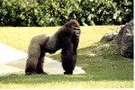
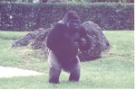
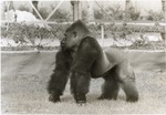
| Adult male Lowland gorilla walking in habitat at Miami Metrozoo |
|
| Publication Date: | |
1970/1990
|
| Creator: | |
Zoo Miami
|
| Format: | |
1 b&w photograph, 25 x 20 cm
|
| Subjects.Display: | |
Miami Metrozoo
Gorilla
Zoo animals
Zoo Miami
Zoos -- Exhibitions
|
| Source Institution: | |
Florida International University
|
|
| Adult male Lowland gorilla walking in habitat at Miami Metrozoo |
|
 |
| Adult male lowland gorilla walking through boulders in its habitat at Miami Metrozoo |
|
| Publication Date: | |
1970/1990
|
| Creator: | |
Zoo Miami
|
| Format: | |
1 color slide
|
| Subjects.Display: | |
Miami Metrozoo
Gorilla
Zoo animals
Zoo Miami
Gorilla -- Behavior
Zoos -- Exhibition
|
| Source Institution: | |
Government Resource and Information Department, Florida International University
|
|
| Adult male lowland gorilla walking through boulders in its habitat at Miami Metrozoo |
|
|
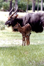 |
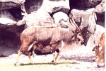
| Adult male nyala and its young standing in their habitat at Miami Metrozoo |
|
| Publication Date: | |
1980/2000
|
| Creator: | |
Zoo Miami
|
| Format: | |
1 color photograph, 15 x 10 cm
|
| Subjects.Display: | |
Miami Metrozoo
Nyala
Zoo animals
Zoo Miami
Zoos -- Exhibitions
|
| Source Institution: | |
Florida International University
|
|
| Adult male nyala and its young standing in their habitat at Miami Metrozoo |
|
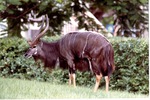 |
| Adult male nyala standing in the greenery of its habitat at Miami Metrozoo |
|
| Publication Date: | |
1980/2000
|
| Creator: | |
Zoo Miami
|
| Format: | |
1 color photograph, 15 x 10 cm
|
| Subjects.Display: | |
Miami Metrozoo
Nyala
Zoo animals
Zoo Miami
Zoos -- Exhibitions
|
| Source Institution: | |
Florida International University
|
|
| Adult male nyala standing in the greenery of its habitat at Miami Metrozoo |
|
|
 |
| Adult male nyala walking towards other nyala in their habitat at Miami Metrozoo |
|
| Publication Date: | |
1980/2000
|
| Creator: | |
Zoo Miami
|
| Format: | |
1 color photograph, 15 x 10 cm
|
| Subjects.Display: | |
Miami Metrozoo
Nyala
Zoo animals
Zoo Miami
Zoos -- Exhibitions
|
| Source Institution: | |
Florida International University
|
|
| Adult male nyala walking towards other nyala in their habitat at Miami Metrozoo |
|
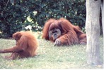 |
| Adult male Sumatran orangutan and a young one by a wooden pillar at Miami Metrozoo |
|
| Publication Date: | |
1980/2000
|
| Creator: | |
Zoo Miami
|
| Format: | |
1 color photograph, 15 x 10 cm
|
| Subjects.Display: | |
Miami Metrozoo
Orangutans
Zoo animals
Zoo Miami
Zoos -- Exhibition
Sumatran orangutan
Sumatran orangutan -- Infancy
|
| Source Institution: | |
Florida International University
|
|
| Adult male Sumatran orangutan and a young one by a wooden pillar at Miami Metrozoo |
|
|
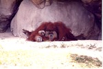 |
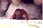
| Adult male Sumatran orangutan laying on the ground against some rocks at Miami Metrozoo |
|
| Publication Date: | |
1980/2000
|
| Creator: | |
Zoo Miami
|
| Format: | |
1 color photograph, 15 x 10 cm
|
| Subjects.Display: | |
Miami Metrozoo
Orangutans
Zoo animals
Zoo Miami
Zoos -- Exhibition
Sumatran orangutan
|
| Source Institution: | |
Florida International University
|
|
| Adult male Sumatran orangutan laying on the ground against some rocks at Miami Metrozoo |
|
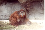 |
| Adult male Sumatran orangutan seated beside a rock-face in its habitat at Miami Metrozoo |
|
| Publication Date: | |
1980/2000
|
| Creator: | |
Zoo Miami
|
| Format: | |
1 color photograph, 15 x 10 cm
|
| Subjects.Display: | |
Miami Metrozoo
Orangutans
Zoo animals
Zoo Miami
Zoos -- Exhibition
Sumatran orangutan
|
| Source Institution: | |
Florida International University
|
|
| Adult male Sumatran orangutan seated beside a rock-face in its habitat at Miami Metrozoo |
|
|
 |
| Adult male Sumatran orangutan sitting in the shade of a rock-face at Miami Metrozoo |
|
| Publication Date: | |
1980/2000
|
| Creator: | |
Zoo Miami
|
| Format: | |
1 color photograph, 15 x 10 cm
|
| Subjects.Display: | |
Miami Metrozoo
Orangutans
Zoo animals
Zoo Miami
Zoos -- Exhibition
Sumatran orangutan
|
| Source Institution: | |
Florida International University
|
|
| Adult male Sumatran orangutan sitting in the shade of a rock-face at Miami Metrozoo |
|
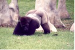 |
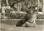
| Adult male western lowland gorilla on its elbows and feet in its habitat at Miami Metrozoo |
|
| Publication Date: | |
1980/2000
|
| Creator: | |
Zoo Miami
|
| Format: | |
1 color photograph, 15 x 10 cm
|
| Subjects.Display: | |
Miami Metrozoo
Gorilla
Zoo animals
Zoo Miami
Zoos -- Exhibitions
|
| Source Institution: | |
Florida International University
|
|
| Adult male western lowland gorilla on its elbows and feet in its habitat at Miami Metrozoo |
|

