|
|
| |
|
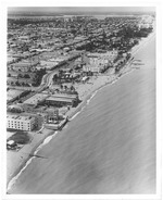 |
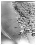
| Aerial view of Miami Beach, looking north from Seventy-first Street |
|
| Publication Date: | |
1964
|
| Creator: | |
Hansen, Chris ( Photographer )
|
| Publisher.Display: | |
The City of Miami Beach News Bureau, ( Miami Beach, Fla. : )
|
| Format: | |
1 photograph : ill. ; 26 x 21 cm.
|
| Measurements: | |
26 x 21
|
| Subjects.Display: | |
Miami Beach (Fla.)--Buildings, structures, etc.--Pictorial works.
Miami Beach (Fla.)--Aerial photographs.
Beaches--United States--Florida--Miami Beach--1960-1970.
Parks--United States--Florida--Miami Beach--1960-1970.
Lummus Park (Miami Beach, Fla. )
|
| Source Institution: | |
City of Miami Beach
|
|
| Aerial view of Miami Beach, looking north from Seventy-first Street |
|
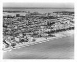 |
| Aerial view of Miami Beach looking west, 1964 |
|
| Publication Date: | |
1964
|
| Creator: | |
Hansen, Chris ( Photographer )
|
| Publisher.Display: | |
City of Miami Beach News Bureau, ( Miami Beach, Fla. : )
|
| Format: | |
1 photograph : ill. ; 20 x 25 cm.
|
| Measurements: | |
20 x 25
|
| Subjects.Display: | |
Miami Beach (Fla.)--Pictorial works.
Miami Beach (Fla.)--Buildings, structures, etc.--Pictorial works.
Miami Beach (Fla.)--Aerial views.
Beaches--United States--Florida--Miami Beach--1960-1970.
Ocean Drive (Miami Beach, Fla.)--1960-1970.
Aerial photographs.
|
| Source Institution: | |
City of Miami Beach
|
|
| Aerial view of Miami Beach looking west, 1964 |
|
|
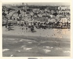 |
| Aerial view of Ocean Drive between Fifth and Seventh Streets in 1960s |
|
| Publication Date: | |
1960
|
| Format: | |
1 photograph : ill. ; 19 x 24 cm.
|
| Measurements: | |
19 x 24
|
| Subjects.Display: | |
Miami Beach (Fla.)--Buildings, structures, etc.--Pictorial works.
Miami Beach (Fla.)--Aerial views.
Bathing beaches--United States--Florida--Miami Beach--History--20th century--Pictorial works.
Beaches--United States--Florida--Miami Beach--1960-1970.
Palms--United States--Florida--Miami Beach--1960-1970.
Causeways--1960-1970.
Ocean waves--United States--Florida--Miami Beach--Pictorial works.
|
| Source Institution: | |
City of Miami Beach
|
|
| Aerial view of Ocean Drive between Fifth and Seventh Streets in 1960s |
|
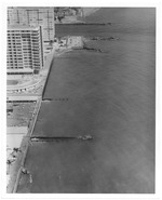 |
| Aerial view of oceanfront hotels looking north |
|
| Publication Date: | |
1972/1974
|
| Creator: | |
Chris Hansen
Miami Beach Tourist Development Auth. Publicity Dept
|
| Publisher.Display: | |
The City of Miami Beach Tourist Development Authority, Publicity Department
|
| Format: | |
8 x 10 cm
|
| Subjects.Display: | |
Miami Beach (Fla.)--Pictorial works.
Miami Beach (Fla.)--Buildings, structures, etc.--Pictorial works.
Miami Beach (Fla.)--Aerial views.
Miami Beach (Fla.)--Aerial photographs.
Beaches--1970-1980.
Hotels--1970-1980.
|
| Source Institution: | |
City of Miami Beach
|
| Donor: | |
Miami Beach Public Works Department
|
|
Aerial view of oceanfront hotels looking north
( 37 volumes ) |
|
|
 |
| Aerial view of sunbathers forming the word Miami Beach on the beach next to the Fontainebleau and Sorrento Hotel |
|
| Publication Date: | |
1980/1989
|
| Format: | |
1 negative and 1 photograph : col. ill. ; 7 x 18 cm.
|
| Measurements: | |
7 x 18
|
| Subjects.Display: | |
Miami Beach (Fla.)--Pictorial works.
Miami Beach (Fla.)--Aerial photographs.
Beaches--United States--Florida--Miami Beach--1980-1990
Tourism--1980-1990.
Sunbathing--1980-1990.
Bathing suits--1980-1990.
|
| Source Institution: | |
City of Miami Beach
|
|
| Aerial view of sunbathers forming the word Miami Beach on the beach next to the Fontainebleau and Sorrento Hotel |
|
 |
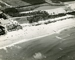
| Aerial view of the beach looking south at Lummus Park from the vantage point of Seventeenth Street |
|
| Publication Date: | |
1964
|
| Creator: | |
Hansen, Chris, ( Photographer )
|
| Publisher.Display: | |
The City of Miami Beach News Bureau, ( Miami Beach, Fla. : )
|
| Format: | |
1 photograph : ill. ; 24 x 20 cm.
|
| Measurements: | |
24 x 20
|
| Subjects.Display: | |
Miami Beach (Fla.)--Aerial photographs.
Beaches--United States--Florida--Miami Beach--1960-1970.
Swimming pools--United States--Florida--Miami Beach--1960-1970.
Parks--United States--Florida--Miami Beach--1960-1970.
Hotels--United States--Florida--Miami Beach--1960-1970.
|
| Source Institution: | |
City of Miami Beach
|
|
| Aerial view of the beach looking south at Lummus Park from the vantage point of Seventeenth Street |
|
|
 |
| Aerial view of the Boynton Beach Casino, 1957 |
|
| Publication Date: | |
1957-04-14
|
| Creator: | |
Bill Bosworth ( Photographer )
|
| Format: | |
1 black and white print; 10 x 8 inches
|
| Subjects.Display: | |
Beaches
aerial photographs
Landscapes
Boynton Beach Casino (Boynton Beach, Fla.)
Boynton Beach Photograph Collection
|
| Source Institution: | |
Boynton Beach City Library Local History Archives
|
|
| Aerial view of the Boynton Beach Casino, 1957 |
|
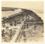 |
| Aerial view of the Firestone Estate and Pancoast House |
|
| Publication Date: | |
1932
|
| Format: | |
1 photograph : ill. ; 20 x 25 cm.
|
| Measurements: | |
20 x 25
|
| Subjects.Display: | |
Miami Beach (Fla.)--Aerial photographs.
Mansions--United States--Florida--Miami Beach--1910-1940.
Historic houses--Pictorial works.
Estates--United States--Florida--Miami Beach--1920-1940.
Palms--United States--Florida—Miami Beach--1920-1940.
Roads--Florida--Miami Beach--1920-1940.
Beaches--United States--Florida--Miami Beach--1920-1940.
Houses--United States--Florida--Miami Beach--1920-1940.
|
| Source Institution: | |
City of Miami Beach
|
|
| Aerial view of the Firestone Estate and Pancoast House |
|
|
 |
| Aerial views of Miami Beach |
|
| Publication Date: | |
1961
|
| Creator: | |
Wengrow, Lloyd
|
| Format: | |
1 pamphlet 36p : ill.
|
| Subjects.Display: | |
Library catalogs
|
| Source Institution: | |
City of Miami Beach
|
|
Aerial views of Miami Beach
( 2 volumes ) |
|
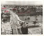 |
| Aerial views of Miami Beach, 1960s |
|
| Publication Date: | |
1966
|
| Creator: | |
Hansen, Chris ( Photographer )
|
| Publisher.Display: | |
The City of Miami Beach News Bureau ( Miami Beach, Fla. : )
|
| Format: | |
4 photographs : ill. ; 22 x 26 cm.
|
| Measurements: | |
22 x 26
|
| Subjects.Display: | |
Miami Beach (Fla.)
Miami Beach (Fla.)--Pictorial works.
Miami Beach (Fla.)--Aerial views.
Beaches--1960-1970.
Streets--United States--Florida--Miami Beach--1960-1970.
Hotels--1960-1970.
Parks--1960-1970.
Islands--1960-1970.
|
| Source Institution: | |
City of Miami Beach
|
|
| Aerial views of Miami Beach, 1960s |
|
|
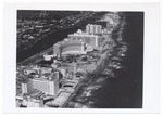 |
| Aerial views of Miami Beach and surrounding islands, 1960-1970 |
|
| Publication Date: | |
1960/1970
|
| Creator: | |
Hansen, Chris. ( Photographer )
Hamilton, George. ( Photographer )
|
| Format: | |
34 photographs : col. ill. ; 17 x 13 cm.
|
| Measurements: | |
17 x 13
|
| Subjects.Display: | |
Miami Beach (Fla.)
Miami Beach (Fla.)--Buildings, structures, etc.--Pictorial works.
Miami Beach (Fla.)--Aerial views.
Miami Beach (Fla.)--Aerial photographs.
Fontainebleau (Miami Beach, Fla.)
Government Cut--Pictorial works.
South Pointe Park (Miami Beach, Fla.).
Streets--United States--Florida--Miami Beach--1960-1970.
Apartment buildings--United States--Florida--Miami Beach--1960-1970.
Islands--United States--Florida--Miami Beach--1960-1970.
Beaches--United States--Florida--Miami Beach--1960-1970.
Swimming pools--United States--Florida--Miami Beach--1960-1970.
Parks--United States--Florida--Miami Beach--1960-1970.
Hotels--United States--Florida--Miami Beach--1960-1970.
Palms--United States--Florida--Miami Beach--1960-1970.
Causeways--1960-1970.
Lummus Park (Miami Beach, Fla.).
Ocean Drive (Miami Beach, Fla.)--1960-1970.
Boats--United States--Florida--Miami Beach--1960-1970.
Collins Avenue (Miami Beach, Fla.)--1960-1970.
|
| Source Institution: | |
City of Miami Beach
|
|
| Aerial views of Miami Beach and surrounding islands, 1960-1970 |
|
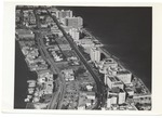 |
| Aerial Views of Miami Beach,1960-1980 |
|
| Publication Date: | |
1980
|
| Creator: | |
Hansen, Chris ( Photographer )
|
| Format: | |
32 photographs : col. ill. ; 18 x 13 cm.
|
| Measurements: | |
18 x 13
|
| Subjects.Display: | |
Miami Beach (Fla.)
Indian Creek (Miami Beach, Fla.)
Miami Beach (Fla.)--Buildings, structures, etc.--Pictorial works.
Miami Beach (Fla.)--Aerial views.
Miami Beach (Fla.)--Aerial photographs.
Miami (Fla.)--Pictorial works.
Construction--1960-1980.
Clearing of land--United States--Florida--Miami Beach--1960-1980.
Hotels--United States--Florida--Miami Beach--1960-1980.
Golf courses--1960-1980.
Streets--United States--Florida--Miami Beach--1960-1980.
Street lights--1960-1980.
Causeways--1960-1980.
Bridges--1960-1980.
Lincoln Road (Miami Beach, Fla.)--1960-1980.
Dade Boulevard (Miami Beach, Fla.)--1960-1980.
Collins Avenue (Miami Beach, Fla.)--1960-1980.
Beaches--United States--Florida--Miami Beach--1960-1980.
Waterways--1960-1980.
Canals--1960-1980.
|
| Source Institution: | |
City of Miami Beach
|
|
| Aerial Views of Miami Beach,1960-1980 |
|
|
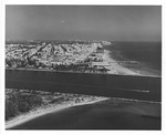 |
| Aerial views of oceanfront buildings and Miami Beach, late 1960s |
|
| Publication Date: | |
1969-07-09
|
| Creator: | |
Hansen, Chris ( Photographer )
|
| Publisher.Display: | |
The City of Miami Beach News Bureau, ( Miami Beach, Fla. : )
|
| Subjects.Display: | |
Miami Beach (Fla.)
Miami Beach (Fla.)--Buildings, structures, etc.--Pictorial works.
Beaches--Environmental aspects.
Hotels--1960-1970.
Monuments & memorials--1960-1970.
Islands--1960-1970.
Aerial views--Pictorial works.
|
| Source Institution: | |
City of Miami Beach
|
| Donor: | |
City of Miami Beach, Public Works Department
|
|
| Aerial views of oceanfront buildings and Miami Beach, late 1960s |
|
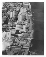 |
| Aerial views of oceanfront buildings showing parks and beach erosion between Fisher Island and Halouver Pass, 1969 |
|
| Publication Date: | |
1969-11-03
|
| Creator: | |
Hansen, Chris
|
| Publisher.Display: | |
The City of Miami Beach News Bureau, ( Miami Beach, Fla. : )
|
| Subjects.Display: | |
Miami Beach (Fla.)
Miami Beach (Fla.)--Buildings, structures, etc.--Pictorial works.
Miami Beach (Fla.)--Aerial views.
Beaches--Environmental aspects.
Beaches--United States--Florida--Miami Beach--1960-1970.
Hotels--1960-1970.
Parks--1960-1970.
Construction--1960-1970.
Gardens--1960-1970.
|
| Source Institution: | |
City of Miami Beach
|
|
| Aerial views of oceanfront buildings showing parks and beach erosion between Fisher Island and Halouver Pass, 1969 |
|
|
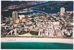 |
| Aerial views of South Beach, Government Cut, Miami Beach Marina, MacArthur Causeway and Islands, early 2000s |
|
| Publication Date: | |
2000
|
| Subjects.Display: | |
Miami Beach (Fla.)
Miami Beach (Fla.)--Buildings, structures, etc.--Pictorial works.
Miami Beach (Fla.)--Aerial views.
Apartment buildings--United States--Florida--Miami Beach--2000-2010.
Convention facilities--United States--Florida--Miami Beach--Pictorial works.
City halls--2000-2010.
Parks--2000-2010.
Golf courses--2000-2010.
Museums--2000-2010.
Marinas--Pictorial works.
Architecture--United States--Florida--Miami Beach--Art Deco--Pictorial works.
Causeways--2000-2010.
Harbors--2000-2010.
Streets--United States--Florida--Miami Beach--2000-2010.
Beaches--2000-2010.
|
| Source Institution: | |
City of Miami Beach
|
|
| Aerial views of South Beach, Government Cut, Miami Beach Marina, MacArthur Causeway and Islands, early 2000s |
|
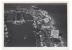 |
| Aerial views of the City of Miami Beach and the City of Miami 1960-1970 |
|
| Publication Date: | |
1966
|
| Creator: | |
Chris Hansen ( Photographer )
|
| Format: | |
30 photographs : col. ill. ; 18 x 13 cm.
|
| Measurements: | |
18 x 13
|
| Subjects.Display: | |
Miami Beach (Fla.)
Miami (Fla.)
Indian Creek (Miami Beach, Fla.)
Miami Beach (Fla.)--Buildings, structures, etc.--Pictorial works.
Miami Beach (Fla.)--Aerial views.
Miami Beach (Fla.)--Aerial photographs.
Miami (Fla.)--Pictorial works.
Fontainebleau (Miami Beach, Fla.)
Government Cut--Pictorial works.
Streets--United States--Florida--Miami Beach--1960-1970.
Beaches--United States--Florida--Miami Beach--1960-1970.
Parks--United States--Florida--Miami Beach--1960-1970.
Hotels--United States--Florida--Miami Beach--1960-1970.
Causeways--1960-1970.
Bridges--1960-1970.
Construction--1960-1970.
Collins Avenue (Miami Beach, Fla.)--1960-1970.
Real estate development--United States--Florida--Miami Beach--1960-1970.
Eden Roc Hotel (Miami Beach, Fla.)
Lakes & ponds--United States--Florida--Miami Beach--1960-1970.
Roads--Florid--Miami Beach--1960-1970.
|
| Source Institution: | |
Miami Beach Digital Archive
|
|
| Aerial views of the City of Miami Beach and the City of Miami 1960-1970 |
|
|
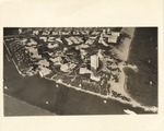 |
| Aerial views of various parts of Miami Beach, 1970s |
|
| Publication Date: | |
1973
|
| Publisher.Display: | |
City of Miami Beach
|
| Format: | |
19 photographs : ill. ; 21 x 26 cm.
|
| Measurements: | |
21 x 26
|
| Subjects.Display: | |
Miami Beach (Fla.)--Pictorial works.
Architecture—United States—Florida—Miami Beach--Spanish influences—Pictorial works.
Miami Beach (Fla.)--Aerial views.
Beaches--United States--Florida--Miami Beach--1970-1980.
Hotels—United States—Florida—Miami Beach--1970-1980.
Real estate development--United States--Florida--Miami Beach--1970-1980.
|
| Source Institution: | |
City of Miami Beach
|
|
| Aerial views of various parts of Miami Beach, 1970s |
|
 |
| Alton Beach Embankment, Biscayne Bay, and Belle Isle |
|
| Publication Date: | |
1925
|
| Creator: | |
Fisher, Carl G.
|
| Format: | |
2 photographs : ill. ; 10 x 26 cm.
|
| Measurements: | |
10 x 26
|
| Subjects.Display: | |
Miami Beach (Fla.)--Pictorial works.
Beaches--1920-1930.
Islands--1920-1930.
|
| Source Institution: | |
City of Miami Beach
|
|
| Alton Beach Embankment, Biscayne Bay, and Belle Isle |
|
|
 |
| Army Barrack on Pablo Beach |
|
| Publication Date: | |
1900
|
| Creator: | |
Monroe County Public Library System
May Hill Russell Library -- History Dept
|
| Format: | |
1 photograph : sepia ; 5 x 6 in.
|
| Subjects.Display: | |
Buildings, structures, etc -- Photographs -- Key West (Fla.)
Photographs -- Key West (Fla.)
Photographs -- Monroe County (Fla.)
Monroe -- 12087
Beaches -- Photographs -- Florida -- Key West
Photographs -- Pablo Beach (Fla.)
|
| Source Institution: | |
Florida International University
|
|
| Army Barrack on Pablo Beach |
|
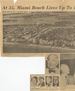 |
| At 35, Miami Beach lives up to its pioneers' dream |
|
| Publication Date: | |
1950
|
| Creator: | |
Marschale Rothe
|
| Publisher.Display: | |
The Miami Herald ( Miami, Fla. )
|
| Subjects.Display: | |
Miami Beach (Fla.)--Pictorial works.
Miami Beach (Fla.)--Aerial photographs.
Miami Beach (Fla.)--History--20th century--Pictorial works.
Beaches--United States--Florida--Miami Beach--1950-1960.
|
| Source Institution: | |
City of Miami Beach
|
|
| At 35, Miami Beach lives up to its pioneers' dream |
|
|

