| |
|
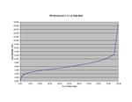 |
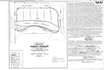
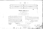
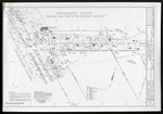
| South Beach Hypsographic Curve (Adjusted) |
|
| Creator: | |
Harlem,Peter
|
| Subjects.Display: | |
Florida
Maps
Hypsographic maps
|
| Source Institution: | |
Florida International University
|
|
| South Beach Hypsographic Curve (Adjusted) |
|
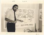 |
| South Shore planning concepts, 1970s |
|
| Publication Date: | |
1976
|
| Publisher.Display: | |
Miami Beach Tourist Development Authority, Publicity Department, ( Miami Beach, Fla. : )
|
| Format: | |
64 photographs and photocopies : ill. ; [various sizes, 28 x 22 cm].
|
| Subjects.Display: | |
Miami Beach (Fla.)
Miami Beach (Fla.)--Pictorial works.
Miami Beach (Fla.)--Aerial views.
Parks.
Boats.
Bridges.
Hotels--1970-1980.
Amsterdam, Holland--Pictorial works.
Construction projects--United States--Florida--Miami Beach--Maps--Pictorial works.
Buildings--1970-1980.
Signs and signboards--Pictorial works.
Gondolas--Italy--Venice.
Canals--Italy--Venice.
Canals--Holland--Amsterdam.
Awnings.
Markets--Europe--Pictorial works.
Pedestrian areas--Europe--Pictorial works.
Stores & Shops.
|
| Source Institution: | |
City of Miami Beach
|
|
| South Shore planning concepts, 1970s |
|
|
 |
| State and local governments plan for development of most land vulnerable to rising sea level along the US Atlantic coast |
|
| Publication Date: | |
2009
|
| Creator: | |
Titus, James G.
|
| Subjects.Display: | |
Climate change
Geographic information systems
Wetlands
Maps
|
| Source Institution: | |
Florida International University
|
|
| State and local governments plan for development of most land vulnerable to rising sea level along the US Atlantic coast |
|
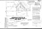 |
| Subdivision of Block 57 Country Club Section Part - 4 Coral Gables |
|
| Publication Date: | |
1936-11
|
| Creator: | |
Giersch Engineering Company
|
| Format: | |
map
|
| Subjects.Display: | |
Coral Gables (Fla.)
Real property--Maps
Cadastral maps
Plat books
|
| Source Institution: | |
Florida International University
|
|
| Subdivision of Block 57 Country Club Section Part - 4 Coral Gables |
|
|
 |
| Subdivision of Block G4 Coral Gables Country Club Section Part Four |
|
| Publication Date: | |
1948-10
|
| Creator: | |
Biscayne Engineering Company
|
| Format: | |
map
|
| Subjects.Display: | |
Coral Gables (Fla.)
Real property--Maps
Cadastral maps
Plat books
|
| Source Institution: | |
Florida International University
|
|
| Subdivision of Block G4 Coral Gables Country Club Section Part Four |
|
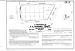 |
| Subdivision of F.H. Dunbar Tract |
|
| Publication Date: | |
1953-10
|
| Creator: | |
Garris, M.B.
|
| Format: | |
map
|
| Subjects.Display: | |
Coral Gables (Fla.)
Real property--Maps
Cadastral maps
Plat books
|
| Source Institution: | |
Florida International University
|
|
| Subdivision of F.H. Dunbar Tract |
|
|
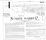 |
| Sunrise Harbour |
|
| Publication Date: | |
1947-10
|
| Creator: | |
Garris, M.B.
|
| Format: | |
map
|
| Subjects.Display: | |
Coral Gables (Fla.)
Real property--Maps
Cadastral maps
Plat books
|
| Source Institution: | |
Florida International University
|
|
| Sunrise Harbour |
|
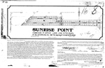 |
| Sunrise Point |
|
| Publication Date: | |
1925-04
|
| Creator: | |
Bliss, W.C.
|
| Format: | |
map
|
| Subjects.Display: | |
Coral Gables (Fla.)
Miami-Dade County (Fla.)
Real property--Maps
Cadastral maps
Plat books
|
| Source Institution: | |
Florida International University
|
|
| Sunrise Point |
|
|
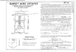 |
| Sunset Acre Estates |
|
| Publication Date: | |
1969-09
|
| Creator: | |
Mueller & Faith, Inc.
|
| Format: | |
map
|
| Subjects.Display: | |
Coral Gables (Fla.)
Real property--Maps
Cadastral maps
Plat books
|
| Source Institution: | |
Florida International University
|
|
| Sunset Acre Estates |
|
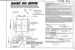 |
| Sunset Bay Estates |
|
| Publication Date: | |
1979-08-21
|
| Creator: | |
Jack Mueller & Associates, Inc.
|
| Format: | |
map
|
| Subjects.Display: | |
Coral Gables (Fla.)
Real property--Maps
Cadastral maps
Plat books
|
| Source Institution: | |
Florida International University
|
|
| Sunset Bay Estates |
|
|
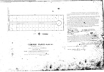 |
| Tamiami Place Plan No 1. |
|
| Publication Date: | |
1920-12-14
|
| Creator: | |
The Montray Corporation
|
| Format: | |
map
|
| Subjects.Display: | |
Coral Gables (Fla.)
Miami-Dade County (Fla.)
Real property--Maps
Cadastral maps
Plat books
|
| Source Institution: | |
Florida International University
|
|
| Tamiami Place Plan No 1. |
|
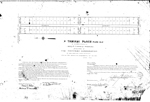 |
| Tamiami Place Plan No 2 |
|
| Publication Date: | |
1920-12-14
|
| Creator: | |
The Montray Corporation
|
| Format: | |
map
|
| Subjects.Display: | |
Coral Gables (Fla.)
Miami-Dade County (Fla.)
Real property--Maps
Cadastral maps
Plat books
|
| Source Institution: | |
Florida International University
|
|
| Tamiami Place Plan No 2 |
|
|
 |
| Tamiami Place Plan No 3 |
|
| Publication Date: | |
1921-01-03
|
| Creator: | |
The Montray Corporation
|
| Format: | |
map
|
| Subjects.Display: | |
Coral Gables (Fla.)
Miami-Dade County (Fla.)
Real property--Maps
Cadastral maps
Plat books
|
| Source Institution: | |
Florida International University
|
|
| Tamiami Place Plan No 3 |
|
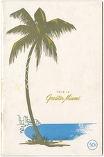 |
| This is Greater Miami |
|
| Publication Date: | |
1947
|
| Publisher.Display: | |
Arthur E. Curtis & Associates, ( Miami, Fla. : )
|
| Format: | |
1 book, 58p : ill. ; 23 x16 cm.
|
| Measurements: | |
23 x 16
|
| Subjects.Display: | |
Miami Beach (Fla.)--Pictorial works.
Miami (Fla.)--Pictorial works.
Miami Beach (Fla.)--Guidebooks.
Miami (Fla.)--Guidebooks.
Advertising--United States--Florida--Miami Beach.
Miami (Fla.)--Maps.
|
| Source Institution: | |
City of Miami Beach
|
|
| This is Greater Miami |
|
|
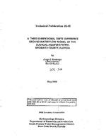 |
| A Three-Dimensional Finite Difference Ground Water Flow Model of the Surficial Aquifer System, Broward County, Florida |
|
| Publication Date: | |
1992-05
|
| Creator: | |
South Florida Water Management District (Fla.)
South Florida Water Management District
Restrepo Mejia, Jorge I
Bevier, Cindy
Butler, David
|
| Publisher.Display: | |
Hydrogeology Division, Dept. of Research and Evaluation, South Florida Water Management District ( West Palm Beach, Fla )
|
| Format: | |
viii, 262 p. : ill., charts, maps ; 28 cm.
|
| Subjects.Display: | |
Broward County (Fla.)
Hydrologic models ( lcsh )
Groundwater flow -- Mathematical models ( lcsh )
Groundwater -- Mathematical models ( lcsh )
Groundwater -- Maps
Water-supply -- Maps
Aquifers -- Maps
|
| Source Institution: | |
Florida International University
|
|
| A Three-Dimensional Finite Difference Ground Water Flow Model of the Surficial Aquifer System, Broward County, Florida |
|
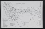 |
| Topographic Survey for the Virginia Key Beach Restoration Project |
|
| Publication Date: | |
5/1/2002
|
| Creator: | |
A.R. Toussaint and Associates, Inc.
|
| Subjects.Display: | |
Virginia Key Beach Park (Miami, Fla.)
Historical geography--Maps
United States--Historical geography--Maps
|
| Source Institution: | |
Virginia Key Beach Park Trust
|
|
| Topographic Survey for the Virginia Key Beach Restoration Project |
|
|
 |
| Topographic Survey for the Virginia Key Beach Restoration Project |
|
| Publication Date: | |
5/1/2002
|
| Creator: | |
A.R. Toussaint and Associates, Inc.
|
| Subjects.Display: | |
Virginia Key Beach Park (Miami, Fla.)
Historical geography--Maps
United States--Historical geography--Maps
|
| Source Institution: | |
Virginia Key Beach Park Trust
|
|
Topographic Survey for the Virginia Key Beach Restoration Project
( 4 volumes ) |
|
 |
| Township Map of Virginia Key and Key Biscayne |
|
| Publication Date: | |
5/13/1884
|
| Creator: | |
Florida Surveyor General's Office
|
| Subjects.Display: | |
Virginia Key Beach Park (Miami, Fla.)
Historical geography--Maps
United States--Historical geography--Maps
|
| Source Institution: | |
Virginia Key Beach Park Trust
|
|
| Township Map of Virginia Key and Key Biscayne |
|
|
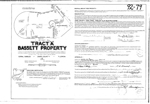 |
| Tract "A" Bassett Property |
|
| Publication Date: | |
1971-01
|
| Creator: | |
Garris Engineers, Inc.
|
| Format: | |
map
|
| Subjects.Display: | |
Coral Gables (Fla.)
Real property--Maps
Cadastral maps
Plat books
|
| Source Institution: | |
Florida International University
|
|
| Tract "A" Bassett Property |
|
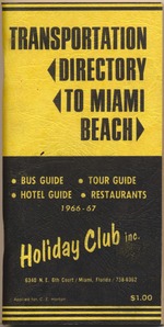 |
| Transportation Directory to Miami Beach |
|
| Publication Date: | |
1967
|
| Publisher.Display: | |
Holiday Club Inc. ( Miami, Fla. : )
|
| Format: | |
106p. ; 18 x 10 cm.
|
| Measurements: | |
18 x 10
|
| Subjects.Display: | |
Miami Beach (Fla.)--Description and travel.
Miami Beach (Fla.)--Maps.
Transportation--1960-1970.
Maps--1960-1970.
|
| Source Institution: | |
City of Miami Beach
|
|
| Transportation Directory to Miami Beach |
|

