|
|
| |
|
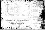 |
| Peacock's Resubdivision of block 35 Section B Coral Gables |
|
| Publication Date: | |
1930-07
|
| Creator: | |
Jones, H.J.
|
| Format: | |
map
|
| Subjects.Display: | |
Coral Gables (Fla.)
Real property--Maps
Cadastral maps
Plat books
|
| Source Institution: | |
Florida International University
|
|
| Peacock's Resubdivision of block 35 Section B Coral Gables |
|
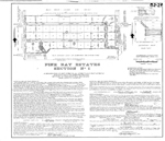 |
| Pine Bay Estates Section No. 1 |
|
| Publication Date: | |
1966-06
|
| Creator: | |
E.R. Brownell & Associates
|
| Format: | |
map
|
| Subjects.Display: | |
Coral Gables (Fla.)
Miami-Dade County (Fla.)
Real property--Maps
Cadastral maps
Plat books
|
| Source Institution: | |
Florida International University
|
|
| Pine Bay Estates Section No. 1 |
|
|
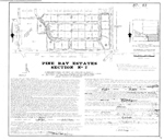 |
| Pine Bay Estates Section No. 2 |
|
| Publication Date: | |
1970-01
|
| Creator: | |
E.R. Brownell & Associates
|
| Publisher.Display: | |
FI14031804
|
| Format: | |
map
|
| Subjects.Display: | |
Coral Gables (Fla.)
Real property--Maps
Cadastral maps
Plat books
|
| Source Institution: | |
Florida International University
|
|
| Pine Bay Estates Section No. 2 |
|
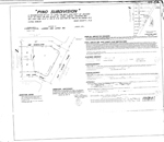 |
| Pino Subdivision |
|
| Publication Date: | |
1974-01
|
| Creator: | |
Lannes and Lopez Inc.
|
| Format: | |
map
|
| Subjects.Display: | |
Coral Gables (Fla.)
Real property--Maps
Cadastral maps
Plat books
|
| Source Institution: | |
Florida International University
|
|
| Pino Subdivision |
|
|
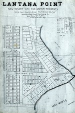 |
| Plat of Lantana Point, 1912 |
|
| Publication Date: | |
1912
|
| Format: | |
1 black and white slide; 1 x .7 inches
|
| Subjects.Display: | |
Maps
Mary Linehan Slide Collection
Plats
|
| Source Institution: | |
Boynton Beach City Library Local History Archives
|
| Donor: | |
Scan gift of Lantana Public Library.
|
|
| Plat of Lantana Point, 1912 |
|
 |
| Plat of Leyshon Property |
|
| Publication Date: | |
1935-04
|
| Creator: | |
Hannock, Chas. G.
|
| Format: | |
map
|
| Subjects.Display: | |
Coral Gables (Fla.)
Real property--Maps
Cadastral maps
Plat books
|
| Source Institution: | |
Florida International University
|
|
| Plat of Leyshon Property |
|
|
 |
| Plat of The Cocoplum Commercial Center |
|
| Publication Date: | |
1925-10
|
| Creator: | |
Freeman, O.I.
The Cocoplum Development Co. ( Contributor )
|
| Format: | |
map
|
| Subjects.Display: | |
Coral Gables (Fla.)
Real property--Maps
Cadastral maps
Plat books
|
| Source Institution: | |
Florida International University
|
|
| Plat of The Cocoplum Commercial Center |
|
 |
| Plat of Welbon |
|
| Publication Date: | |
1938-02-18
|
| Creator: | |
DeWinkler, August
|
| Format: | |
map
|
| Subjects.Display: | |
Coral Gables (Fla.)
Real property--Maps
Cadastral maps
Plat books
|
| Source Institution: | |
Florida International University
|
|
| Plat of Welbon |
|
|
 |
| Plat Showing Propery of Florida Year Round Clubs Inc. with Miami Biltmore Hotel & Country Club Grounds & Golf Course |
|
| Publication Date: | |
1936-09
|
| Creator: | |
Bliss, W.C.
|
| Format: | |
map
|
| Subjects.Display: | |
Coral Gables (Fla.)
Real property--Maps
Cadastral maps
Plat books
|
| Source Institution: | |
Florida International University
|
|
| Plat Showing Propery of Florida Year Round Clubs Inc. with Miami Biltmore Hotel & Country Club Grounds & Golf Course |
|
 |
| Pocket map guide to the Miami Beach area |
|
| Publication Date: | |
1970
|
| Publisher.Display: | |
Miami Beach Tourist Development Authority, ( Miami Beach, Fla. )
|
| Format: | |
1 leaflet, 3p : ill. ; 9 x 13 cm.
|
| Measurements: | |
9 x 13
|
| Subjects.Display: | |
Miami Beach (Fla.)--Pictorial works.
Miami Beach (Fla.)--Buildings, structures, etc.--Pictorial works.
Miami Beach (Fla.)--Maps.
|
| Source Institution: | |
City of Miami Beach
|
|
| Pocket map guide to the Miami Beach area |
|
|
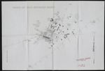 |
| Preliminary Drawing for the Virginia Key Beach Restoration Project |
|
| Subjects.Display: | |
Virginia Key Beach Park (Miami, Fla.)
United States--Historical geography--Maps
|
| Source Institution: | |
Virginia Key Beach Park Trust
|
|
| Preliminary Drawing for the Virginia Key Beach Restoration Project |
|
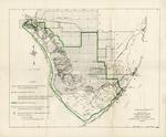 |
| Proposed final boundary, Everglades National Park, Florida |
|
| Publication Date: | |
1957-04
|
| Creator: | |
United States Department of the Interior, National Park Service
|
| Publisher.Display: | |
United States Department of the Interior National Park Service
|
| Format: | |
1 map: 14 x 17 in.
|
| Subjects.Display: | |
Everglades National Park (Fla.)
United States--Florida--Monroe County
United States--Florida--Collier County
United States--Florida--Miami-Dade County
National parks and reserves--Maps--Florida--Everglades National Park
|
| Source Institution: | |
Florida International University
|
|
| Proposed final boundary, Everglades National Park, Florida |
|
|
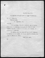 |
| Records pertaining to Everglades land in T59S R37E |
|
| Publication Date: | |
1911
|
| Creator: | |
Model Land Company
Reclaiming the Everglades ( Contributor )
Ingraham, James Edmundson, 1850-1924 ( contributor )
Morse, Frederick S., 1859-1920 ( contributor )
|
| Format: | |
33 items (34 p.), 1 map. : ;
|
| Subjects.Display: | |
Maps -- Everglades (Fla.)
Florida Fruit Land Company
Indian reservations -- Maps -- Florida
Seminole Indians -- Reservations
Krome, William J. -- 1876-1939
Holmberg, J. L.,--Dr.
Richardson Kollet Company
|
| Source Institution: | |
Florida International University
|
|
| Records pertaining to Everglades land in T59S R37E |
|
 |
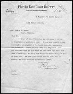
| Records relating to Ingraham Highway and Royal Palm Hammock (Royal Palm State Park) |
|
| Publication Date: | |
1920
|
| Creator: | |
Model Land Company
Reclaiming the Everglades ( Contributor )
Ingraham, James Edmundson, 1850-1924 ( contributor )
Harrison, Sidney ( contributor )
Pepper, Frank J., b. 1880 ( contributor )
Morse, Frederick S., 1859-1920 ( contributor )
Dooley, A. A. ( contributor )
Dewhurst, William W ( William Whitwell ), b. 1850 ( contributor )
Parker, Dorothy D. ( contributor )
|
| Format: | |
61 items (68 p.), 1 map. : ;
|
| Subjects.Display: | |
Sable, Cape (Fla.)
Maps -- Everglades (Fla.)
Ingraham Highway (Fla.)
Royal Palm Hammock (Fla.)
Royal Palm State Park (Fla.)
Flamingo (Fla.)
Long Pine Key (Fla.)
Mangrove -- Maps
Marl -- Maps
Camp Dewhurst (Fla.)
Camp Jennings (Fla.)
Camp Omega (Fla.)
Jennings, William Sherman -- 1863-1920
Cape Sable Development Company
Dewhurst, William W. -- William Whitwell -- b. 1850
McCrary, J. B.
Mosier, Charles R.
McCrary Engineering Corporation
Paradise Land Company
Paradise Prairie Land Co.
|
| Source Institution: | |
Florida International University
|
|
| Records relating to Ingraham Highway and Royal Palm Hammock (Royal Palm State Park) |
|
|
 |
| Records relating to land in the Cape Sable region |
|
| Publication Date: | |
1913
|
| Creator: | |
Model Land Company
Reclaiming the Everglades ( Contributor )
|
| Format: | |
3 items. : ;
|
| Subjects.Display: | |
Sable, Cape (Fla.)
Maps -- Everglades (Fla.)
Maps -- Monroe County (Fla.)
Maps -- Sable, Cape (Fla.)
Jennings, William Sherman -- 1863-1920
Dewhurst, William W. -- (William Whitwell) -- b. 1850
|
| Source Institution: | |
Florida International University
|
|
| Records relating to land in the Cape Sable region |
|
 |
| Records relating to T48S R43S section 30 (Pompano Beach) |
|
| Publication Date: | |
1917
|
| Creator: | |
Model Land Company
Reclaiming the Everglades ( Contributor )
Ingraham, James Edmundson, 1850-1924 ( contributor )
Pepper, Frank J., b. 1880 ( contributor )
Morse, Frederick S., 1859-1920 ( contributor )
Chapman, Thomas H. ( contributor )
Dooley, A. A. ( contributor )
Marshall, Carlton ( contributor )
Marshall, Victoria B ( contributor )
|
| Format: | |
31 items (35 p.), 2 maps. : ;
|
| Subjects.Display: | |
Maps -- Everglades (Fla.)
Reclamation of land -- Florida -- Pompano Beach
Florida East Coast Canal (Fla.)
Pompano Beach (Fla.)
Florida East Coast Railway
Everglades Plantation Company
Everglades Engineering Company
Florida Coast Line Canal & Transportation Company
|
| Source Institution: | |
Florida International University
|
|
| Records relating to T48S R43S section 30 (Pompano Beach) |
|
|
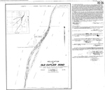 |
| Relocation of Old Cutler Road |
|
| Publication Date: | |
1950-07
|
| Creator: | |
Biscayne Engineering Company
|
| Format: | |
map
|
| Subjects.Display: | |
Coral Gables (Fla.)
Real property--Maps
Cadastral maps
Plat books
|
| Source Institution: | |
Florida International University
|
|
| Relocation of Old Cutler Road |
|
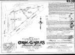 |
| Replat of a Portion of Block 16 of the Revised Plat Coral Gables Industrial Section |
|
| Publication Date: | |
1944-05
|
| Creator: | |
Garris, M.B.
|
| Format: | |
map
|
| Subjects.Display: | |
Coral Gables (Fla.)
Real property--Maps
Cadastral maps
Plat books
|
| Source Institution: | |
Florida International University
|
|
| Replat of a Portion of Block 16 of the Revised Plat Coral Gables Industrial Section |
|
|
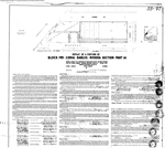 |
| Replat of a Portion of Block 199 Coral Gables Riviera Section Part 14 |
|
| Publication Date: | |
1953-10
|
| Creator: | |
Garris, M.B.
|
| Format: | |
map
|
| Subjects.Display: | |
Coral Gables (Fla.)
Real property--Maps
Cadastral maps
Plat books
|
| Source Institution: | |
Florida International University
|
|
| Replat of a Portion of Block 199 Coral Gables Riviera Section Part 14 |
|
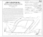 |
| Replat of a Portion of Block 2 Hammock Lake Park |
|
| Publication Date: | |
1965-02
|
| Creator: | |
Schuler & Associates, Inc.
|
| Format: | |
map
|
| Subjects.Display: | |
Coral Gables (Fla.)
Miami-Dade County (Fla.)
Real property--Maps
Cadastral maps
Plat books
|
| Source Institution: | |
Florida International University
|
|
| Replat of a Portion of Block 2 Hammock Lake Park |
|
|

