| |
|
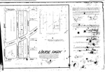 |
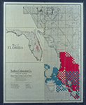
| Louise Park |
|
| Publication Date: | |
1926-07-07
|
| Creator: | |
Rossetter, D.E.
|
| Format: | |
map
|
| Subjects.Display: | |
Coral Gables (Fla.)
Real property--Maps
Cadastral maps
Plat books
|
| Source Institution: | |
Florida International University
|
|
| Louise Park |
|
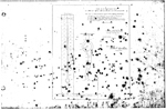 |
| The M S Foster Plat |
|
| Publication Date: | |
1921-03
|
| Format: | |
map
|
| Subjects.Display: | |
Coral Gables (Fla.)
Coconut Grove (Miami, Fla.)
Real property--Maps
Cadastral maps
Plat books
|
| Source Institution: | |
Florida International University
|
|
| The M S Foster Plat |
|
|
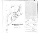 |
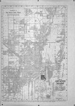
| Main Campus University of Miami |
|
| Publication Date: | |
1946-09
|
| Creator: | |
Biscayne Engineering Company
|
| Format: | |
map
|
| Subjects.Display: | |
Coral Gables (Fla.)
Real property--Maps
Cadastral maps
Plat books
|
| Source Institution: | |
Florida International University
|
|
| Main Campus University of Miami |
|
 |
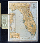
| Map and Seal of Florida |
|
| Publication Date: | |
1908
|
| Publisher.Display: | |
Emanuel Co.
|
| Subjects.Display: | |
Florida
Florida-Maps
|
| Source Institution: | |
Florida International University
|
|
| Map and Seal of Florida |
|
|
 |
| Map made for the U.S. Coast and Geodetic Survey of Cape Sable : East Cape to Shark River, April 12, 1928 |
|
| Publication Date: | |
1928
|
| Creator: | |
U.S. Coast and Geodetic Survey.
Reading, O. S. ( contributor )
|
| Format: | |
1 map
|
| Subjects.Display: | |
Everglades (Fla.)--Maps.
Sable, Cape (Fla.)--Maps.
Shark River (Fla.)--Maps.
Whitewater Bay (Fla.)--Maps.
|
| Source Institution: | |
Florida International University
|
|
| Map made for the U.S. Coast and Geodetic Survey of Cape Sable : East Cape to Shark River, April 12, 1928 |
|
 |
| Map of Boynton Beach drawn by Lyman Boomer, 1910 |
|
| Publication Date: | |
1910
|
| Format: | |
scan only
|
| Subjects.Display: | |
Maps
Map Collection
|
| Source Institution: | |
Boynton Beach City Library Local History Archives
|
|
| Map of Boynton Beach drawn by Lyman Boomer, 1910 |
|
|
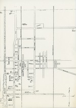 |
| Map of Boynton streets, c. 1945 |
|
| Publication Date: | |
1940/1949
|
| Format: | |
1 black and white document; 8 x 12 inches
|
| Subjects.Display: | |
Maps
Map Collection
|
| Source Institution: | |
Boynton Beach City Library Local History Archives
|
|
| Map of Boynton streets, c. 1945 |
|
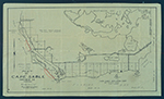 |
| Map of Cape Sable. |
|
| Creator: | |
Model Land Company.
|
| Format: | |
1 item.
|
| Subjects.Display: | |
Sable, Cape (Fla.)--Maps.
|
| Source Institution: | |
Florida International University
|
|
| Map of Cape Sable. |
|
|
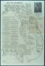 |
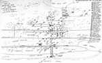
| Map of Florida |
|
| Publication Date: | |
1910
|
| Creator: | |
Moore-Willson, Minnie, b. 1863. ( Contributor )
|
| Format: | |
1 map. : ill.
|
| Subjects.Display: | |
Drainage--Florida--Everglades.
Everglades (Fla.)--Maps.
Broward, Napoleon Bonaparte,--1857-1910.
Florida--Maps.
|
| Source Institution: | |
Florida International University
|
|
| Map of Florida |
|
 |
| Map of Florida 500,000 acres choice prairie farming lands in Florida. |
|
| Creator: | |
Moore-Willson, Minnie, b. 1863. ( Contributor )
Southern Colonization Company.
|
| Publisher.Display: | |
Southern Colonization Company
|
| Format: | |
1 map.
|
| Subjects.Display: | |
Everglades (Fla.)--Maps.
Real estate development--Florida--Everglades.
Florida--Maps.
|
| Source Institution: | |
Florida International University
|
|
| Map of Florida 500,000 acres choice prairie farming lands in Florida. |
|
|
 |
| Map of Florida showing routes and railroad connections. |
|
| Publication Date: | |
1903
|
| Creator: | |
Moore-Willson, Minnie, b. 1863. ( Contributor )
Clyde Steamship Company.
|
| Publisher.Display: | |
C. S. Hammond & Co., ( New York : )
|
| Format: | |
1 map.
|
| Subjects.Display: | |
Florida--Maps.
|
| Source Institution: | |
Florida International University
|
|
| Map of Florida showing routes and railroad connections. |
|
 |
| Map of Greater Miami Florida |
|
| Publication Date: | |
1939?
|
| Creator: | |
Miami Daily News
|
| Publisher.Display: | |
Dolph, Stewart & Miller ( New York )
|
| Format: | |
1 b&w map
|
| Subjects.Display: | |
Miami (Fla.) -- Maps
|
| Source Institution: | |
Greater North Miami Historical Society
|
|
| Map of Greater Miami Florida |
|
|
 |
| Map of Indian Creek Golf Club (Miami Beach, Fla.) |
|
| Publication Date: | |
1930
|
| Creator: | |
Matlack, Claude Carson ( Photographer )
|
| Format: | |
1 black and white photographic print
|
| Subjects.Display: | |
Golf courses
Miami Beach (Fla.)
Clubhouses
Florida--Maps
|
| Source Institution: | |
HistoryMiami Museum
|
|
| Map of Indian Creek Golf Club (Miami Beach, Fla.) |
|
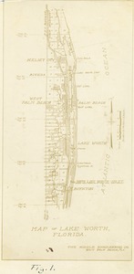 |
| Map of Lake Worth Florida, 1925 |
|
| Publication Date: | |
1925
|
| Creator: | |
Ray B. Dame ( Photographer )
|
| Format: | |
1 black and white print; 4.5 x 9 inches
|
| Subjects.Display: | |
Bridges
Canals
Maps
Boynton Inlet (Boynton Beach, Fla.)
Riddle Engineering Company
Lake Worth (Fla.)--Maps
Riddle Engineering Photoalbum
|
| Source Institution: | |
Boynton Beach City Library Local History Archives
|
| Donor: | |
Gift of Linda Jackson.
|
|
| Map of Lake Worth Florida, 1925 |
|
|
 |
| Map of Matheson Hammock Park |
|
| Publication Date: | |
1933
|
| Publisher.Display: | |
Miami News
|
| Format: | |
4 x 11” black and white print
|
| Subjects.Display: | |
Matheson Hammock Park (Miami, Fla.)
Parks -- Florida -- Miami -- Maps
|
| Source Institution: | |
HistoryMiami Museum
|
|
| Map of Matheson Hammock Park |
|
 |
| Map of Miami to Key West |
|
| Format: | |
Undetermined
|
| Subjects.Display: | |
Florida--Key West
Advertising--Maps
|
| Source Institution: | |
Florida International University
|
|
| Map of Miami to Key West |
|
|
 |
| Map of Miami to Key West |
|
| Format: | |
Undetermined
|
| Subjects.Display: | |
Florida--Key West
Advertising--Maps
|
| Source Institution: | |
Florida International University
|
|
| Map of Miami to Key West |
|
![Map of South Florida. 19--]](http://dpanther.fiu.edu/sobek/content/MW/00/99/00/02/00001/001a_thm.jpg) |
| Map of South Florida. 19--] |
|
| Creator: | |
Moore-Willson, Minnie, b. 1863. ( Contributor )
|
| Format: | |
1 map.
|
| Subjects.Display: | |
Everglades (Fla.)--Maps.
|
| Source Institution: | |
Florida International University
|
|
| Map of South Florida. 19--] |
|
|
 |
| Map of the Virginia Key Abandoned Military Reservation |
|
| Publication Date: | |
5/18/1918
|
| Creator: | |
United States Department of the Interior
|
| Subjects.Display: | |
Virginia Key Beach Park (Miami, Fla.)
Historical geography--Maps
United States--Historical geography--Maps
|
| Source Institution: | |
Virginia Key Beach Park Trust
|
|
| Map of the Virginia Key Abandoned Military Reservation |
|
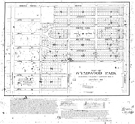 |
| Map of Wynwood Park |
|
| Publication Date: | |
1917-01
|
| Creator: | |
Llewellyn Eng. Co.
|
| Format: | |
map
|
| Subjects.Display: | |
Real property--Maps
Wynwood (Miami, Fla.)
|
| Source Institution: | |
Florida International University
|
|
| Map of Wynwood Park |
|

