|
|
| |
|
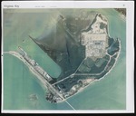 |
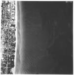
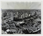
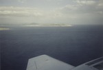
| Aerial Photograph of Virginia Key |
|
| Creator: | |
unknown
|
| Subjects.Display: | |
aerial photographs
Virginia Key Beach Park (Miami, Fla.)
|
| Source Institution: | |
Virginia Key Beach Park Trust
|
|
| Aerial Photograph of Virginia Key |
|
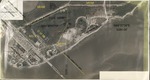 |
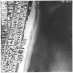
| Aerial Photograph of Virginia Key Depicting Property Lines |
|
| Subjects.Display: | |
Architecture
Virginia Key Beach Park (Miami, Fla.)
|
| Source Institution: | |
Virginia Key Beach Park Trust
|
|
| Aerial Photograph of Virginia Key Depicting Property Lines |
|
|
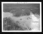 |
| Aerial photographs depicting the Everglades, 1929-1931 (bulk 1929) |
|
| Publication Date: | |
1929/1931
|
| Creator: | |
Matlack, Claude Carson, 1878-1944.
|
| Format: | |
15 photos. : black and white; 18 x 13 cm.
|
| Subjects.Display: | |
Everglades
Paradise Key (Fla.)
Royal Palm State Park (Fla.)
Ten Thousand Islands (Fla.)
Cladium
Hardwood hammocks
Cypress--Florida--Everglades
Mangrove plants--Florida--Everglades
Everglades (Fla.)--Aerial Photographs
|
| Source Institution: | |
Florida International University
|
|
| Aerial photographs depicting the Everglades, 1929-1931 (bulk 1929) |
|
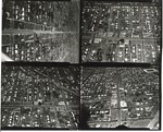 |
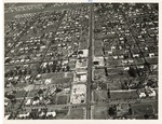
| Aerial survey of Miami Shores |
|
| Format: | |
Aerial Photograph
|
| Subjects.Display: | |
Aerial views
Florida--Miami Shores
|
| Source Institution: | |
Brockway Memorial Library
|
|
| Aerial survey of Miami Shores |
|
|
 |
| Aerial survey photographs of Miami Beach along coast and A1A Collins Ave |
|
| Publication Date: | |
1958
|
| Publisher.Display: | |
Rader & Associates Engineers & Architects ( Miami, Fla. )
|
| Format: | |
7 photographs : ill. ; 23 x 23 cm.
|
| Measurements: | |
23 x 23
|
| Subjects.Display: | |
Miami Beach (Fla.)--Aerial views.
Miami Beach (Fla.)--Aerial photographs.
Collins Avenue (Miami Beach, Fla.)--1950-1960.
Houses--1950-1960.
Beaches--1950-1960.
Indian Creek Drive (Miami Beach, Fla.)--1950-1960.
|
| Source Institution: | |
City of Miami Beach
|
|
| Aerial survey photographs of Miami Beach along coast and A1A Collins Ave |
|
 |
| Aerial survey photographs of Miami Beach between Lummus Park to Government Cut. |
|
| Publisher.Display: | |
Rader & Associates, ( Miami, Fla. : )
|
| Format: | |
5 photographs : ill. ; 23 x 23 cm.
|
| Measurements: | |
23 x 23
|
| Subjects.Display: | |
Miami Beach (Fla.)--Buildings, structures, etc.--Pictorial works.
Miami Beach (Fla.)--Aerial views.
Miami Beach (Fla.)--Aerial photographs.
Collins Avenue (Miami Beach, Fla.)--1950-1960.
Houses--1950-1960.
Parks--1950-1960.
Washington Avenue (Miami Beach, Fla.)--1950-1960.
Lincoln Road (Miami Beach, Fla.)--1950-1960.
Ocean Drive (Miami Beach, Fla.)--1950-1960.
Streets--1950-1970.
|
| Source Institution: | |
City of Miami Beach
|
| Donor: | |
Ares, Aristotle.
|
|
| Aerial survey photographs of Miami Beach between Lummus Park to Government Cut. |
|
|
 |
| Aerial View - NE 2nd Ave from 95th St north |
|
| Publication Date: | |
1940/1949
|
| Format: | |
Aerial Photograph
|
| Subjects.Display: | |
Aerial views
Florida--Miami Shores
|
| Source Institution: | |
Brockway Memorial Library
|
|
| Aerial View - NE 2nd Ave from 95th St north |
|
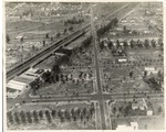 |
| Aerial View - NE 6th Ave and 96th St |
|
| Publication Date: | |
1940/1949
|
| Format: | |
Aerial Photograph
|
| Subjects.Display: | |
Aerial views
Florida--Miami Shores
Renuart Lumber
Miami Shores Presbyterian Church (Miami Shores, Fla.)
|
| Source Institution: | |
Brockway Memorial Library
|
|
| Aerial View - NE 6th Ave and 96th St |
|
|
 |
| Aerial view facing north-west above Bayfront Park on Biscayne Bay |
|
| Publication Date: | |
1953-10-18
|
| Publisher.Display: | |
Miami News
|
| Format: | |
8”x10” Black and white photograph
|
| Subjects.Display: | |
Bayfront Park (Miami, Florida)
Biscayne Boulevard (Miami, Florida)
|
| Source Institution: | |
HistoryMiami Museum
|
|
| Aerial view facing north-west above Bayfront Park on Biscayne Bay |
|
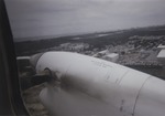 |
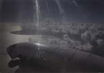
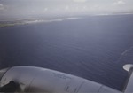
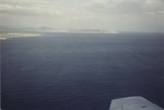
| Aerial view from plane, Guantanamo Bay Naval Base 1 |
|
| Publication Date: | |
1995-09/1996-01
|
| Creator: | |
Shartz, Kenneth (Shartz, Cyril, Fr.)
|
| Format: | |
1 color photograph
|
| Subjects.Display: | |
Guantanamo Bay Detention Camp.
|
| Source Institution: | |
Florida International University
|
| Donor: | |
Shartz, Kenneth (Shartz, Cyril, Fr.)
|
|
| Aerial view from plane, Guantanamo Bay Naval Base 1 |
|
|
 |
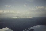
| Aerial view from plane, Guantanamo Bay Naval Base 2 |
|
| Publication Date: | |
1995-09/1996-01
|
| Creator: | |
Shartz, Kenneth (Shartz, Cyril, Fr.)
|
| Format: | |
1 color photograph
|
| Subjects.Display: | |
Guantanamo Bay Detention Camp.
|
| Source Institution: | |
Florida International University
|
| Donor: | |
Shartz, Kenneth (Shartz, Cyril, Fr.)
|
|
| Aerial view from plane, Guantanamo Bay Naval Base 2 |
|
 |
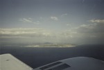
| Aerial view from plane, Guantanamo Bay Naval Base 3 |
|
| Publication Date: | |
1995-09/1996-01
|
| Creator: | |
Shartz, Kenneth (Shartz, Cyril, Fr.)
|
| Format: | |
1 color photograph
|
| Subjects.Display: | |
Guantanamo Bay Detention Camp.
|
| Source Institution: | |
Florida International University
|
| Donor: | |
Shartz, Kenneth (Shartz, Cyril, Fr.)
|
|
| Aerial view from plane, Guantanamo Bay Naval Base 3 |
|
|
 |
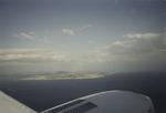
| Aerial view from plane, Guantanamo Bay Naval Base 4 |
|
| Publication Date: | |
1995-09/1996-01
|
| Creator: | |
Shartz, Kenneth (Shartz, Cyril, Fr.)
|
| Format: | |
1 color photograph
|
| Subjects.Display: | |
Guantanamo Bay Detention Camp.
|
| Source Institution: | |
Florida International University
|
| Donor: | |
Shartz, Kenneth (Shartz, Cyril, Fr.)
|
|
| Aerial view from plane, Guantanamo Bay Naval Base 4 |
|
 |
| Aerial view from plane, Guantanamo Bay Naval Base 5 |
|
| Publication Date: | |
1995-09/1996-01
|
| Creator: | |
Shartz, Kenneth (Shartz, Cyril, Fr.)
|
| Format: | |
1 color photograph
|
| Subjects.Display: | |
Guantanamo Bay Detention Camp.
|
| Source Institution: | |
Florida International University
|
| Donor: | |
Shartz, Kenneth (Shartz, Cyril, Fr.)
|
|
| Aerial view from plane, Guantanamo Bay Naval Base 5 |
|
|
 |
| Aerial view from plane, Guantanamo Bay Naval Base 6 |
|
| Publication Date: | |
1995-09/1996-01
|
| Creator: | |
Shartz, Kenneth (Shartz, Cyril, Fr.)
|
| Format: | |
1 color photograph
|
| Subjects.Display: | |
Guantanamo Bay Detention Camp.
|
| Source Institution: | |
Florida International University
|
| Donor: | |
Shartz, Kenneth (Shartz, Cyril, Fr.)
|
|
| Aerial view from plane, Guantanamo Bay Naval Base 6 |
|
 |
| Aerial view from plane, Guantanamo Bay Naval Base 7 |
|
| Publication Date: | |
1995-09/1996-01
|
| Creator: | |
Shartz, Kenneth (Shartz, Cyril, Fr.)
|
| Format: | |
1 color photograph
|
| Subjects.Display: | |
Guantanamo Bay Detention Camp.
|
| Source Institution: | |
Florida International University
|
| Donor: | |
Shartz, Kenneth (Shartz, Cyril, Fr.)
|
|
| Aerial view from plane, Guantanamo Bay Naval Base 7 |
|
|
 |
| Aerial view from plane, Guantanamo Bay Naval Base 8 |
|
| Publication Date: | |
1995-09/1996-01
|
| Creator: | |
Shartz, Kenneth (Shartz, Cyril, Fr.)
|
| Format: | |
1 color photograph
|
| Subjects.Display: | |
Guantanamo Bay Detention Camp.
|
| Source Institution: | |
Florida International University
|
| Donor: | |
Shartz, Kenneth (Shartz, Cyril, Fr.)
|
|
| Aerial view from plane, Guantanamo Bay Naval Base 8 |
|
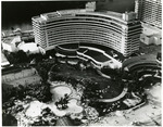 |
| Aerial view looking east of Fontainebleau Hotel |
|
| Publication Date: | |
1970
|
| Publisher.Display: | |
Miami News
|
| Format: | |
8 x 10” black and white print
|
| Subjects.Display: | |
Hotels
Fontainebleau Hotel (Miami Beach, Fla.)
|
| Source Institution: | |
HistoryMiami Museum
|
|
| Aerial view looking east of Fontainebleau Hotel |
|
|
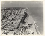 |
| Aerial view looking north from 4th Street, 1964 |
|
| Publication Date: | |
1964
|
| Creator: | |
Hansen, Chris ( Photographer )
|
| Publisher.Display: | |
The City of Miami Beach News Bureau, ( Miami Beach, Fla. : )
|
| Format: | |
1 photograph: ill . ; 21 x 26 cm
|
| Measurements: | |
21 x 26
|
| Subjects.Display: | |
Miami Beach (Fla.)--Pictorial works.
Miami Beach (Fla.)--Aerial views.
Art deco (Architecture)--United States--Florida--Miami Beach--Pictorial works.
Beaches--United States--Florida--Miami Beach--1960-1970.
Lummus Park (Miami Beach, Fla.)
Ocean Drive (Miami Beach, Fla.)--1960-1970.
Fourth Street (Miami Beach, Fla.)--1960-1970.
|
| Source Institution: | |
City of Miami Beach
|
|
| Aerial view looking north from 4th Street, 1964 |
|
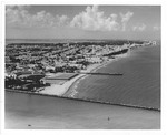 |
| Aerial view looking north from Government Cut showing Greyhound Racetrack in South Shore, 1964 |
|
| Publication Date: | |
1964
|
| Creator: | |
Hansen, Chris ( Photographer )
|
| Publisher.Display: | |
City of Miami Beach News Bureau, ( Miami Beach, Fla. : )
|
| Format: | |
1 photograph : ill. ; 21 x 26 cm.
|
| Subjects.Display: | |
Miami Beach (Fla.)--Pictorial works.
Miami Beach (Fla.)--Buildings, structures, etc.--Pictorial works.
Miami Beach (Fla.)--Aerial photographs.
Beaches--United States--Florida--Miami Beach--1960-1970.
Lummus Park (Miami Beach, Fla.)
Channels--1960-1970.
Racetracks--1960-1970.
Jetties--1960-1970
Government Cut (Miami Beach (Fla.)
|
| Source Institution: | |
City of Miami Beach
|
|
| Aerial view looking north from Government Cut showing Greyhound Racetrack in South Shore, 1964 |
|
|

