| |
|
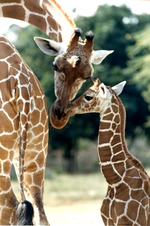 |
| Adult reticulated giraffe leaning down to nuzzle at its infant at Miami Metrozoo |
|
|
| Adult reticulated giraffe leaning down to nuzzle at its infant at Miami Metrozoo |
|
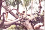 |
| Adult seated next to infant gibbon and clinging to a branch on a structure at Miami Metrozoo |
|
|
| Adult seated next to infant gibbon and clinging to a branch on a structure at Miami Metrozoo |
|
|
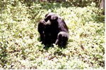 |
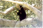
| Adult Siamang among the greenery on the ground in its habitat at Miami Metrozoo |
|
|
| Adult Siamang among the greenery on the ground in its habitat at Miami Metrozoo |
|
 |
| Adult Siamang amongst the branches of a tree in its habitat at Miami Metrozoo |
|
|
| Adult Siamang amongst the branches of a tree in its habitat at Miami Metrozoo |
|
|
 |
| Adult Siamang and its young sitting in the branches of a tree at Miami Metrozoo |
|
|
| Adult Siamang and its young sitting in the branches of a tree at Miami Metrozoo |
|
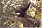 |
| Adult Siamang climbing through the branches of a tree in its habitat at Miami Metrozoo |
|
|
| Adult Siamang climbing through the branches of a tree in its habitat at Miami Metrozoo |
|
|
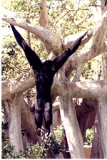 |
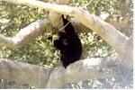
| Adult Siamang hanging between branches in its habitat at Miami Metrozoo |
|
|
| Adult Siamang hanging between branches in its habitat at Miami Metrozoo |
|
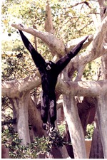 |
| Adult Siamang swinging through the branches of its habitat at Miami Metrozoo |
|
|
| Adult Siamang swinging through the branches of its habitat at Miami Metrozoo |
|
|
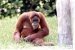 |
| Adult Sumatran orangutan sitting beside a wooden pillar in its habitat at Miami Metrozoo |
|
|
| Adult Sumatran orangutan sitting beside a wooden pillar in its habitat at Miami Metrozoo |
|
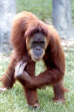 |
| Adult Sumatran orangutan walking in the grass at Miami Metrozoo |
|
|
| Adult Sumatran orangutan walking in the grass at Miami Metrozoo |
|
|
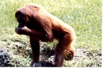 |
| Adult Sumatran orangutan walking over the rocks in their habitat at Miami Metrozoo |
|
|
| Adult Sumatran orangutan walking over the rocks in their habitat at Miami Metrozoo |
|
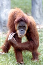 |
| Adult Sumatran orangutan walking through the grass at Miami Metrozoo |
|
|
| Adult Sumatran orangutan walking through the grass at Miami Metrozoo |
|
|
 |
|
| Adulterio |
|
|
|
| Adulterio |
|
|
 |
| Adults and children in procession, San Juan Fiesta |
|
|
| Adults and children in procession, San Juan Fiesta |
|
 |
| Adults and children in procession, San Juan Fiesta |
|
|
| Adults and children in procession, San Juan Fiesta |
|
|
 |
|
| Advance guard |
|
 |
| Advanced water supply alternatives for the Upper East Coast Planning Area : parts I and II |
|
|
| Advanced water supply alternatives for the Upper East Coast Planning Area : parts I and II |
|
|
 |
| Advancing the Science of Climate Change |
|
|
| Advancing the Science of Climate Change |
|
 |
|
| Advent Lutheran Church |
|

